MyTopo
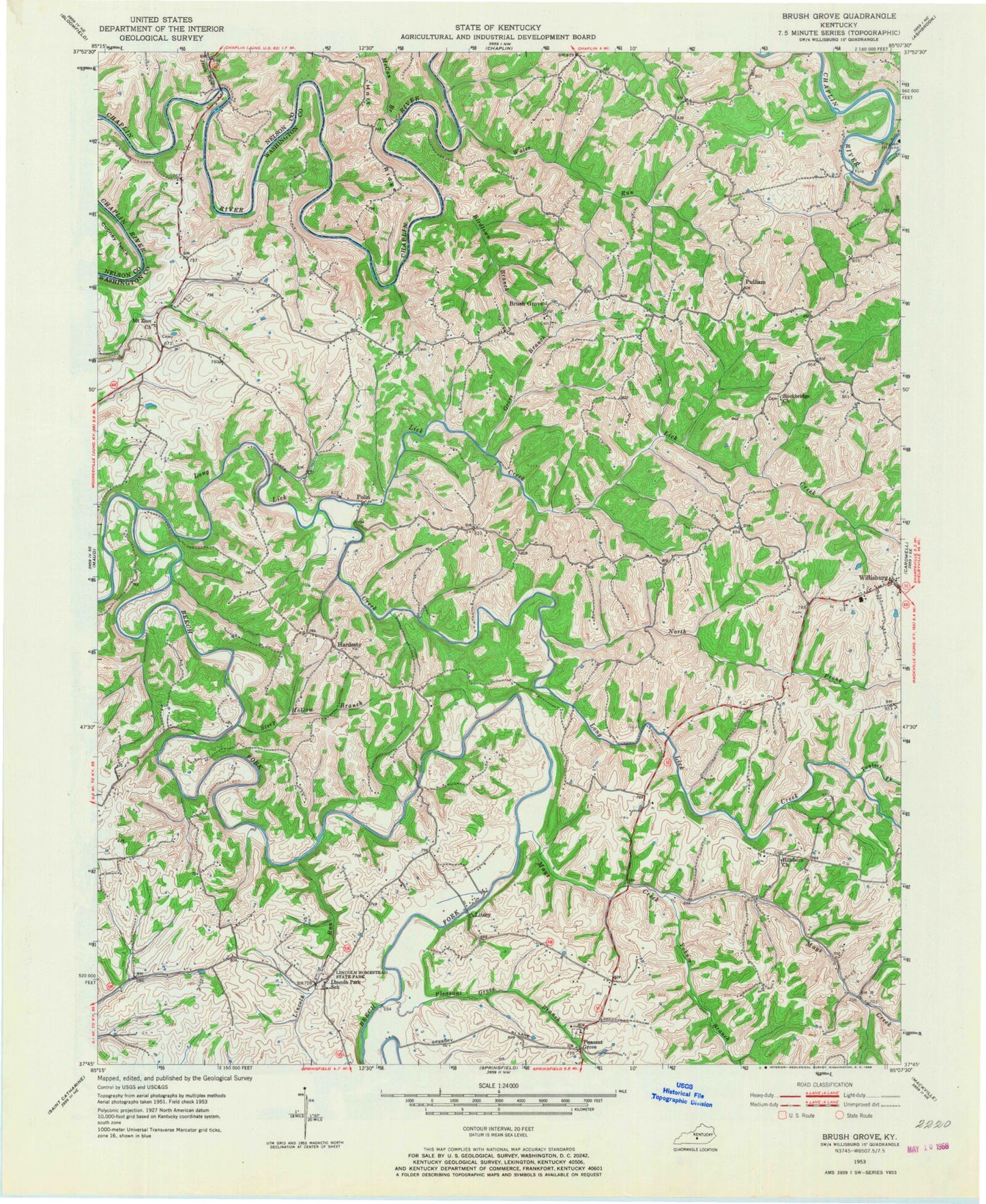
Classic USGS Brush Grove Kentucky 7.5'x7.5' Topo Map
Couldn't load pickup availability
Historical USGS topographic quad map of Brush Grove in the state of Kentucky. Map scale may vary for some years, but is generally around 1:24,000. Print size is approximately 24" x 27"
This quadrangle is in the following counties: Nelson, Washington.
The map contains contour lines, roads, rivers, towns, and lakes. Printed on high-quality waterproof paper with UV fade-resistant inks, and shipped rolled.
Contains the following named places: Beechland Post Office, Birdtown Branch, Bredding Grist Mill, Brush Grove, Brush Grove Baptist Church, Brush Grove School, Cooney Neck, Glens Creek, Grove Branch, Hardesty, Hillsboro Church, Holt Ridge, Jessie Run, Lick Creek, Lincoln Homestead State Park, Lincoln Park School, Lincoln Run, Litsey, Litsey Post Office, Long Lick Creek, Maple Hill Post Office, Mays Creek, McCan Branch, Mount Zion Church, North Prong Long Lick Creek, Pleasant Grove, Pleasant Grove Academy, Pleasant Grove Branch, Pleasant Grove Cemetery, Polin, Polin Post Office, Poortown School, Pulliam, Pulliam Post Office, Rockbridge Baptist Church, Ryans Mill, Steep Hollow Branch, Tatham Post Office, Taylors Fork, Tunnel Mill Covered Bridge, Washington County, Water Run, Willisburg, Willisburg Church, Willisburg Division, Willisburg Lake, Yancey Post Office, Yokum Branch, ZIP Code: 40078