MyTopo
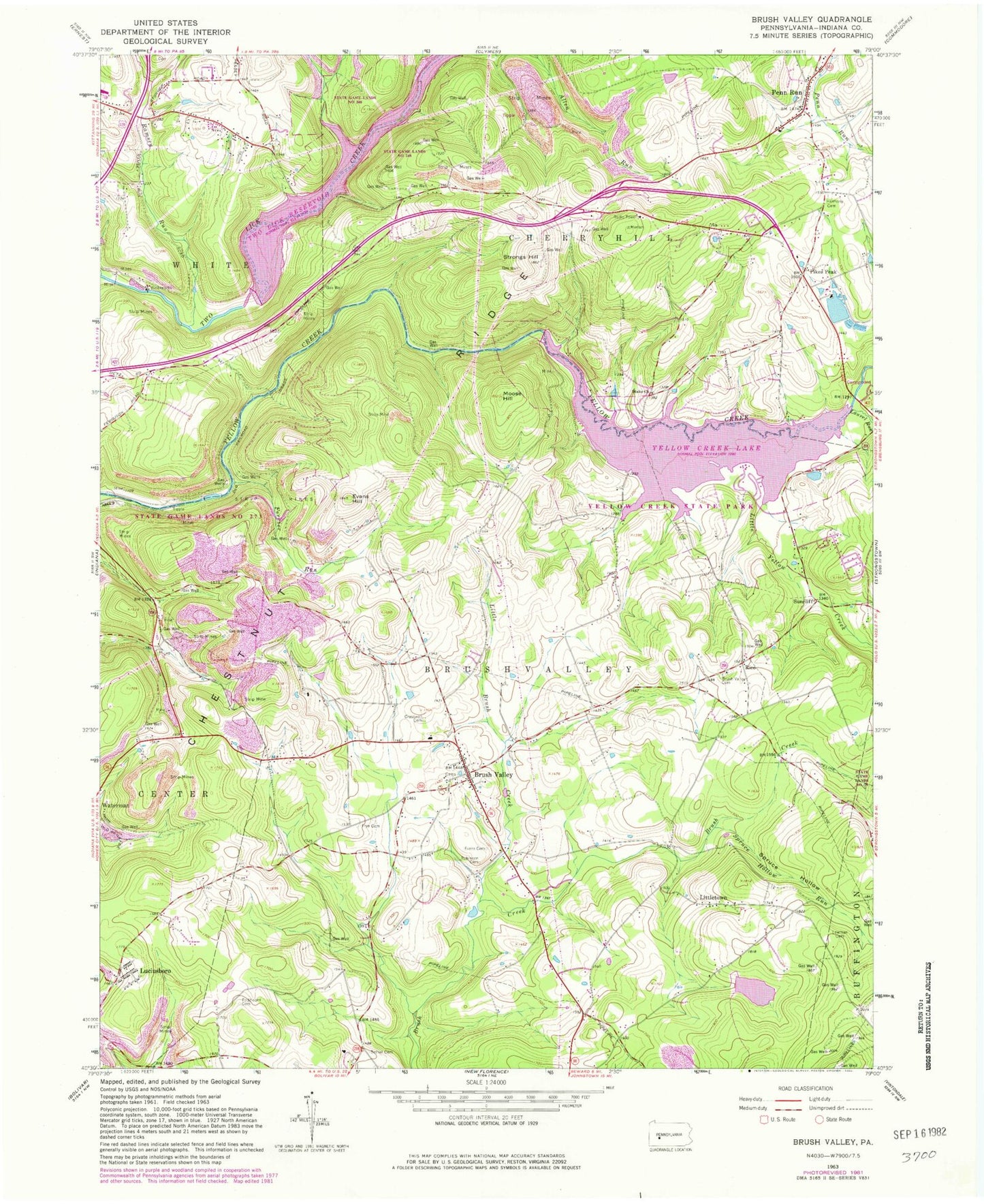
Classic USGS Brush Valley Pennsylvania 7.5'x7.5' Topo Map
Couldn't load pickup availability
Historical USGS topographic quad map of Brush Valley in the state of Pennsylvania. Typical map scale is 1:24,000, but may vary for certain years, if available. Print size: 24" x 27"
This quadrangle is in the following counties: Indiana.
The map contains contour lines, roads, rivers, towns, and lakes. Printed on high-quality waterproof paper with UV fade-resistant inks, and shipped rolled.
Contains the following named places: Dutch Bethel Evangelical Cemetery, Brush Valley, Brush Valley Cemetery, Evans Cemetery, Evans Hill, Ferrier Run, Frye Cemetery, Laurel Run, Little Brush Creek, Little Yellow Creek, Littletown, Luciusboro, Moose Hill, Penn Run, Pikes Peak, Ramsey Run, Rico, Robinson Cemetery, Spruce Hollow, Spruce Hollow Run, Stake Church, Strongs Hill, Suncliff, Gillhouser Run, Evans Field (historical), Bennett Airport (historical), Pond Number Four Dam, Pond Number Four, Lucerne Dam, Lake Margus, Elroy Face Dam, Yellow Creek State Park Dam, Two Lick Creek Dam, Two Lick Creek Reservoir, Yellow Creek State Park, Greenville, Mechanicsburg, Suncliff, South Branch Brush Creek, State Game Lands Number 273, State Game Lands Number 248, Mentch, Township of Brush Valley, Cherryhill Township Volunteer Fire Department Station 240, Brush Valley Volunteer Fire Department Station 230, Penn Run Post Office, Brush Valley Post Office, Cresswell Cemetery, Brush Valley Methodist Cemetery, Harmony Cemetery