MyTopo
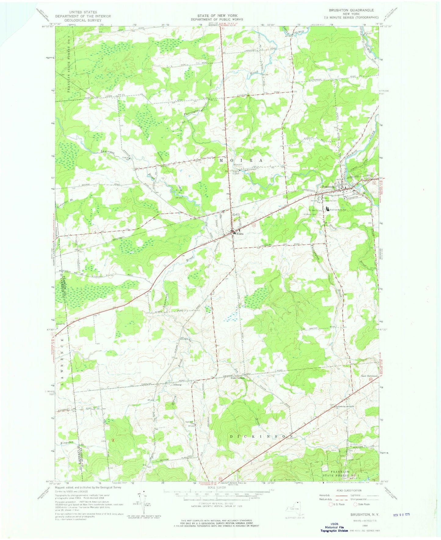
Classic USGS Brushton New York 7.5'x7.5' Topo Map
Couldn't load pickup availability
Historical USGS topographic quad map of Brushton in the state of New York. Map scale may vary for some years, but is generally around 1:24,000. Print size is approximately 24" x 27"
This quadrangle is in the following counties: Franklin, St. Lawrence.
The map contains contour lines, roads, rivers, towns, and lakes. Printed on high-quality waterproof paper with UV fade-resistant inks, and shipped rolled.
Contains the following named places: Alburg, Alburg Brook, Brushton, Brushton Post Office, Brushton Volunteer Fire Department, Brushton-Moira School, East Dickinson Cemetery, Evangelical Wesleyan Church, First Christian Church, Irish Corners, Joy Brook, Moira, Moira Community Cemetery, Moira Post Office, Moira Volunteer Fire Department, North Dickinson Cemetery, Potter School, Saint Marys Cemetery, Saint Mary's Church, Saint Mary's Parish Center, Saint Peters Cemetery, Sand Hill Church, School Number 10, School Number 11, School Number 3, School Number 5, School Number 6, School Number 7, School Number 8, School Number 9, Stony Brook, Sunnyside Cemetery, Town of Moira, Ursone Airport, Village of Brushton, ZIP Codes: 12916, 12957