
MyTopo
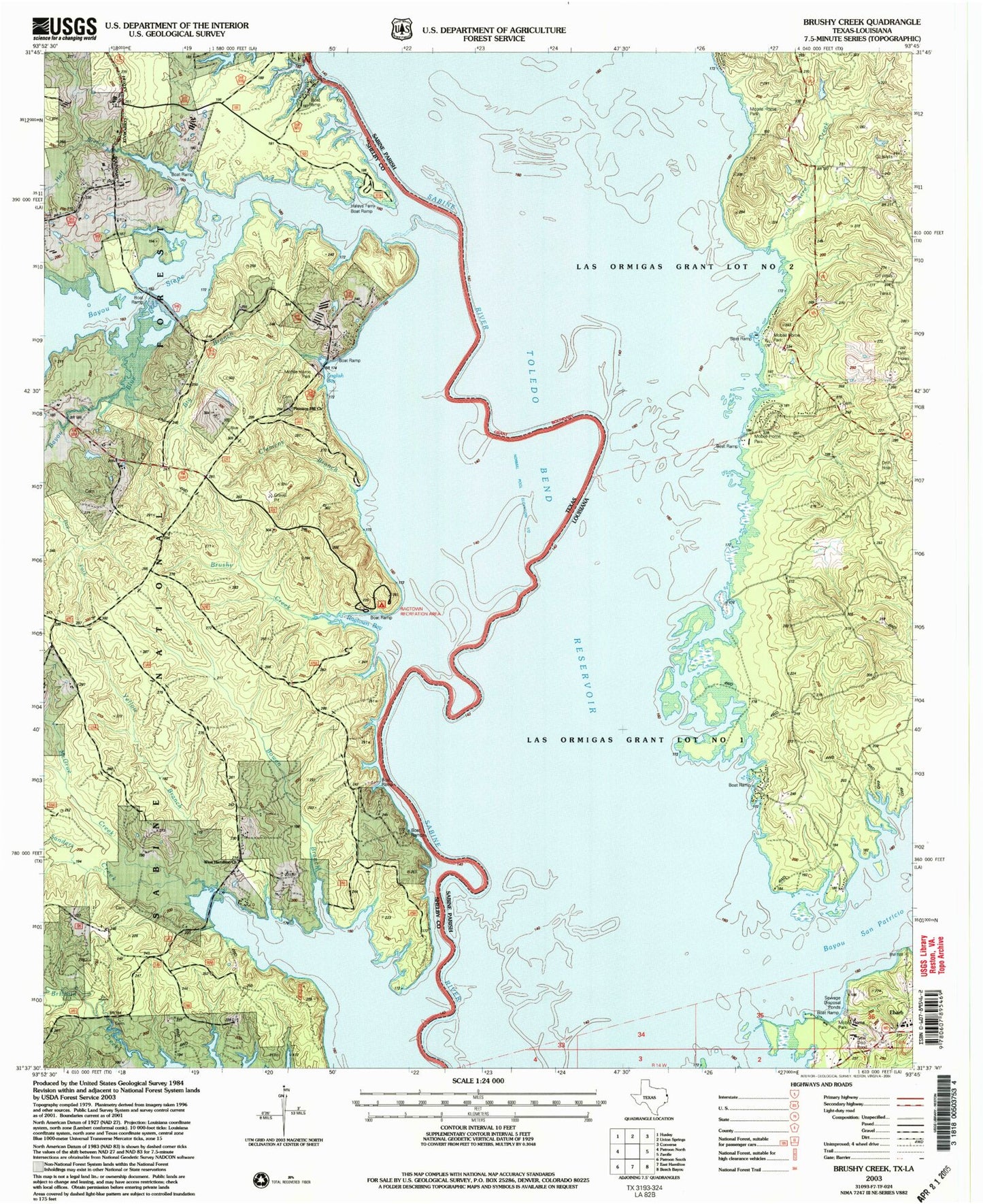
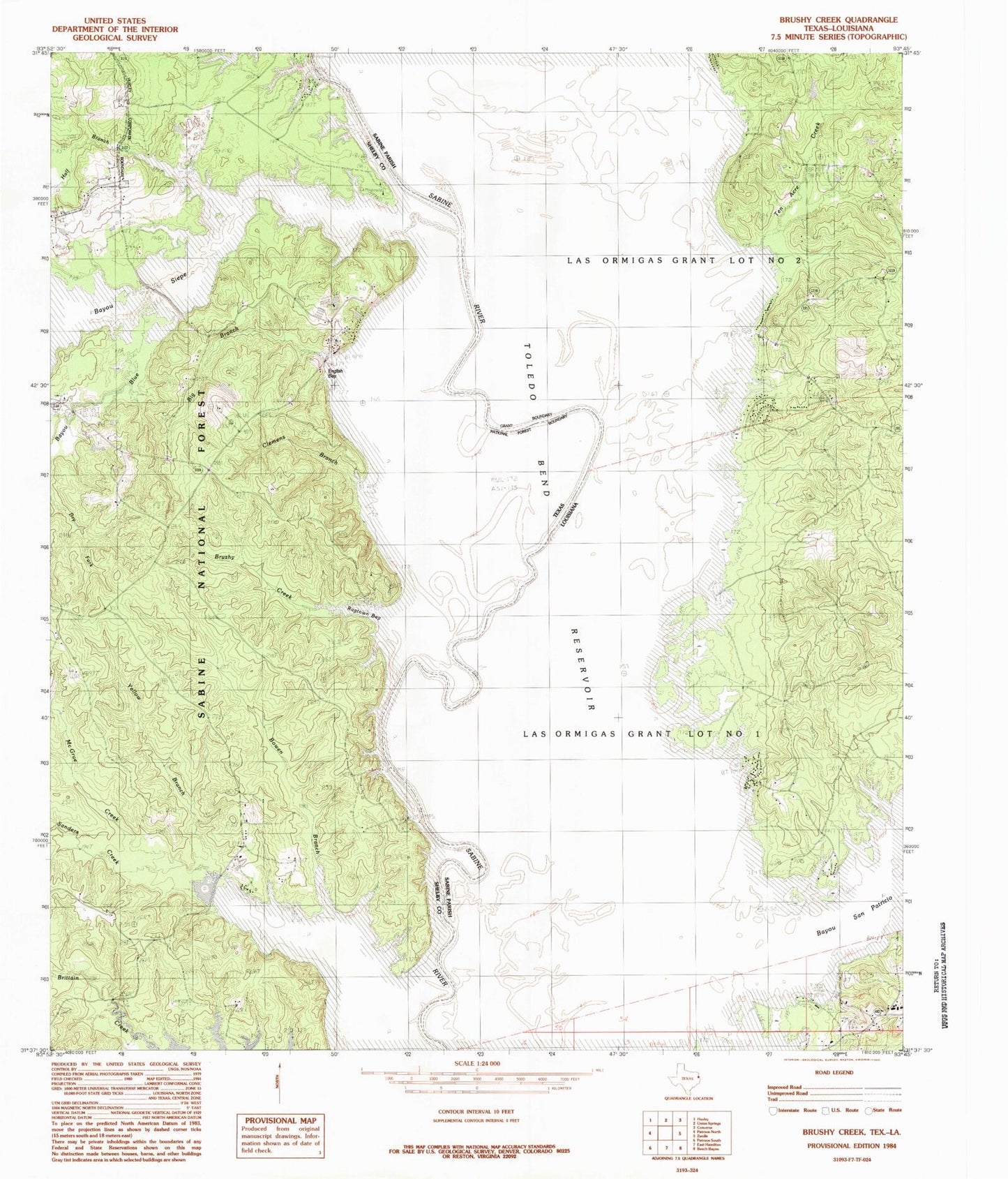
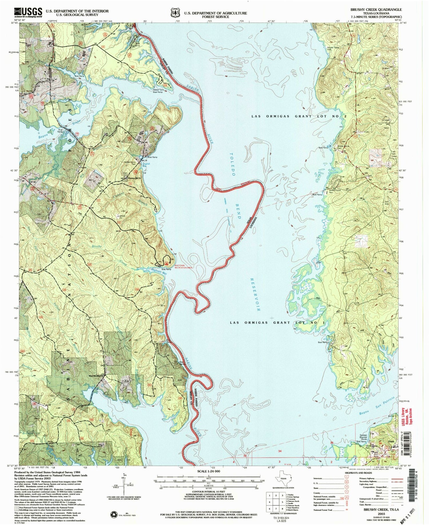
Classic USGS Brushy Creek Texas 7.5'x7.5' Topo Map
Couldn't load pickup availability
Historical USGS topographic quad map of Brushy Creek in the states of Texas, Louisiana. Map scale may vary for some years, but is generally around 1:24,000. Print size is approximately 24" x 27"
This quadrangle is in the following counties: Sabine, Shelby.
The map contains contour lines, roads, rivers, towns, and lakes. Printed on high-quality waterproof paper with UV fade-resistant inks, and shipped rolled.
Contains the following named places: Bayou Blue, Big Branch, Bowen Branch, Brown School, Browns Bend, Brushy Creek, Buzzard Bend, Charley Buck Slough, Clemens Branch, Ebarb, Ebarb High School, Haley Ferry, Half Branch, Horseshoe Slough, Jones Old River, Kilgore Slough, McGrue Creek, North Sabine Fire Protection District Hotwell Station, Parish Governing Authority District 7, Pleasant Hill Church, Prairie Slough, Ragtown Recreation Site, Round Lake, Round Lake Swamp, Saline Lake, San Patricio Lake, Sanders Creek, Silvie Bend, Snyders Boat Ramp, Soto Saline Slough, Sulphur Springs Slough, Ten Acre Creek, Tiger Lake Slough, West Hamilton Church, Yellow Branch