
MyTopo
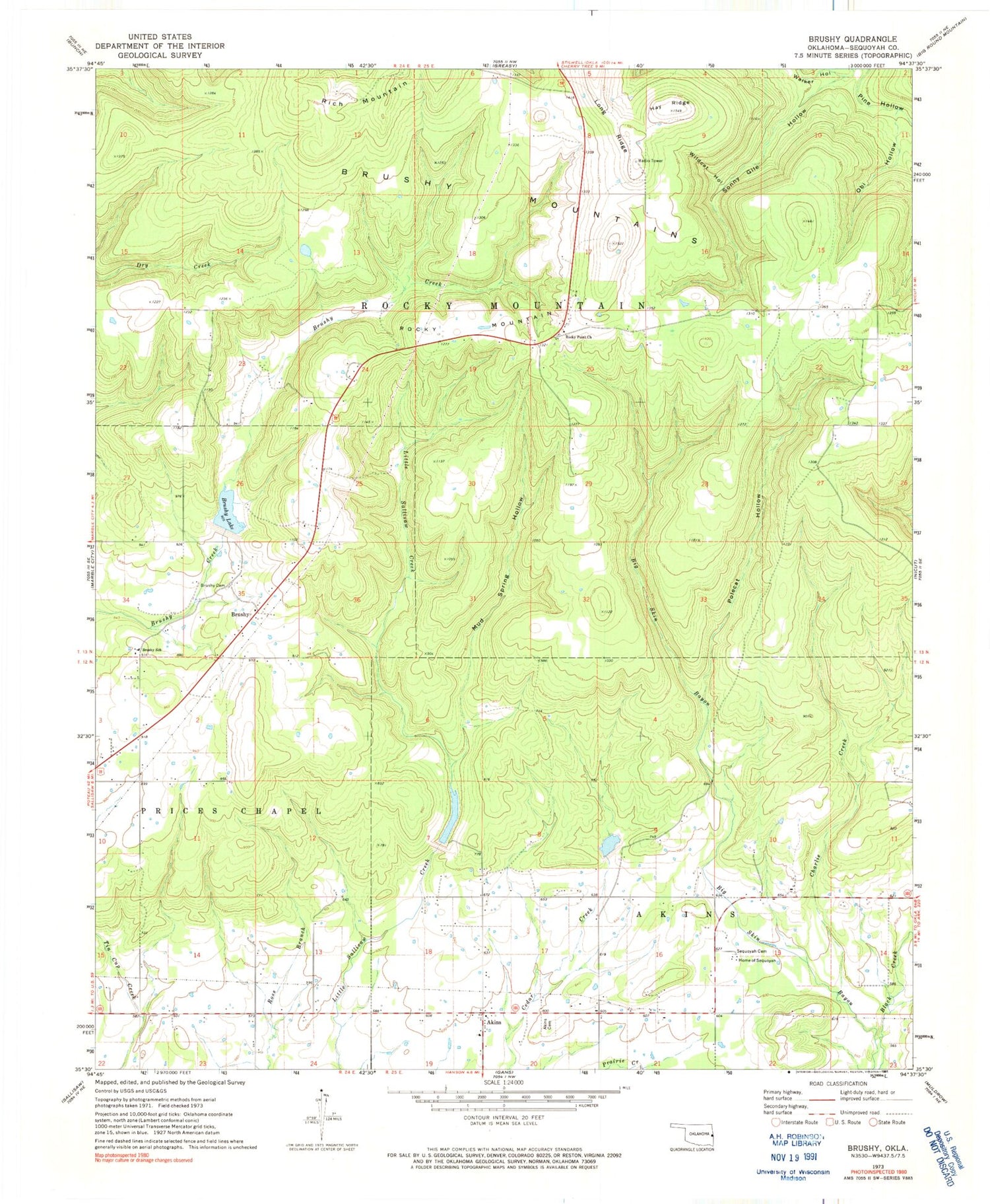
Classic USGS Brushy Oklahoma 7.5'x7.5' Topo Map
Couldn't load pickup availability
Historical USGS topographic quad map of Brushy in the state of Oklahoma. Map scale may vary for some years, but is generally around 1:24,000. Print size is approximately 24" x 27"
This quadrangle is in the following counties: Sequoyah.
The map contains contour lines, roads, rivers, towns, and lakes. Printed on high-quality waterproof paper with UV fade-resistant inks, and shipped rolled.
Contains the following named places: Akins, Akins Cemetery, Akins Census Designated Place, Brushy, Brushy Cemetery, Brushy Census Designated Place, Brushy Elementary School, Brushy Lake, Brushy Mountain Volunteer Fire Department Sequoyah County, Brushy Mountains, Charlie Creek, Hay Ridge, Home of Sequoyah, Long Ridge, Mud Spring Hollow, Northview Cemetery, Obi Hollow, Polecat Hollow, Rocky Mountain, Rocky Point Cemetery, Rocky Point Church, Rocky Point Fire Department, Sallisaw Creek Site 22 Dam, Sallisaw Creek Site 22 Reservoir, Sallisaw Creek Site 30 Dam, Sallisaw Creek Site 36 Dam, Sallisaw Creek Site 36 Reservoir, Sallisaw Creek Site 37 Dam, Sallisaw Creek Site 37 Reservoir, Sallisaw North Division, Sequoyah Cemetery, Sequoyah Non-Community, Stoney Point, Stoney Point Census Designated Place, Township of Prices Chapel, Township of Rocky Mountain, Walker Hollow, Wildcat Hollow


