MyTopo
Classic USGS Bryantsville Kentucky 7.5'x7.5' Topo Map
Couldn't load pickup availability
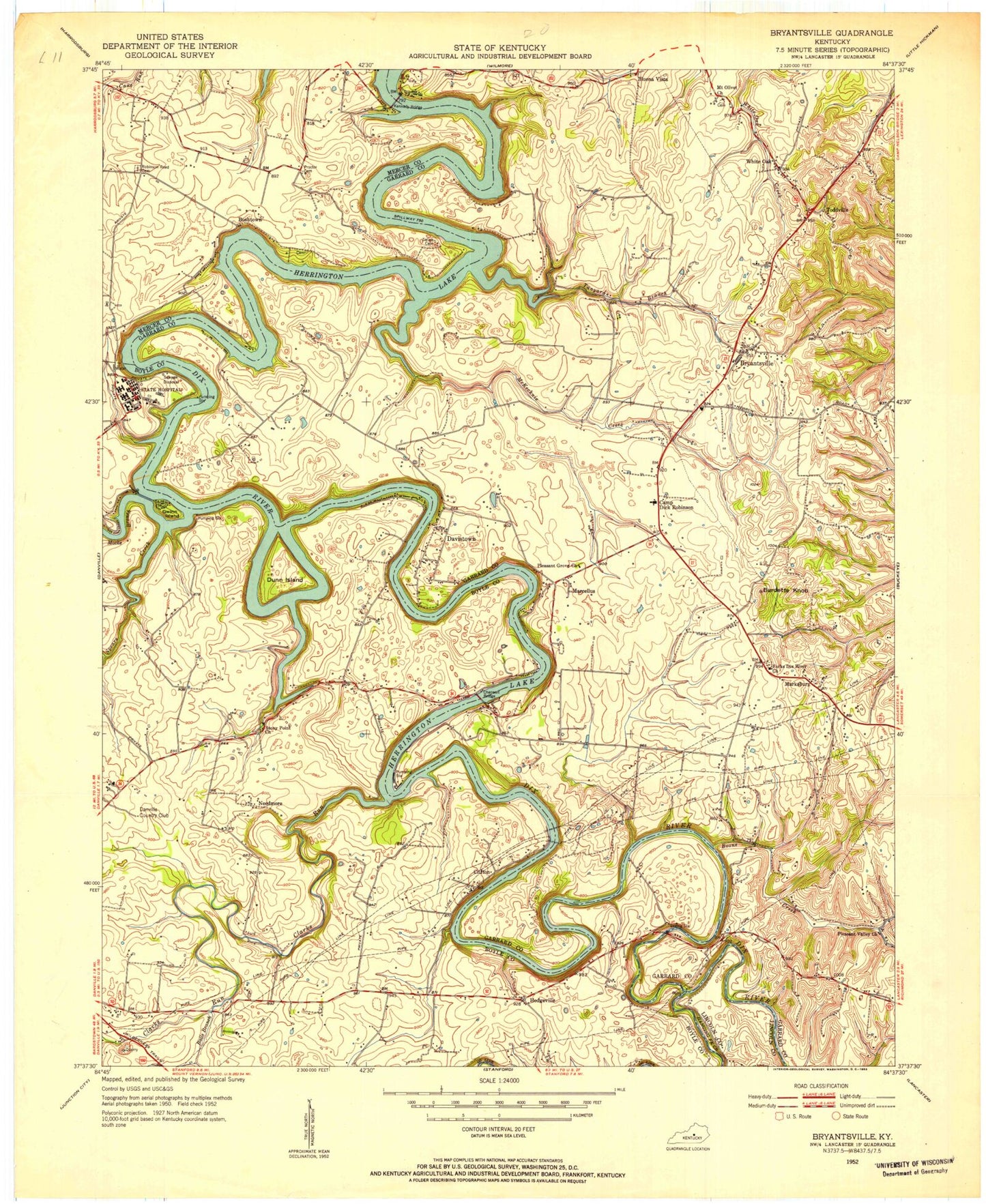
Historical USGS topographic quad map of Bryantsville in the state of Kentucky. Typical map scale is 1:24,000, but may vary for certain years, if available. Print size: 24" x 27"
This quadrangle is in the following counties: Boyle, Garrard, Lincoln, Mercer.
The map contains contour lines, roads, rivers, towns, and lakes. Printed on high-quality waterproof paper with UV fade-resistant inks, and shipped rolled.
Contains the following named places: Balls Branch, Boone Creek, Bryantsville, Burdette Knob, Camp Dick Robinson, Chenault Bridge, Clarks Run, Davistown, Dunn Island, Forks Dix River Church, Gwinn Island, Hanging Fork Creek, Herrington Lake, Kennedy Bridge, McKecknie Creek, Mocks Branch, Mount Olivet Church, Pleasant Grove Church, Pleasant Valley Church, Proctor Cemetery, Robinson Road Cemetery, Spears Creek, Stony Point Church, Tanyard Branch, Bushtown, Clifton, Hedgeville, Marcellus, Marksbury, Little Needmore, Toddville, White Oak, Danville Country Club, Gravity Zero Airport, WKLO-AM (Danville), Bryantsville Division, Chenault Bridge, Kings Mill Covered Bridge (historical), Boone Creek School (historical), Brights Bend, Bryantsville School (historical), Downing Station (historical), Fisher Ford (historical), Kennedys Bridge, Marcellus Post Office (historical), Marksbury Post Office (historical), Mount Hebron Ridge, Rice Academy (historical), Sheltons Mill (historical), Toddville Post Office (historical), White Oak School (historical), Cliff Dwellers Club (historical), Clifton School (historical), Danville Youth Development Center, Daugherty Station (historical), Fishers Station (historical), Hedgeville Post Office (historical), Hedgeville School (historical), Kentucky State Hospital (historical), Lancaster River Club (historical), Meuxtown (historical), Syfax Post Office (historical), Walnut Hill School (historical), Wells Landing (historical), Bellevue (historical), Dix River Post Office (historical), Edgewood (historical), Maplewood (historical), Sallee Cemetery, Boyle County Fire Protection District, Camp Dick Fire Department Station 1, Camp Dick Fire Department Station 3, Northpoint Education Center, Northpoint Training Center, Bryantsville Post Office