MyTopo
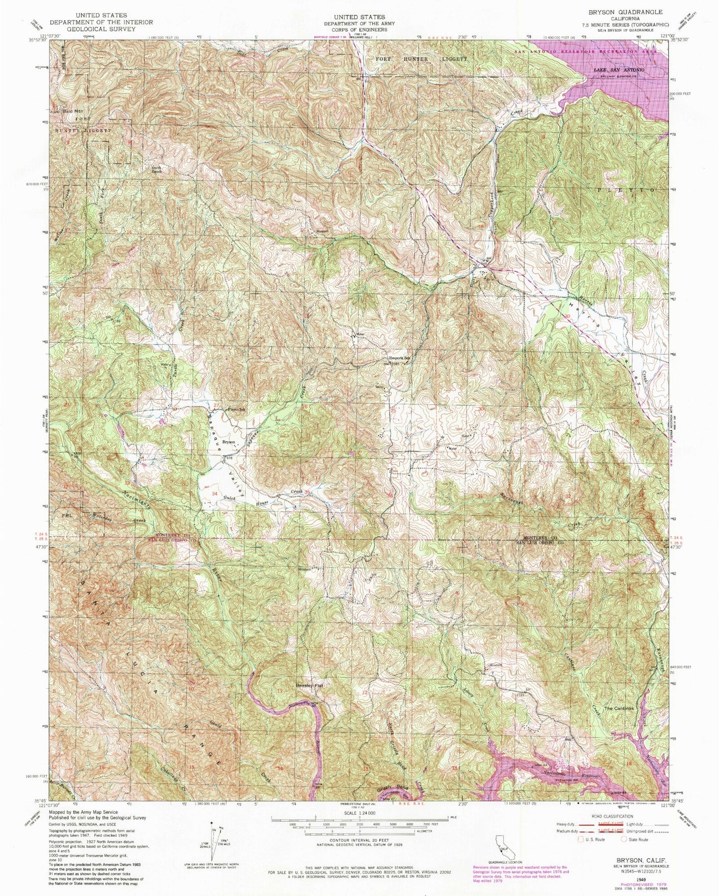
Classic USGS Bryson California 7.5'x7.5' Topo Map
Regular price
$16.95
Regular price
Sale price
$16.95
Unit price
per
Couldn't load pickup availability
Historical USGS topographic quad map of Bryson in the state of California. Map scale may vary for some years, but is generally around 1:24,000. Print size is approximately 24" x 27"
This quadrangle is in the following counties: Monterey, San Luis Obispo.
The map contains contour lines, roads, rivers, towns, and lakes. Printed on high-quality waterproof paper with UV fade-resistant inks, and shipped rolled.
Contains the following named places: Asbury Creek, Bald Mountain, Beasley Flat, Bryson, Cantinas Creek, Copperhead Creek, Gulch House Creek, Hesperia School, Nacimiento River Pit, Pinkerton School, Pleyto School, Sapaque Creek, Sapaque Valley, Smith Ranch, The Cantinas, Turtle Creek, Waterdog Creek