MyTopo
Classic USGS Buck Fever Ridge Wyoming 7.5'x7.5' Topo Map
Couldn't load pickup availability
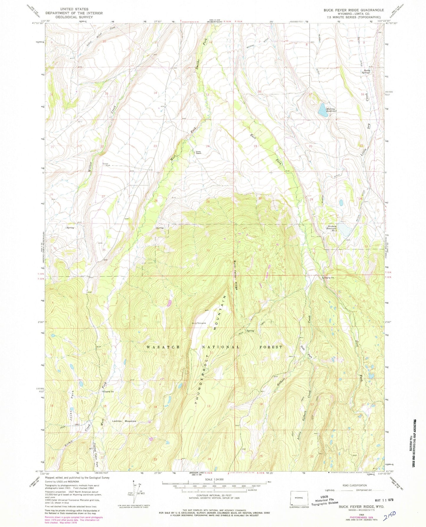
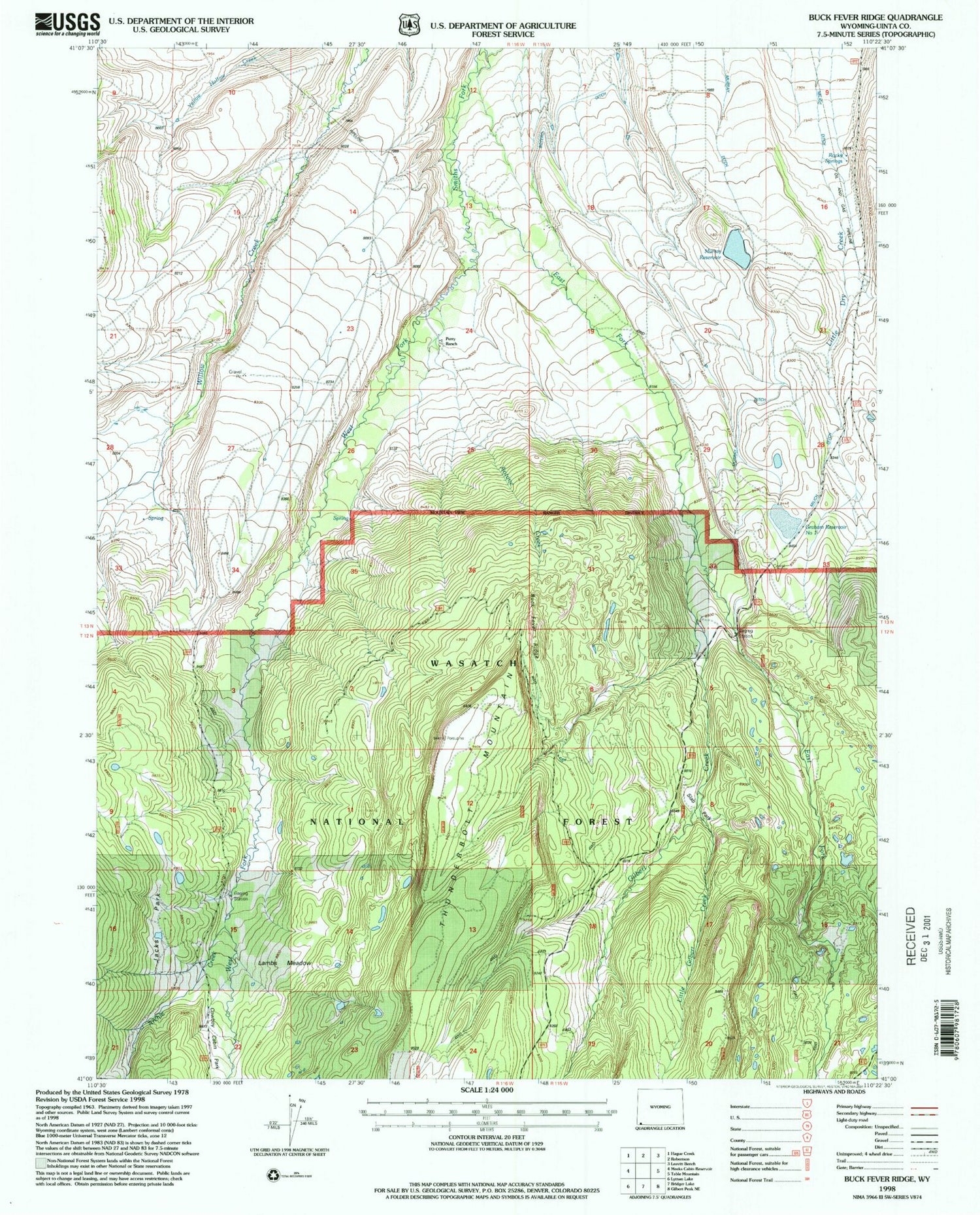
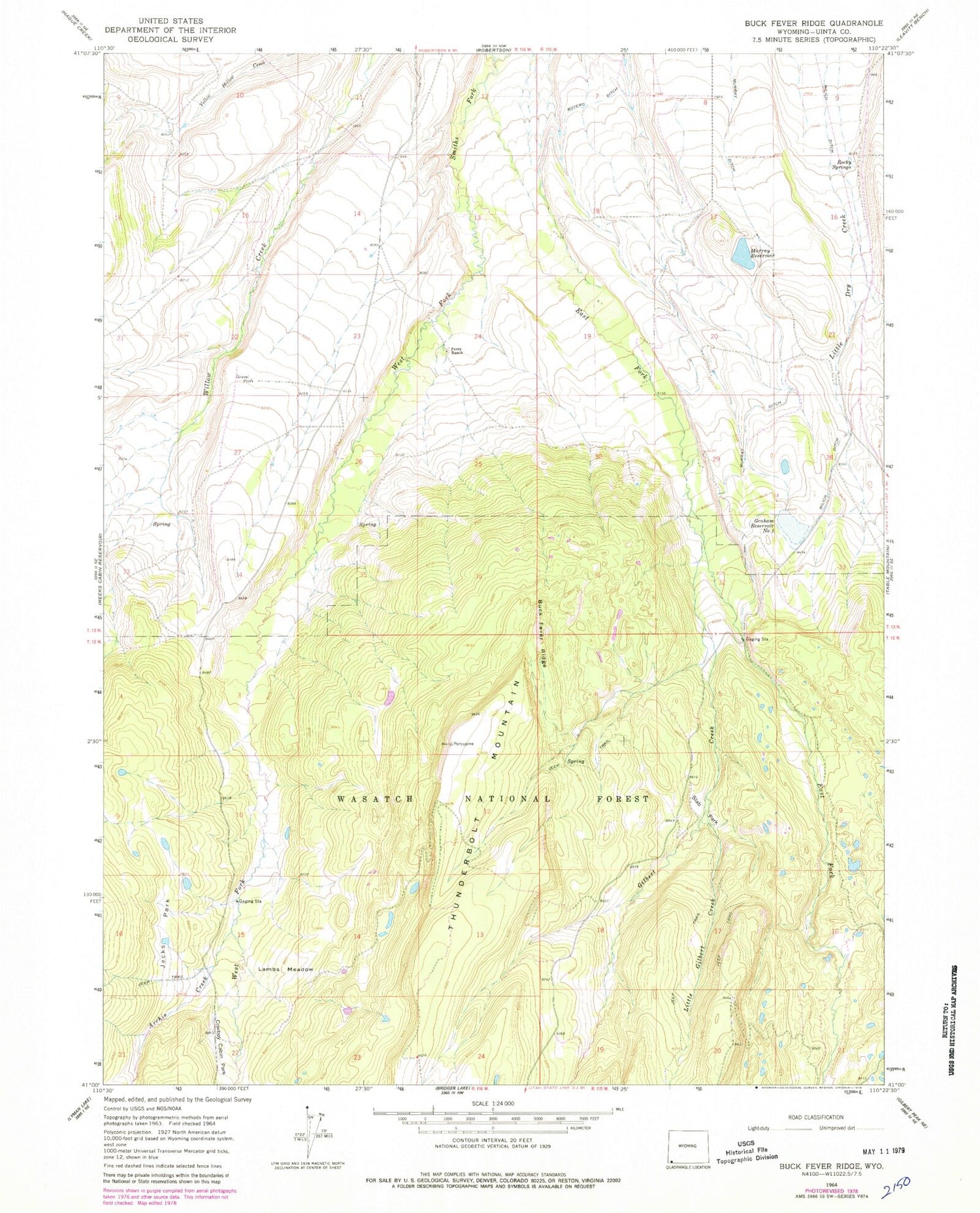
Historical USGS topographic quad map of Buck Fever Ridge in the states of Wyoming, Utah. Map scale is 1:24000. Print size is approximately 24" x 27"
This quadrangle is in the following counties: Uinta.
The map contains contour lines, roads, rivers, towns, and lakes. Printed on high-quality waterproof paper with UV fade-resistant inks, and shipped rolled.
Contains the following named places: Antone Creek, Archie Creek, Botero Ditch, Buck Fever Ridge, Cold Spring, Cowboy Cabin Park, Deadhorse Park, Deadhorse State Hospital Camp, East Fork Smiths Fork, East Fork Smiths Fork, Gilbert Creek, Graham Dam, Graham Reservoir Number 1, Jacks Park, Lambs Meadow, Little Gilbert Creek, Murray Ditch, Murray Reservoir, Perry Ranch, Rocky Springs, Slab Park, Thunderbolt Mountain, Tipperary Dam, West Fork Smiths Fork, West Fork Smiths Fork