MyTopo
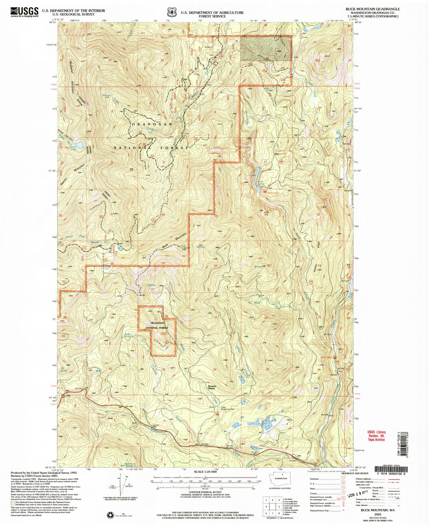
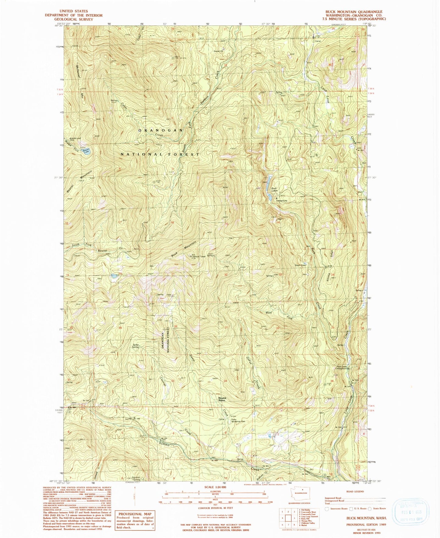
Classic USGS Buck Mountain Washington 7.5'x7.5' Topo Map
Couldn't load pickup availability
Historical USGS topographic quad map of Buck Mountain in the state of Washington. Map scale may vary for some years, but is generally around 1:24,000. Print size is approximately 24" x 27"
This quadrangle is in the following counties: Okanogan.
The map contains contour lines, roads, rivers, towns, and lakes. Printed on high-quality waterproof paper with UV fade-resistant inks, and shipped rolled.
Contains the following named places: Beaver Lake Dam, Beaver Lake Trail, Beaver Mountain, Buck Mountain, Cabin Creek, Central Creek, Depue Creek, DePue Creek, Loup Loup Dam, McDaniel Mountain, Mowich Illahee, Pixley Sportsman Park, Ritchie Ridge, Rock Creek, Rock Creek Campground, Rock Lakes, Rock Lakes Campground, Spike Spring, State Road Cabin Camp, Summit Creek, Sweat Creek, West Fork Rock Creek