MyTopo
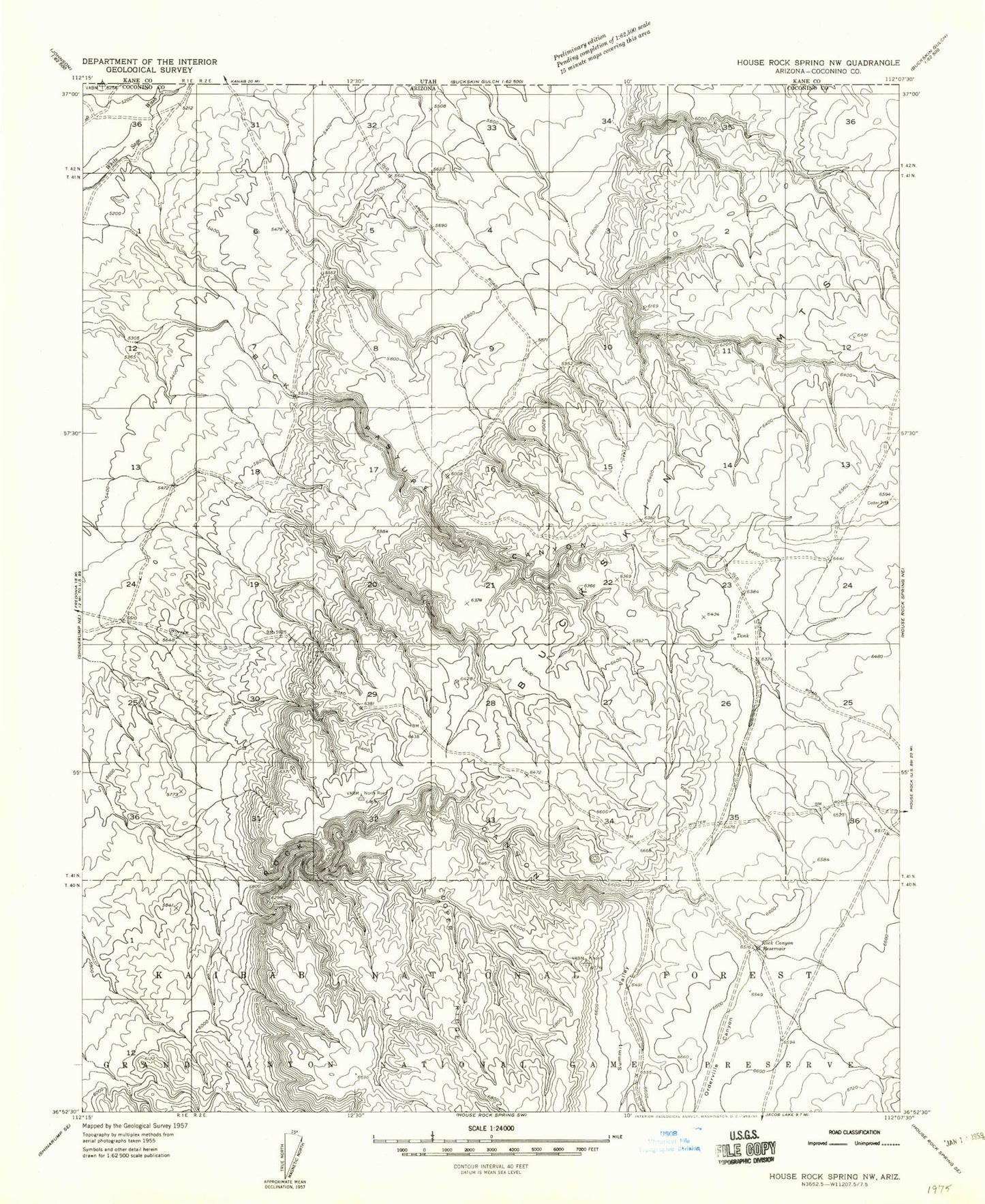
Classic USGS Buck Pasture Canyon Arizona 7.5'x7.5' Topo Map
Couldn't load pickup availability
Historical USGS topographic quad map of Buck Pasture Canyon in the state of Arizona. Typical map scale is 1:24,000, but may vary for certain years, if available. Print size: 24" x 27"
This quadrangle is in the following counties: Coconino.
The map contains contour lines, roads, rivers, towns, and lakes. Printed on high-quality waterproof paper with UV fade-resistant inks, and shipped rolled.
Contains the following named places: Buckskin Mountains, Rock Canyon Reservoir, Summit Valley, Franks Reservoir, Shearing Shed Reservoir, Bentonite Reservoir, Winter Road Catchment, Dead Man Pockets, Old Arizona Catchment, Navajo Trail, Kaibab Plateau Arizona Trail, Summit Valley Tank, Summit Valley Wildlife Apron, Navajo Trait Tank, Navajo Trait Trick Tank, Wagon Hollow, Water Canyon