MyTopo
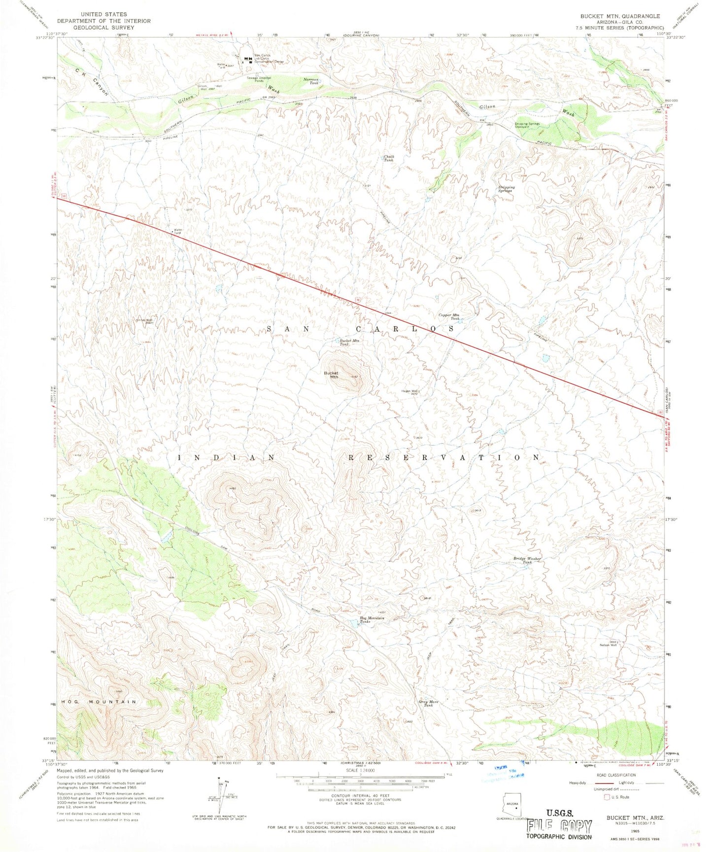
Classic USGS Bucket Mountain Arizona 7.5'x7.5' Topo Map
Couldn't load pickup availability
Historical USGS topographic quad map of Bucket Mountain in the state of Arizona. Map scale may vary for some years, but is generally around 1:24,000. Print size is approximately 24" x 27"
This quadrangle is in the following counties: Gila.
The map contains contour lines, roads, rivers, towns, and lakes. Printed on high-quality waterproof paper with UV fade-resistant inks, and shipped rolled.
Contains the following named places: Baxter Tank, Bridge Washer Tank, Bucket Mountain, Bucket Mountain Tank, C K Canyon, Chalk Tank, Copper Mountain Dam, Copper Mountain Tank, Dripping Springs, Dripping Springs Stockyard, East Bucket Mountain Dam, Gilson Well, Gray Mare Tank, Hagen Well, Hog Mountain Dam, Hog Mountain Dam Number Two, Hog Mountain Tanks, Kinney Well, Narrows Tank, Nelson Well, San Carlos Job Corporation Conservation Center, San Carlos Training Institute