
MyTopo
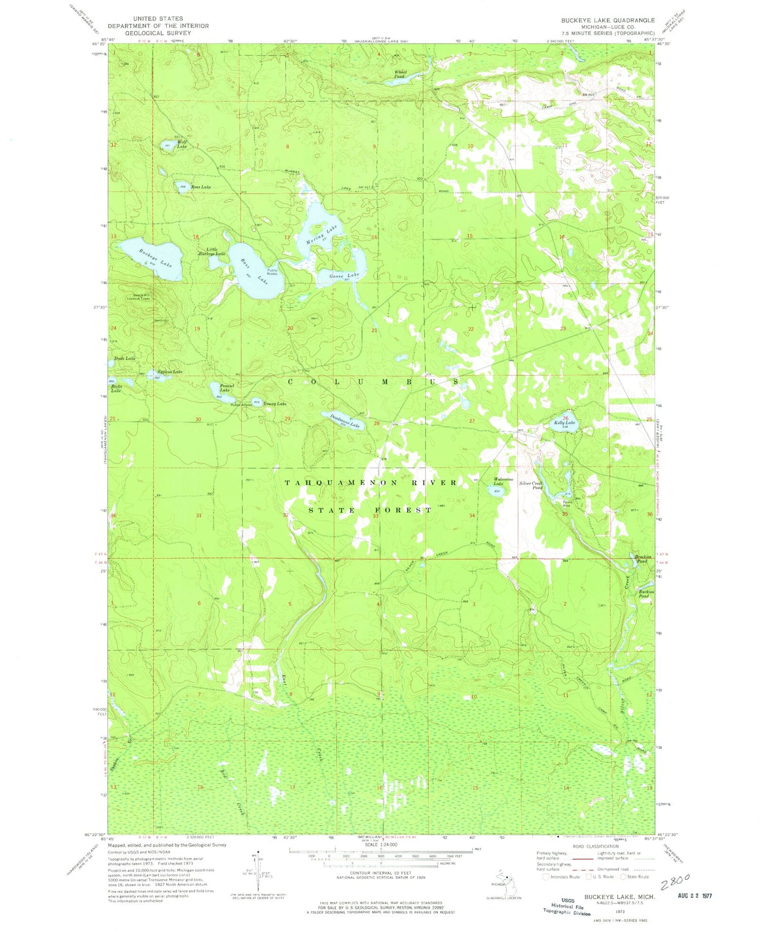
Classic USGS Buckeye Lake Michigan 7.5'x7.5' Topo Map
Couldn't load pickup availability
Historical USGS topographic quad map of Buckeye Lake in the state of Michigan. Map scale may vary for some years, but is generally around 1:24,000. Print size is approximately 24" x 27"
This quadrangle is in the following counties: Luce.
The map contains contour lines, roads, rivers, towns, and lakes. Printed on high-quality waterproof paper with UV fade-resistant inks, and shipped rolled.
Contains the following named places: Bass Lake, Bass Lake State Forest Campground, Becks Lake, Beech Hill Lookout Tower, Brockies Pond, Buckeye Lake, Buckies Pond, Deadmans Lake, Dude Lake, Goose Lake, Kelly Lake, Little Buckeye Lake, Murray Lake, Peanut Lake, Ross Lake, Silver Creek Pond, Syphon Lake, Township of Columbus, Whorl Pond, Wolf Lake, Wolverine Lake, Young Lake


