
MyTopo
Classic USGS Buckeye Mountain California 7.5'x7.5' Topo Map
Couldn't load pickup availability
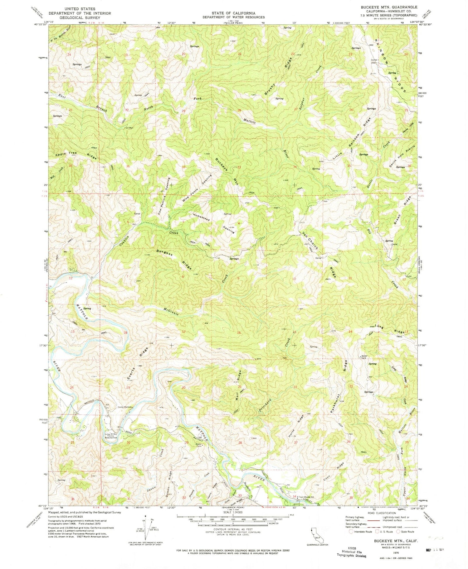
Historical USGS topographic quad map of Buckeye Mountain in the state of California. Map scale is 1:24000. Print size is approximately 24" x 27"
This quadrangle is in the following counties: Humboldt.
The map contains contour lines, roads, rivers, towns, and lakes. Printed on high-quality waterproof paper with UV fade-resistant inks, and shipped rolled.
Contains the following named places: Arthur W Way County Memorial Park, Buckeye Mountain, Burgess Ridge, Camp Mattole, Conklin Creek, Cook Gulch, Coon Ridge, Cow Pasture Opening, Devils Creek, Devils Hole, Devils Hole Prairie, Everts Ridge, Granny Creek, Homestead Opening, Horse Ridge, Indian Creek, Little Rainbow Ridge, Long Ridge, Long Ridge Creek, Mail Ridge, McGinnis Creek, Parkhurst Ridge, Pritchard Creek, Saunders Creek, Squaw Creek, Sulphur Creek, Upper Mattole School, Van Choick Ridge, Wire Fence Opening


