MyTopo
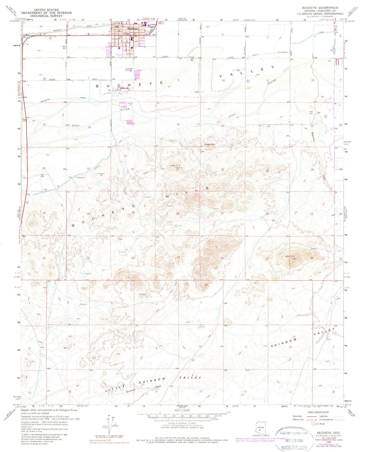
Classic USGS Buckeye Arizona 7.5'x7.5' Topo Map
Couldn't load pickup availability
Historical USGS topographic quad map of Buckeye in the state of Arizona. Map scale may vary for some years, but is generally around 1:24,000. Print size is approximately 24" x 27"
This quadrangle is in the following counties: Maricopa.
The map contains contour lines, roads, rivers, towns, and lakes. Printed on high-quality waterproof paper with UV fade-resistant inks, and shipped rolled.
Contains the following named places: Allenville, Buckeye, Buckeye City Hall, Buckeye Elementary School, Buckeye Fire Department Station 701 Downtown, Buckeye Light and Life Church, Buckeye Middle School, Buckeye Police Department, Buckeye Post Office, Buckeye Primary School, Buckeye Public Library, Buckeye Seventh Day Adventist Church, Buckeye Sports Field, Buckeye Town Park, Buckeye Valley Fire District Station 324, Buckeye Valley Museum, Cactus Plaza Shopping Center, Community United Methodist Church, Dr Robert A Saide Recreation Center, Eagle Mountain, Estrella Valley Mobile Home Park, Farm Ag Airport, First Southern Baptist Church in Buckeye, Maricopa County Sheriff's Office Buckeye, Mount Pleasant Church, Rainbow Valley, The Church of Jesus Christ of Latter Day Saints, Town of Buckeye Wastewater Treatment Plant, Waterman Wash, Westpark Elementary School, ZIP Code: 85326