
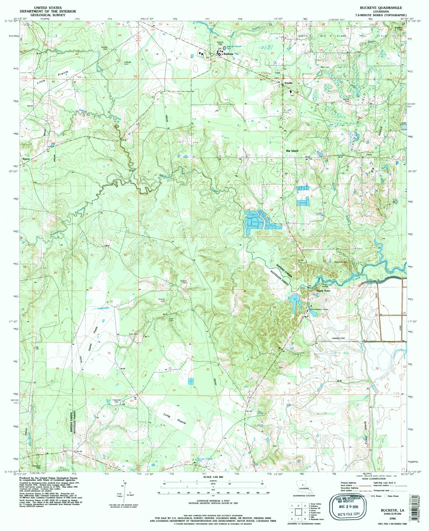
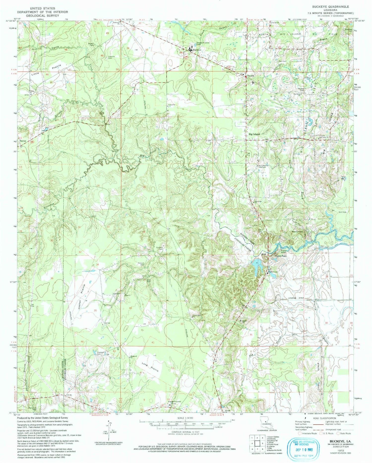
MyTopo
Classic USGS Buckeye Louisiana 7.5'x7.5' Topo Map
Couldn't load pickup availability
Historical USGS topographic quad map of Buckeye in the state of Louisiana. Map scale may vary for some years, but is generally around 1:24,000. Print size is approximately 24" x 27"
This quadrangle is in the following counties: Avoyelles, Rapides.
The map contains contour lines, roads, rivers, towns, and lakes. Printed on high-quality waterproof paper with UV fade-resistant inks, and shipped rolled.
Contains the following named places: Barron, Barron Chapel, Bayou Prairie, Big Creek Church, Big Island, Big Island Baptist Church, Big Island Church, Big Island Oil Field, Big Island School, Big Slough, Bradford Cemetery, Buckeye, Buckeye Elementary School, Buckeye High School, Buckeye Post Office, Burlew Cemetery, Cainey Bayou, Camel Church, Campbell Cemetery, Center Point Census Designated Place, Center Point Church, Charlotte School, Cole Cemetery, Coles Island, Deville, Deville Census Designated Place, Deville Church, Deville Post Office, Dyson Creek, Guillory Cemetery, Guillory School, Haines Creek, Harmony Church, Hayden R Lawrence Upper Elementary School, Hillside Church, Holloway Church, Hopewell Cemetery, Hopewell Church, Horsepen Creek, Island Bayou, Little Prairie, Long Prairie, Louisiana Noname 51 Dam, New Hope Free Methodist Church, Newell Cemetery, Newell Church, North Point, Parish Governing Authority District C, Paul Cemetery, Richey Church, Slocum Cemetery, Smith Cemetery, Tyler Cemetery, Union Church, United Church, Vasher Prairie, Ward One, Wiley Point School, Wileys Point, Woodson Cemetery, World Harvest Tabernacle, ZIP Codes: 71323, 71328


