MyTopo
Classic USGS Buckhead Mesa Arizona 7.5'x7.5' Topo Map
Couldn't load pickup availability
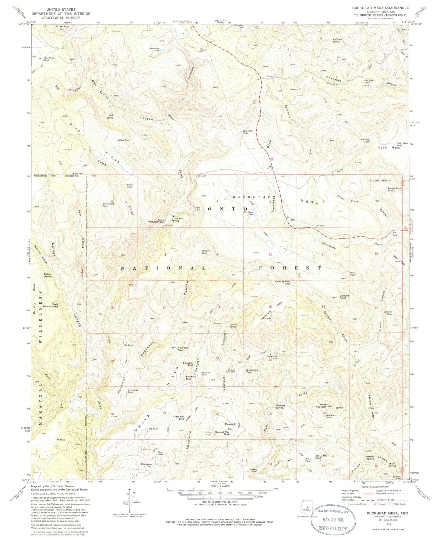
Historical USGS topographic quad map of Buckhead Mesa in the state of Arizona. Typical map scale is 1:24,000, but may vary for certain years, if available. Print size: 24" x 27"
This quadrangle is in the following counties: Gila.
The map contains contour lines, roads, rivers, towns, and lakes. Printed on high-quality waterproof paper with UV fade-resistant inks, and shipped rolled.
Contains the following named places: Bear Canyon, Bee Seep Tank, Big Tank, Birch Mesa, Black Mesa, Bradshaw Tank, Brushy Basin, Brushy Basin Tank, Brushy Canyon, Brushy Tank, Buckhead Canyon, Buckhead Draw, Buckhead Mesa, Buckhead Tank, Buckhead Tank, Cedar Flat Tank, Cedar Mesa, Cedar Mesa Canyon, Cedar Mesa Tank, Connally Point, Connally Point Tank, Contact Canyon, Contact Spring, Contact Trick Tank, Crackerjack Mesa, Crackerjack Mine, Crackerjack Ridge, Crackerjack Tank, Cypress Canyon, Dead Cow Canyon, Donahue Tank, Dripping Springs, East Tank, East Walnut Canyon, Gowan Mine, Horsethief Bench, Horsethief Tank, Juniper Tank, Limestone Tank, Maverick Flat, Maverick Flat Tank, Oak Spring, Oak Spring Canyon, Pilot Knob, Pilot Knob Tank, Pine Ridge, Pine Ridge Tank, Point Tank, Point Tank, Red Hill Tank, Red Rock Spring, Red Rock Tank, Ridge Tank, South Walnut Spring, Summit Mine, Summit Spring, Tank Gulch, Tank Gulch Tank, The Narrows, Tip Tank, Tonto Natural Bridge, Walnut Canyon, Walnut Spring, Water Spring, White Hills, White Hills Tank, White Mountain, White Mountain Mine, White Mountain Tank, White Tank, Whiterock Corral, Thirtysix Tank, Bridge Tank, Cedar Flat, Clover Spring, Rock Canyon, Pine Trailhead, Tonto Natural Bridge State Park