MyTopo
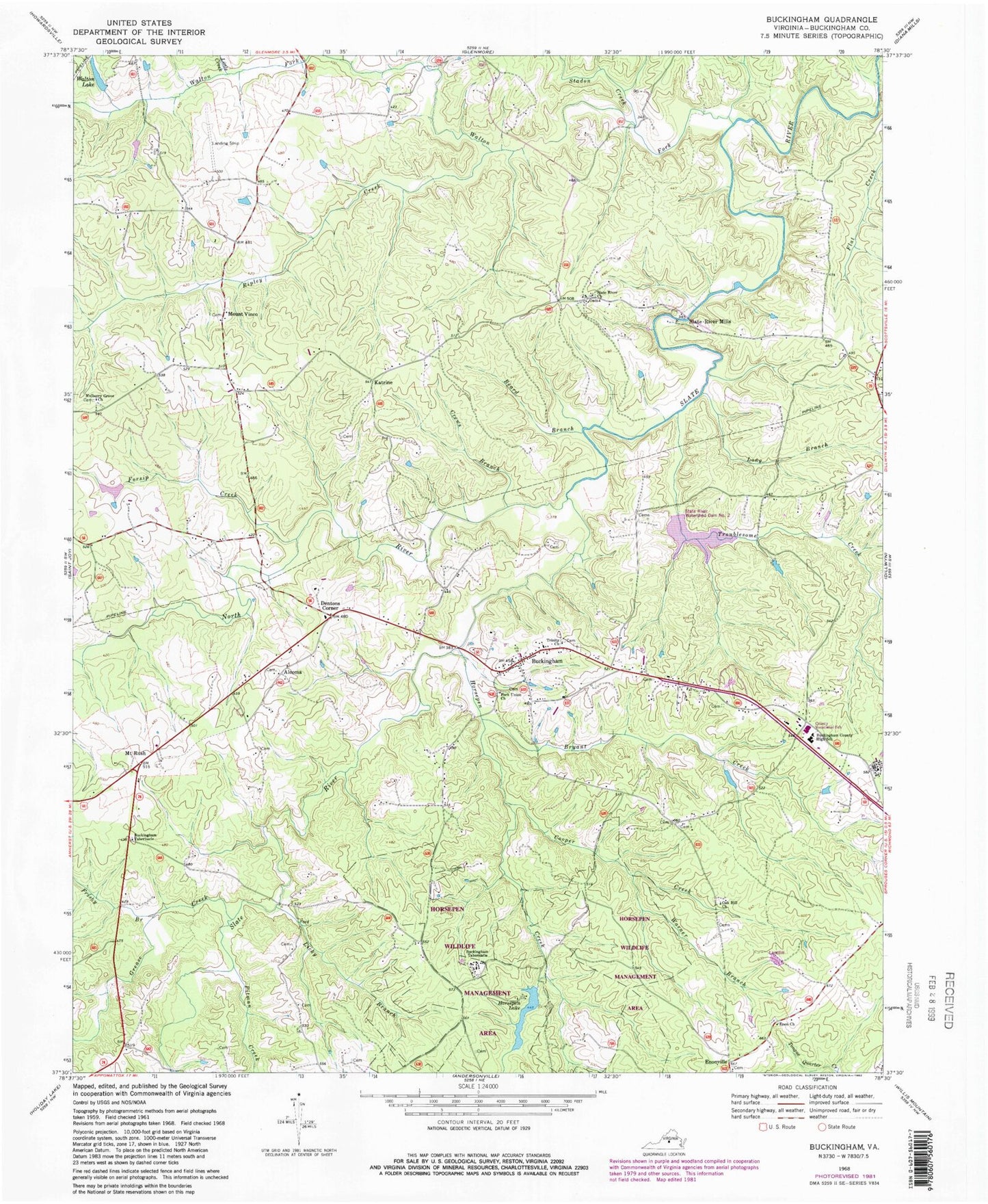
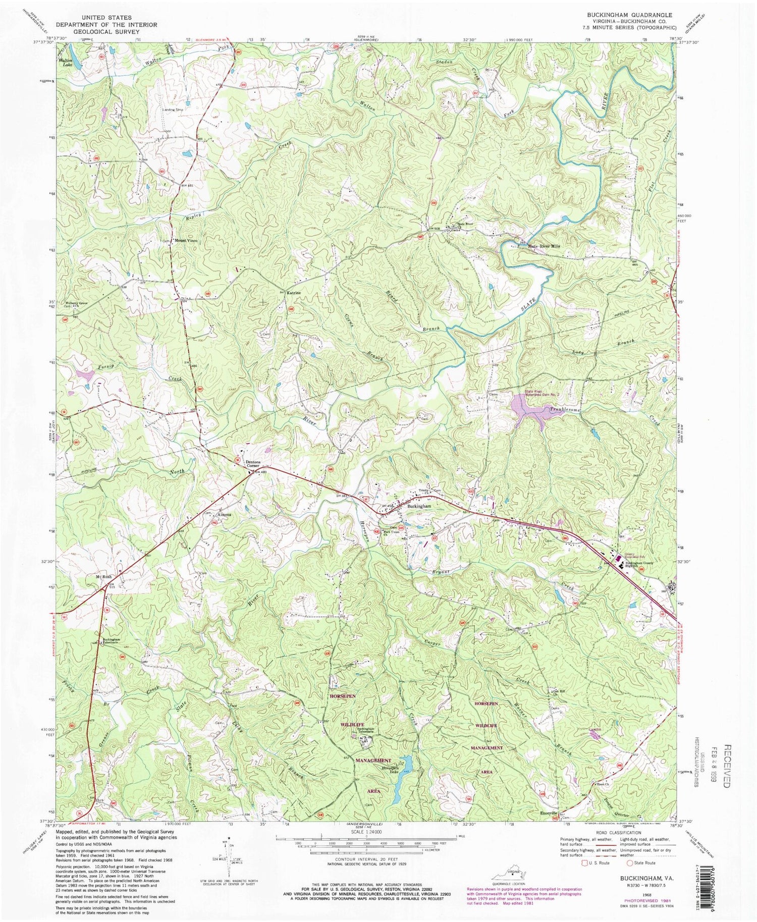
Classic USGS Buckingham Virginia 7.5'x7.5' Topo Map
Couldn't load pickup availability
Historical USGS topographic quad map of Buckingham in the state of Virginia. Map scale is 1:24000. Print size is approximately 24" x 27"
This quadrangle is in the following counties: Buckingham.
The map contains contour lines, roads, rivers, towns, and lakes. Printed on high-quality waterproof paper with UV fade-resistant inks, and shipped rolled.
Contains the following named places: Alcoma, Beard Branch, Bradshaw Pond, Bryant Creek, Buckingham, Buckingham Community Cemetery, Buckingham County, Buckingham County High School, Buckingham County Middle School, Buckingham County Sheriff's Office, Buckingham Courthouse Census Designated Place, Buckingham Courthouse Historic District, Buckingham Post Office, Buckingham Primary School, Buckingham Tabernacle, Buckingham Tabernacle, Carter Dam, Cooper Creek, Crews Branch, Dentons Corner, District 4, Eastview Airport (historical), Enon Cemetery, Enon Church, Fork Union Cemetery, Fork Union Church, Forsip Creek, Frisby Branch, Grease Creek, Horsepen Creek, Horsepen Creek Dam, Horsepen Lake, Horsepen State Wildlife Management Area, Katrine, Licky Branch, Little Creek, Long Branch, Lucas Dam, Mount Rush, Mount Vinco, Mulberry Grove Cemetery, Mulberry Grove Church, New Mount Vinco, North River, Oak Hill Church, Old Mount Vinco, Pitman Creek, Ripley Creek, Slate River Airpark, Slate River Church, Slate River Mills, Slate River Number Two Dam, Slate River School (historical), Stadon Creek, Trinity Cemetery, Trinity Church, Troublesome Creek, Walton Fork, Walton Lake, Warner Branch, Wheatland Airport