MyTopo
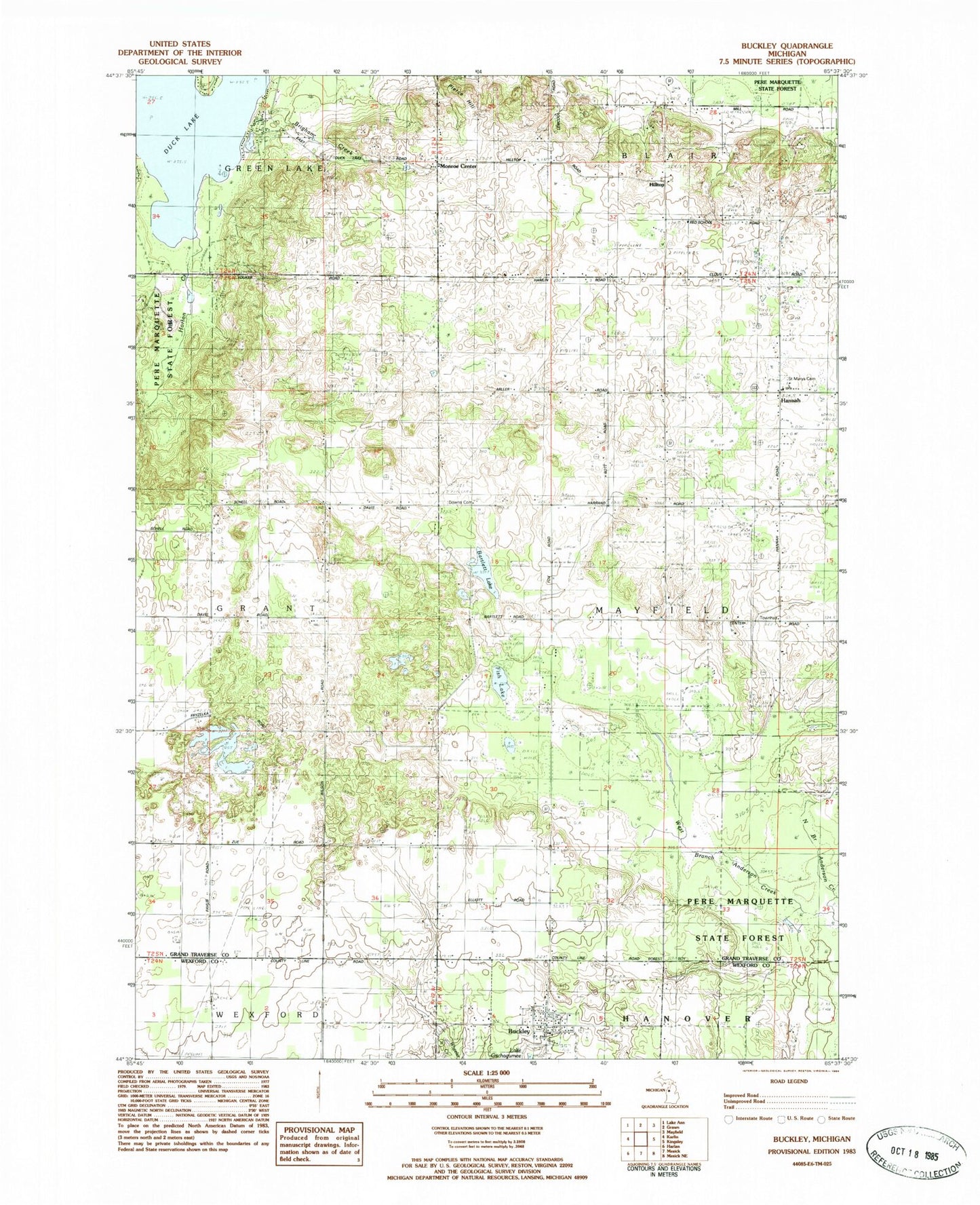
Classic USGS Buckley Michigan 7.5'x7.5' Topo Map
Couldn't load pickup availability
Historical USGS topographic quad map of Buckley in the state of Michigan. Map scale may vary for some years, but is generally around 1:24,000. Print size is approximately 24" x 27"
This quadrangle is in the following counties: Grand Traverse, Wexford.
The map contains contour lines, roads, rivers, towns, and lakes. Printed on high-quality waterproof paper with UV fade-resistant inks, and shipped rolled.
Contains the following named places: Bartlett Lake, Bartlett Post Office, Bartlett School, Brigham Creek, Buckley, Buckley Gospel Tabernacle Church, Buckley Post Office, Buckley Public Library, Buckley School, Buckley Volunteer Fire Department, Buckley Wayside Congregational Church, Canada School, Downs Cemetery, Faith Community Nazarene Church, Fish Lake, Grant United Methodist Church, Gray School, Hannah, Hannah Post Office, Highland School, Hilltop, Mayfield Township Hall, Monroe Center, Monroe Center Cemetery, Monroe Center Post Office, North Branch Anderson Creek, Northern Pines Health Center, Pierce Hill, Saint Mary's Cemetery, Saint Mary's Hannah Catholic Church, Saint Mary's School, Township of Mayfield, Traverse City South KOA Campground, Village of Buckley, West Branch Anderson Creek, Wexford Corner, Wexford Post Office, ZIP Codes: 49620, 49637