MyTopo
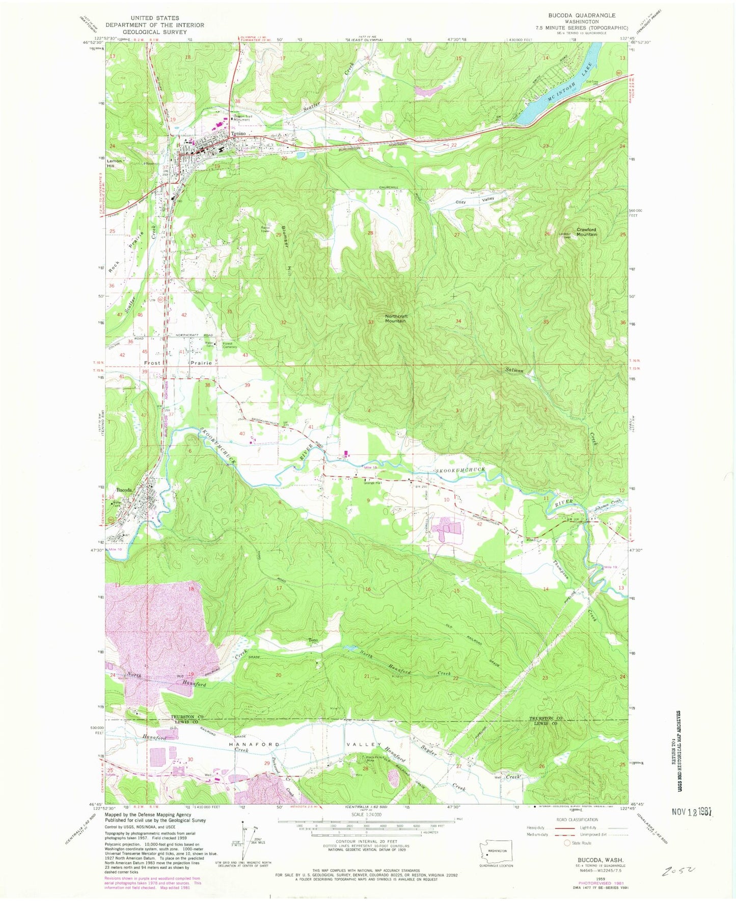
Classic USGS Bucoda Washington 7.5'x7.5' Topo Map
Couldn't load pickup availability
Historical USGS topographic quad map of Bucoda in the state of Washington. Typical map scale is 1:24,000, but may vary for certain years, if available. Print size: 24" x 27"
This quadrangle is in the following counties: Lewis, Thurston.
The map contains contour lines, roads, rivers, towns, and lakes. Printed on high-quality waterproof paper with UV fade-resistant inks, and shipped rolled.
Contains the following named places: Black Prince Mine, Blumaer Hill, Cozy Valley, Forest Grove Cemetery, Frost Prairie, McIntosh Lake, Northcraft Mountain, Oregon Trail Monument, Packwood Creek, Salmon Creek, Tono, Crawford Mountain, Tenino, Tenino Junction, Bucoda Grade School, Bucoda Volunteer Park, McIntosh, Tenino High School, Parkside Elementary School, Tenino Elementary School, Tenino Middle School, Johnson Creek, Snyder Creek, Thompson Creek, Bucoda, Surge Pond, Berger Dam, Dam Number Six, Pond Number Six, Dam Number One, Pond Number One, Memorial Swimming Pool, Surge Pond Dam, Thurston South Division, Town of Bucoda, City of Tenino, Thurston County Fire District 12 Tenino Fire Department, Bucoda Fire Department, Southeast Thurston Fire Authority Station 25 - McIntosh Lake, Thurston County Fire District 12 Tenino Fire Department Station 12 - 3, Tenino Police Department, Bucoda Post Office, Tenino Post Office