MyTopo
Classic USGS Bude Mississippi 7.5'x7.5' Topo Map
Couldn't load pickup availability
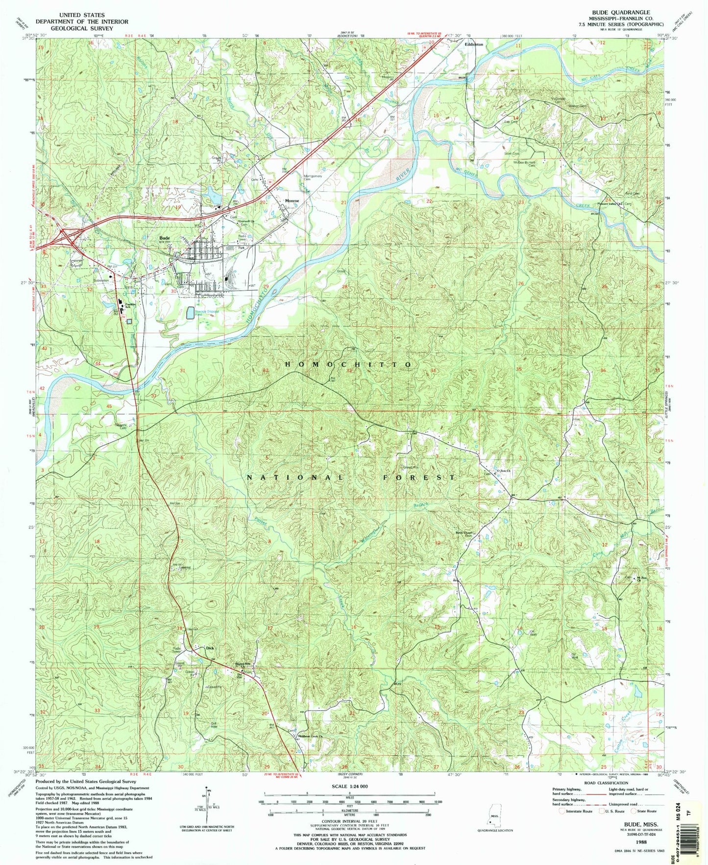
Historical USGS topographic quad map of Bude in the state of Mississippi. Typical map scale is 1:24,000, but may vary for certain years, if available. Print size: 24" x 27"
This quadrangle is in the following counties: Franklin.
The map contains contour lines, roads, rivers, towns, and lakes. Printed on high-quality waterproof paper with UV fade-resistant inks, and shipped rolled.
Contains the following named places: Franklin School, Bude, Bude Oil Field, Byrd Cemetery, Byrds Chapel, Cassedy Cemetery, Dry Creek, Hopewell Baptist Church, Ladds Branch, Lee Cemetery, McCall Creek, McDonald Cemetery, McGee Burnett Cemetery, McGehee Creek, Middleton Creek Primitive Baptist Church, Monroe, Montgomery Cemetery, Moore Branch, Mount Zion Baptist Church, Mud Branch, North Dry Creek, O Zion Baptist Church, Pilgrim Rest Primitive Baptist Church, Pleasant Valley Baptist Church, Porter Creek, Rollins Creek, Scott Cemetery, Walker Cemetery, Willis Branch, Wolvington Branch, Dixie Airport (historical), Bude Sewage Lagoon Dam, Schmidt Lake Dam, Dick, Franklin School, Bude District Ranger Station, Byrds Chapel Cemetery, Hopewell Cemetery, Jeanes School, Middleton Creek Cemetery, Mount Zion Cemetery, Mulkey Cemetery, O'Zion Baptist Church Cemetery, Pilgrim Rest Cemetery, Pleasant Valley Baptist Church Cemetery, Bude Lookout Tower, Bude Work Center, Supervisor District 5, Okhissa Lake, Town of Bude, Bude Volunteer Fire Department, Bude Police Department, Bude Post Office