MyTopo
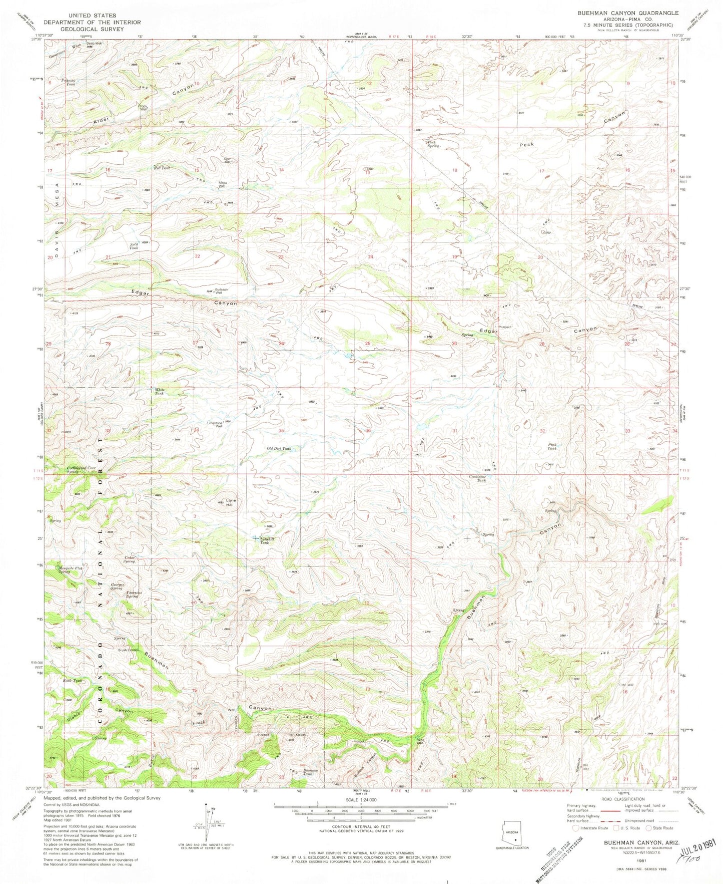
Classic USGS Buehman Canyon Arizona 7.5'x7.5' Topo Map
Couldn't load pickup availability
Historical USGS topographic quad map of Buehman Canyon in the state of Arizona. Typical map scale is 1:24,000, but may vary for certain years, if available. Print size: 24" x 27"
This quadrangle is in the following counties: Pima.
The map contains contour lines, roads, rivers, towns, and lakes. Printed on high-quality waterproof paper with UV fade-resistant inks, and shipped rolled.
Contains the following named places: Brush Corrals, Buehman Canyon, Bullock Canyon, Burro Creek, Cedar Spring, Cottonwood Cove Spring, Deep Well, Diablo Canyon, Lone Hill, Mesquite Flat Spring, Pabasco Tank, Peck Spring, Poppy Well, Red Tank, Rock Tank, White Tank, Burleson Well, Cocklebur Tank, Davis Spring Trail Twenty-eight, Donovan Tank, Georges Spring, Limestone Well, Lonehill Tank, Mesa Well, Old Dirt Tank, Pearsons Spring, Pink Tank, Pipeline Spring, Split Tank, OF Parker Ranch