MyTopo
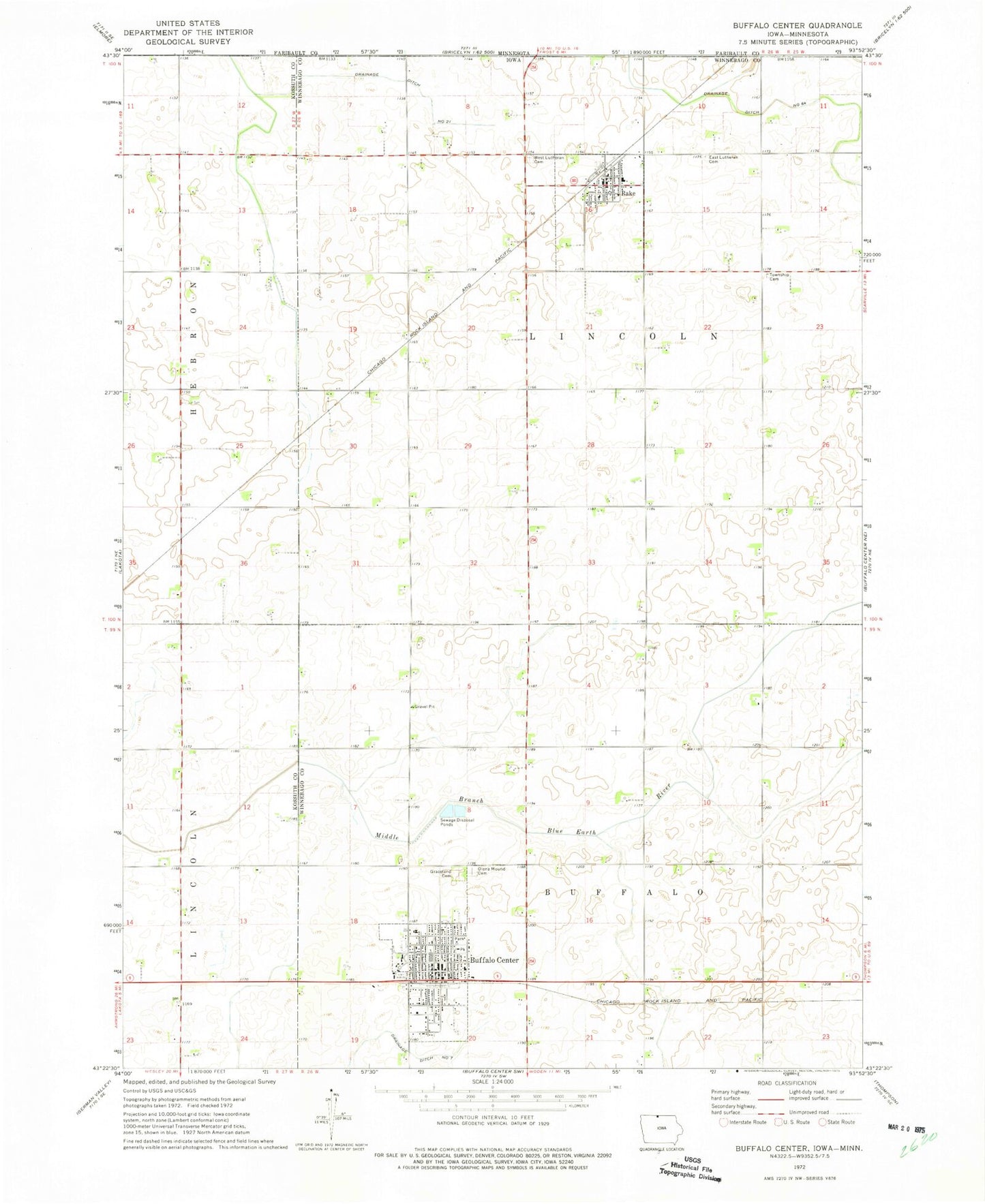
Classic USGS Buffalo Center Iowa 7.5'x7.5' Topo Map
Couldn't load pickup availability
Historical USGS topographic quad map of Buffalo Center in the state of Iowa. Map scale may vary for some years, but is generally around 1:24,000. Print size is approximately 24" x 27"
This quadrangle is in the following counties: Faribault, Kossuth, Winnebago.
The map contains contour lines, roads, rivers, towns, and lakes. Printed on high-quality waterproof paper with UV fade-resistant inks, and shipped rolled.
Contains the following named places: Bethlehem Lutheran Church, Buffalo Center, Buffalo Center Chiropractic, Buffalo Center Fire Department, Buffalo Center Post Office, Buffalo Center Public Library, Buffalo Center Volunteer Ambulance Service, City of Buffalo Center, City of Rake, Congregational Church, Drainage Ditch Number 21, Drainage Ditch Number 64, East Cemetery, Farmers Co-op Elevator, First Baptist Church, First Reformed Church, Graceland Cemetery, Lincoln Township Cemetery, Lions Park, Mercy Family Care - Buffalo Center, North Iowa Community School, North Iowa High School, North Iowa Middle School, Northland Cooperative Elevator, Olena Mound Cemetery, Quam Wildlife Area, Rake, Rake Airport, Rake City Town Hall, Rake Fire Department, Rake First Responders, Rake Post Office, Rake Public Library, Saint Patricks Church, Timely Mission Nursing Home, Township of Buffalo, Township of Lincoln, United Methodist Church, West Cemetery, Zion Lutheran Church, ZIP Codes: 50424, 50465