MyTopo
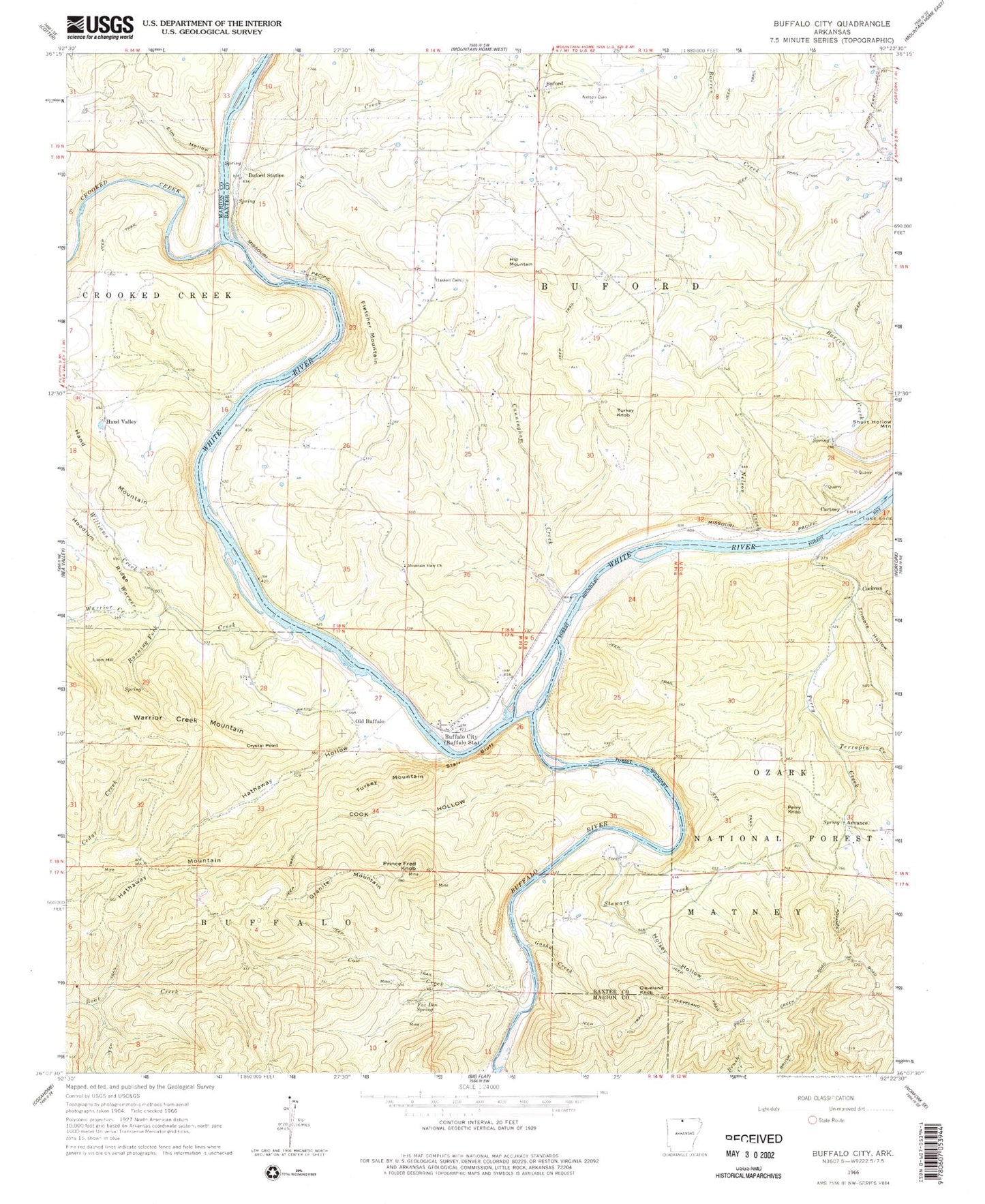
Classic USGS Buffalo City Arkansas 7.5'x7.5' Topo Map
Couldn't load pickup availability
Historical USGS topographic quad map of Buffalo City in the state of Arkansas. Typical map scale is 1:24,000, but may vary for certain years, if available. Print size: 24" x 27"
This quadrangle is in the following counties: Baxter, Marion.
The map contains contour lines, roads, rivers, towns, and lakes. Printed on high-quality waterproof paper with UV fade-resistant inks, and shipped rolled.
Contains the following named places: Buford School (historical), Laytonville (historical), Nelsons Ferry (historical), Township of Buford, Township of Matney, Township of Buffalo (historical), Birds Ford, Buffalo Landing, Campbells Shoal, Cow Rock Shoals, Gin Eddy, Goodmans Ford, Hudsons Bend, Laffoon Creek, Shields Chute, Tinnan Rock Shoals, Advance, Brush Creek, Buford, Buford Station, Cartney, Cleveland Knob, Cockran Creek, Cow Creek, Crooked Creek, Crystal Point, Cunningham Creek, Dry Creek, Elm Hollow, Fletcher Mountain, Fox Den Spring, Gosha Creek, Granite Mountain, Hand Valley, Haskell Cemetery, Hathaway Hollow, Hathaway Mountain, Hip Mountain, Holsey Hollow, Lion Hill, Lone Rock, Mountain View Church, Nelson Cemetery, Nelson Creek, Perry Knob, Prince Fred Knob, Running Fork, Stair Bluff, Steep Gully, Stewart Creek, Terrapin Creek, Trimble Hollow, Turkey Knob, Turkey Mountain, Warner Creek, Warrior Creek, Warrior Creek Mountain, Williams Creek, Buffalo City, Cook Hollow, Old Buffalo, Perry Creek, Buffalo River, Buffalo National River Wilderness, Buford Volunteer Fire Department, Cow Creek Cemetery, Buffalo City Census Designated Place