
MyTopo
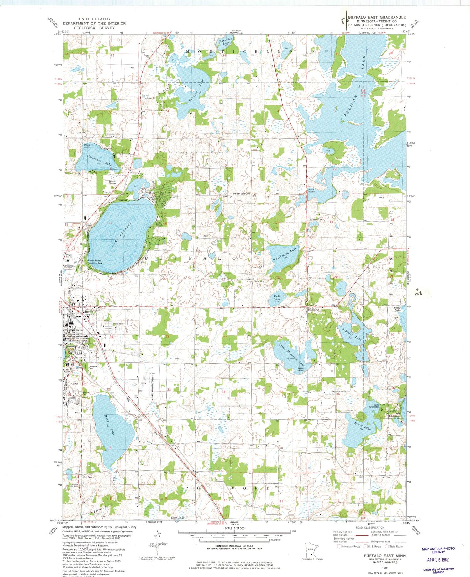
Classic USGS Buffalo East Minnesota 7.5'x7.5' Topo Map
Couldn't load pickup availability
Historical USGS topographic quad map of Buffalo East in the state of Minnesota. Map scale may vary for some years, but is generally around 1:24,000. Print size is approximately 24" x 27"
This quadrangle is in the following counties: Wright.
The map contains contour lines, roads, rivers, towns, and lakes. Printed on high-quality waterproof paper with UV fade-resistant inks, and shipped rolled.
Contains the following named places: Allina Medical Clinic at Buffalo, Bentfield Mills Park, Booth Pond, Buffalo, Buffalo - Hanover- Montrose Special Education Office, Buffalo Assembly of God Church, Buffalo Clinic, Buffalo Community Middle School, Buffalo Covenant Church, Buffalo Free Evangelical Church, Buffalo Heights Golf Course, Buffalo High School, Buffalo Hospital, Buffalo Manor East, Buffalo Municipal Airport, Buffalo Presbyterian Church, Buffalo Rodeo Grounds, Buffalo Unitarian Universalist Church, Bufflao Manor, Camp Greenwood, Centennial Park Fire Station, City of Buffalo, Constance Lake, Discovery Elementary School, Elletson School, Gilchrist Lake, Green Mountain Lake, Greseth Airport, Griffing Park, Honey Bee Apple Orchard, Hosanna Lutheran Church, Ilstrup School, Immanuel Lutheran Church Cemetery, Kobbe School, Lake Pulaski, Lake Pulaski Seaplane Base, Lakeview Cemetery, Little Pulaski Lake, Mary Lake, Middagh School, Mission Cemetery, Moore Lake, Paradise Lake, Park View Care Center, Parkside Elementary School, Pelican Lake, Pelican Lake Cemetery, Pelican Lake Church, Pelican Lake School, Phoenix Learning Center, Pohl Lake, Pulaski Mobile Home Park, Reorganized Church of Jesus Christ of Latter Day Saints, Russell Booth Dam, Saint John's Lutheran Church, Saint Marks Cemetery, Schmidt Lake, Schmidt School, Soo Line Depot, Spirit of Joy Lutheran Church, Tatanka Elementary School, Thompson School, Township of Buffalo, Washington Lake, West Pulaski Park, Woods Edge Apples, Wright County Heritage Center, Wright County Jail, Wright County Sheriff's Office, Wright County Waterfowl Production Area, Wright Technical Center, Zion Cemetery, Zion Lutheran Church, ZIP Code: 55313


