
MyTopo
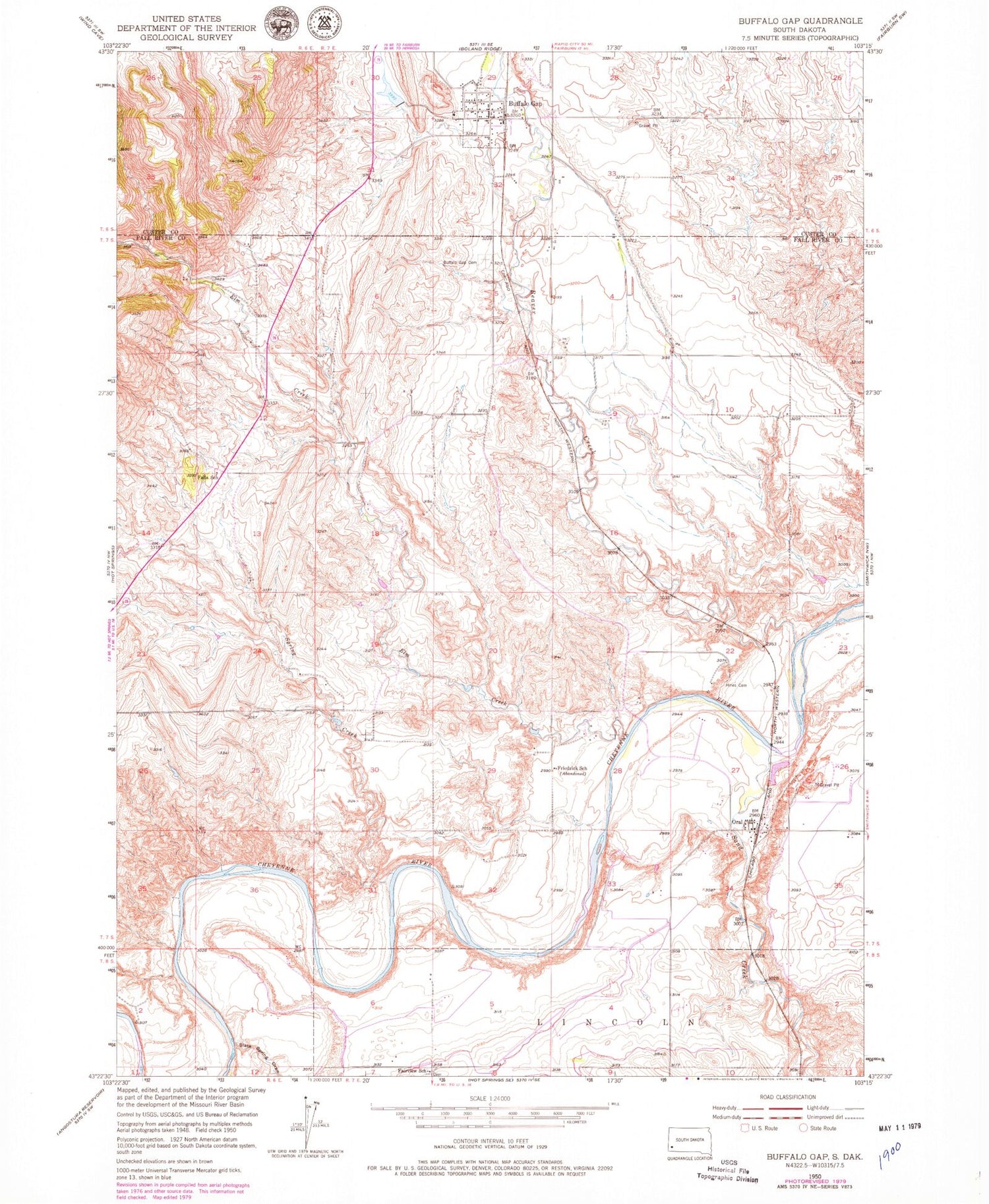
Classic USGS Buffalo Gap South Dakota 7.5'x7.5' Topo Map
Couldn't load pickup availability
Historical USGS topographic quad map of Buffalo Gap in the state of South Dakota. Map scale is 1:24000. Print size is approximately 24" x 27"
This quadrangle is in the following counties: Custer, Fall River.
The map contains contour lines, roads, rivers, towns, and lakes. Printed on high-quality waterproof paper with UV fade-resistant inks, and shipped rolled.
Contains the following named places: Beaver Creek, Buffalo Gap, Buffalo Gap Cemetery, Buffalo Gap Fire Department, Buffalo Gap Post Office, Elm Creek, Elm Creek Siding (historical), Fairview School, Falls School, Friedrick School, Hines Cemetery, Oral, Oral Census Designated Place, Oral Fire Department, Oral Post Office, Sand Creek, Slate Spring Draw, Spring Creek, Town of Buffalo Gap, Township of Beaver


