MyTopo
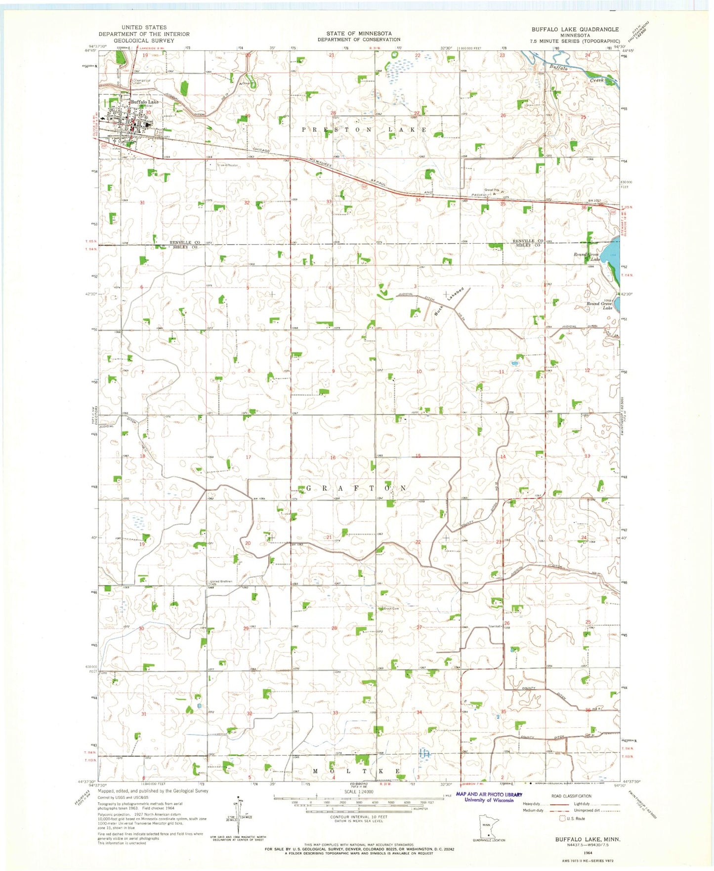
Classic USGS Buffalo Lake Minnesota 7.5'x7.5' Topo Map
Couldn't load pickup availability
Historical USGS topographic quad map of Buffalo Lake in the state of Minnesota. Map scale may vary for some years, but is generally around 1:24,000. Print size is approximately 24" x 27"
This quadrangle is in the following counties: Renville, Sibley.
The map contains contour lines, roads, rivers, towns, and lakes. Printed on high-quality waterproof paper with UV fade-resistant inks, and shipped rolled.
Contains the following named places: Brack Cemetery, Buck Lakebed, Buffalo Lake, Buffalo Lake Ambulance, Buffalo Lake Cemetery, Buffalo Lake Fire Department, Buffalo Lake Hector Elementary School, Buffalo Lake Nursing Home, Buffalo Lake Police Department, Buffalo Lake Post Office, City of Buffalo Lake, County Ditch Number Fifteen, County Ditch Number Nine, County Ditch Number Ten, County Ditch Number Thirtyone, Evangelical Cemetery, Judicial Ditch Number Eleven, Judicial Ditch Number Twentyfour, Knopke - Brown Cemetery, Oakdale Country Club, Township of Grafton, United Brethren Cemetery, Zion United Methodist Church