MyTopo
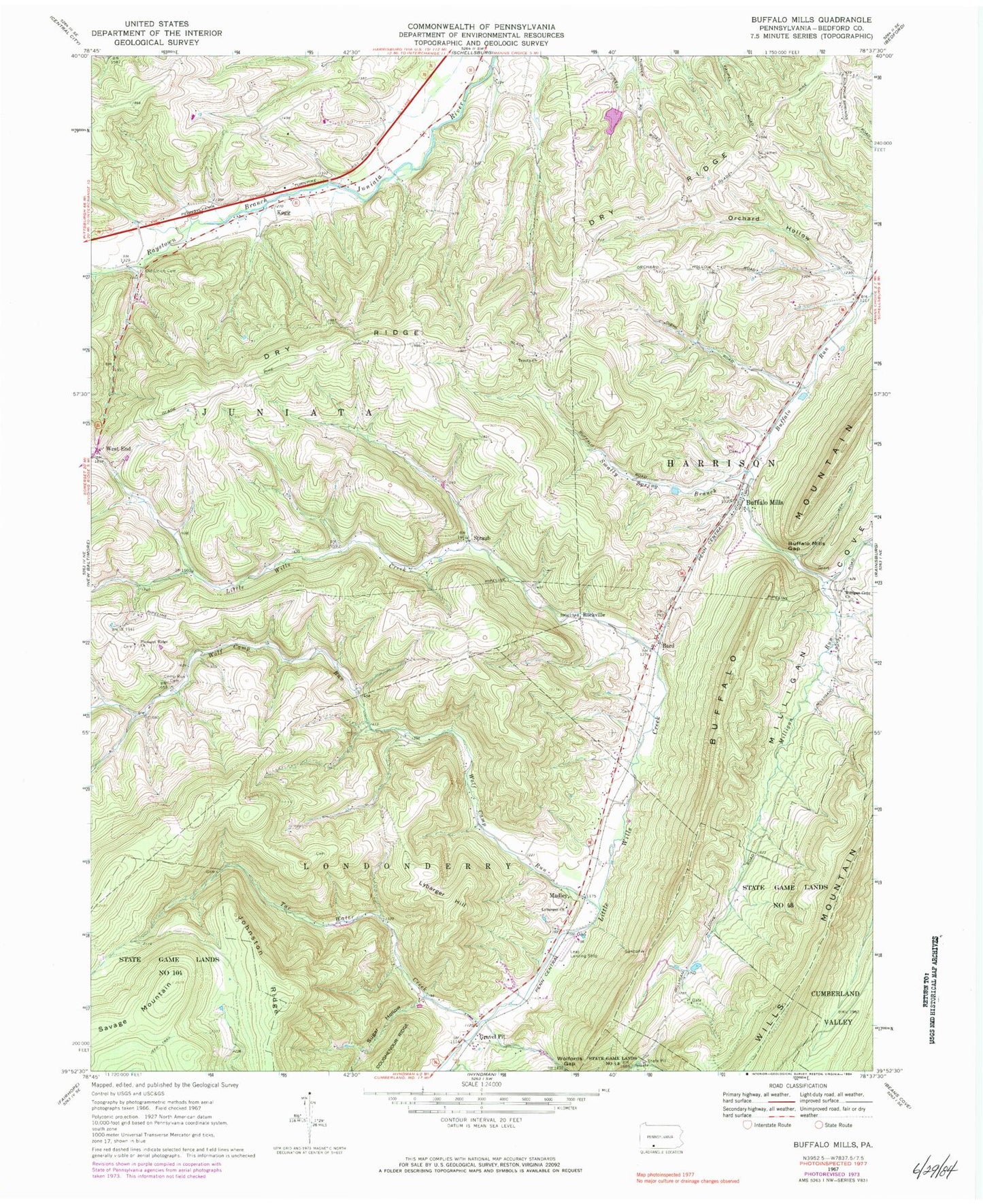
Classic USGS Buffalo Mills Pennsylvania 7.5'x7.5' Topo Map
Couldn't load pickup availability
Historical USGS topographic quad map of Buffalo Mills in the state of Pennsylvania. Map scale may vary for some years, but is generally around 1:24,000. Print size is approximately 24" x 27"
This quadrangle is in the following counties: Bedford.
The map contains contour lines, roads, rivers, towns, and lakes. Printed on high-quality waterproof paper with UV fade-resistant inks, and shipped rolled.
Contains the following named places: Bard, Buffalo Mills, Buffalo Mills Gap, Buffalo Mills Post Office, Buffalo Mountain, Buffalo Run School, Camp Run Cemetery, Camp Run Church, Coughenour School, Curley School, Diehl School, Dry Ridge, Dry Ridge Lutheran Cemetery, Ealy School, Evitts Mountain, Glade Pike Vista, Gravel Pit, Gravel Pit Station, Huffman School, Johnston Ridge, Joseph Smyth Dam, Kegg, Lake Francis, Leap Airport, Lybarger Cemetery, Lybarger Church, Lybarger Hill, Madley, Madley Cemetery, Milligan Cove Church, Milligan Run, Milligans Cove Christian Church Cemetery, Mount Nebo School, Mowry School, Old Philson School, Old Union Cemetery, Orchard Hollow, Pleasant Ridge Church, Pleasant Ridge Church Cemetery, Pleasant Ridge School, Powell School, Ridge School, Rockville, Saint James Church, Savage Mountain, Shroyer Farm Cemetery, Smally Spring Branch, State Game Lands Number 48, Sugar Hollow, Tar Water Creek, Township of Harrison, Township of Juniata, Trinity United Church of Christ Cemetery, Wagerman Family Cemetery, West End, West End Post Office, West End School, Wolf Camp Run, ZIP Codes: 15534, 15550