MyTopo
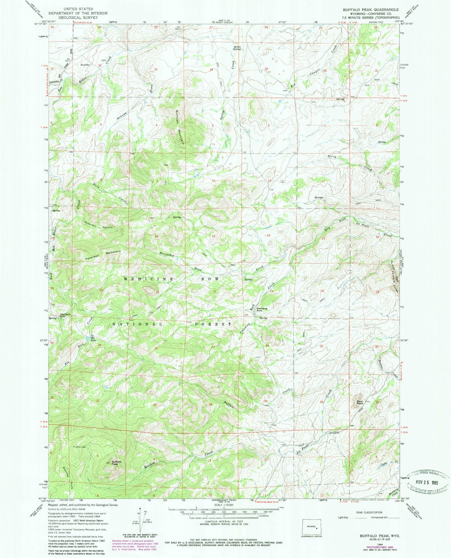
Classic USGS Buffalo Peak Wyoming 7.5'x7.5' Topo Map
Couldn't load pickup availability
Historical USGS topographic quad map of Buffalo Peak in the state of Wyoming. Map scale is 1:24000. Print size is approximately 24" x 27"
This quadrangle is in the following counties: Converse.
The map contains contour lines, roads, rivers, towns, and lakes. Printed on high-quality waterproof paper with UV fade-resistant inks, and shipped rolled.
Contains the following named places: Bear Rock, Boiler Spring, Boxelder, Buffalo Creek, Buffalo Peak, Crazy Horse Creek, East Box Elder Creek, Elk Lake, French Creek, Grouse Draw, Helm Creek, Horseshoe Bend Creek, Keely Draw, La Prele Gorge, Meadow Creek, Olins Lode, Peterson Canyon, Peterson Mountain, Rabbit Creek, Silver Spruce Lodge, Snowshoe Creek, Spring Creek, Standing Rock, Standing Rock Creek, Sullivan Mountain