
MyTopo
Classic USGS Buffalo West Minnesota 7.5'x7.5' Topo Map
Couldn't load pickup availability
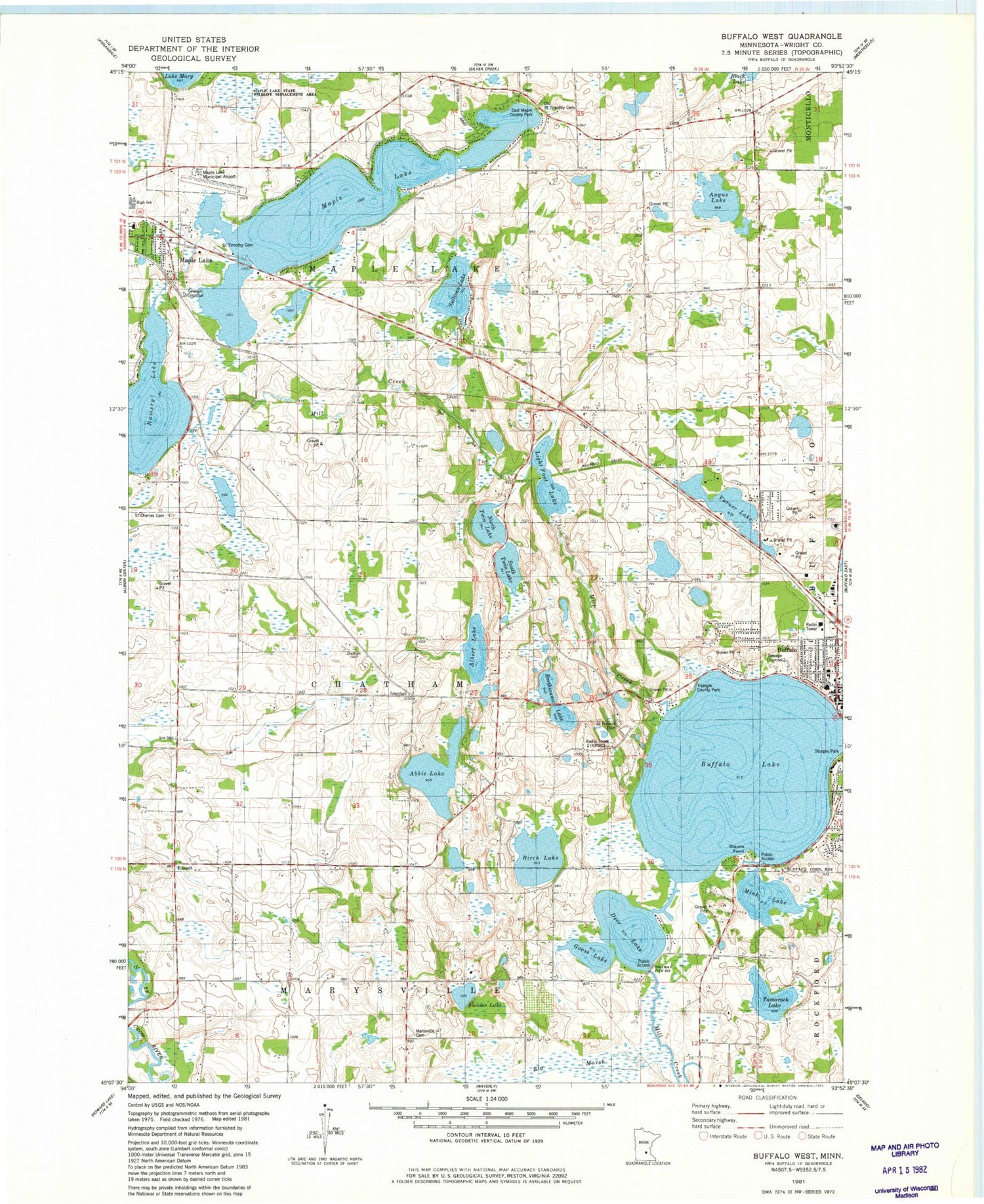
Historical USGS topographic quad map of Buffalo West in the state of Minnesota. Map scale may vary for some years, but is generally around 1:24,000. Print size is approximately 24" x 27"
This quadrangle is in the following counties: Wright.
The map contains contour lines, roads, rivers, towns, and lakes. Printed on high-quality waterproof paper with UV fade-resistant inks, and shipped rolled.
Contains the following named places: Abbie Lake, Albert Lake, Angus Lake, Berthiaume Lake, Big Marsh, Birch Lake, Buffalo City Hall, Buffalo Fire Department, Buffalo Foot Clinic, Buffalo Lake, Buffalo Lake Seaplane Base, Buffalo Police Department, Buffalo Post Office, Buffalo Public Library, Buffalo Seventh Day Adventist Church, Buffalo United Methodist Church, Carlson School, Deer Lake, Deer Lake Dam, Deer Lake Orchard, East Maple County Park, East Maple Lake School, Ebenezer Covenant Home, Fadden Lake, Goose Lake, KRWC-AM (Buffalo), Light Foot Lake, Maple Lake, Maple Lake Elementary School, Maple Lake High School, Maple Lake Municipal Airport-Bill Mavencamp Sr Field, Marysville Cemetery, Mink Lake, North Twin Lake, Northwinds Elementary School, Old Saint Timothy Cemetery, Olsons Point, Persian School, Ramsey Lake, Ramsey Lake Dam, Rassat, Rasset Post Office, Rolling Hills Orchard, Saint Charles Cemetery, Saint Francis Catholic Church, Saint Francis Cemetery, Saint Francis Xavier School, Saint Timothy Cemetery, Saint Timothy's School, South Twin Lake, Sturges Park, Sullivan Lake, Tamarack Lake, The Church of Jesus Christ of Latter Day Saints, Township of Chatham, Township of Maple Lake, Triangle County Park, Varner Lake, Varner School, Vokaty-Yonak Dam, Vokaty-Yonak Reservoir, Wild Marsh Golf Course, Wright County, Wright County Courthouse


