MyTopo
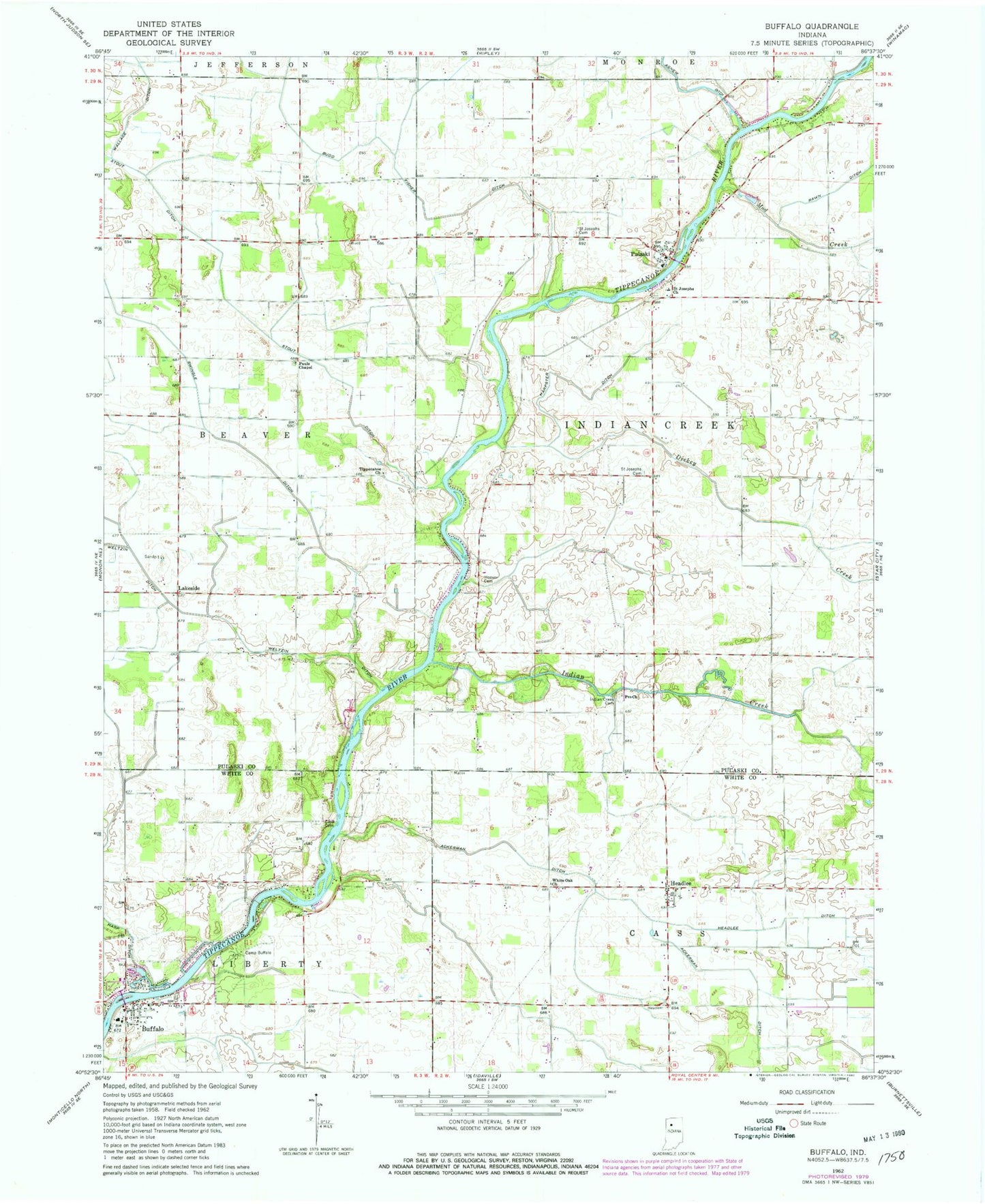
Classic USGS Buffalo Indiana 7.5'x7.5' Topo Map
Couldn't load pickup availability
Historical USGS topographic quad map of Buffalo in the state of Indiana. Map scale may vary for some years, but is generally around 1:24,000. Print size is approximately 24" x 27"
This quadrangle is in the following counties: Pulaski, White.
The map contains contour lines, roads, rivers, towns, and lakes. Printed on high-quality waterproof paper with UV fade-resistant inks, and shipped rolled.
Contains the following named places: Allen Airport, Budd Fisher Ditch, Buffalo, Buffalo Cemetery, Buffalo Census Designated Place, Buffalo Elementary School, Buffalo Liberty Township Volunteer Fire Department, Buffalo Post Office, Camp Buffalo, Clark Cemetery, Dickey Creek, Harpster Ditch, Headlee, Headlee Ditch, Hoover Cemetery, Indian Creek, Indian Creek Cemetery, Lakeside, Liberty Landfill, Mud Creek, Pauls Chapel, Pro Church, Pulaski, Radersdorf Ditch, Rawn Ditch, Saint Josephs Cemetery, Saint Josephs Church, Stout Ditch, Swingle Ditch, Tippecanoe Church, Township of Indian Creek, White Oak Church, ZIP Code: 47925