MyTopo
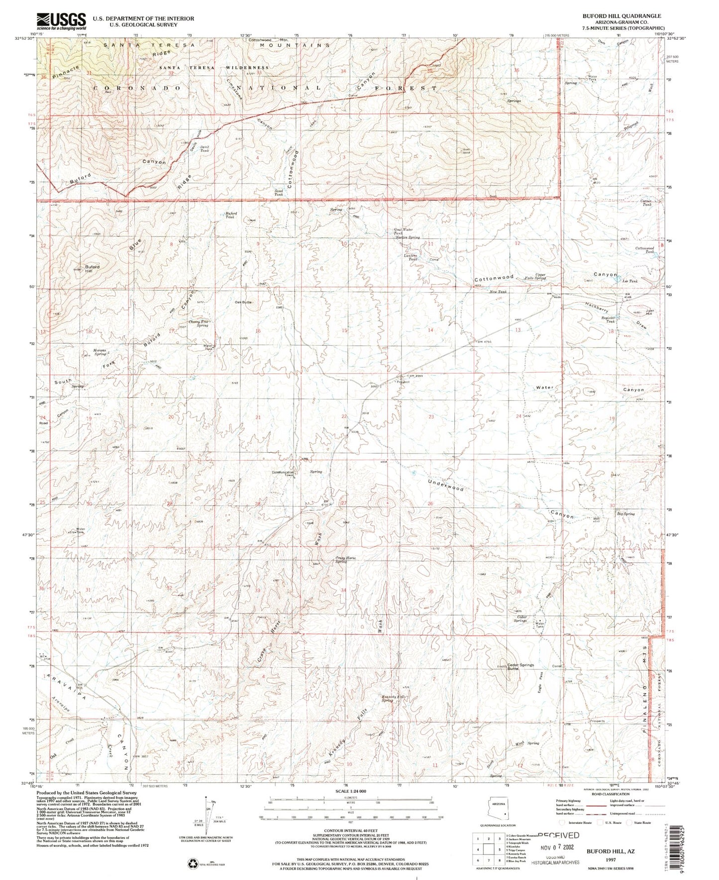
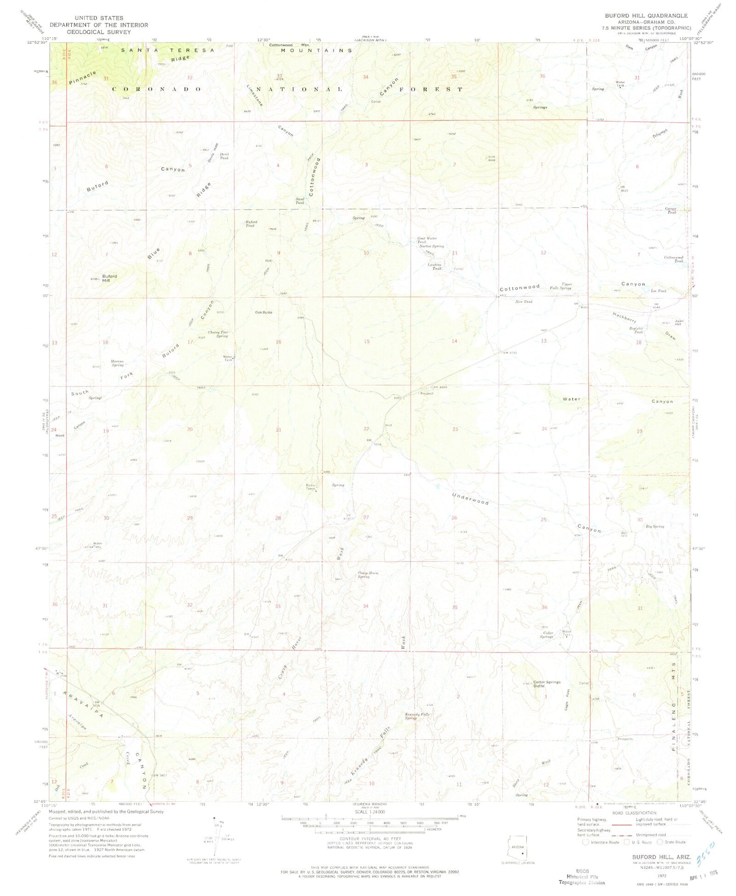
Classic USGS Buford Hill Arizona 7.5'x7.5' Topo Map
Couldn't load pickup availability
Historical USGS topographic quad map of Buford Hill in the state of Arizona. Map scale may vary for some years, but is generally around 1:24,000. Print size is approximately 24" x 27"
This quadrangle is in the following counties: Graham.
The map contains contour lines, roads, rivers, towns, and lakes. Printed on high-quality waterproof paper with UV fade-resistant inks, and shipped rolled.
Contains the following named places: Big Spring, Blue Ridge, Buford Hill, Buford Tank, Buhl Ranch, Cedar Springs, Cedar Springs Butte, Cherry Tree Spring, Cluff Peak, Corner Tank, Cottonwood Tank, Crazy Horse Spring, Crazy Horse Wash, Devil Tank, Devils Hole, Eagle Pass, Goat Water Tank, Juan Hill, Kennedy Falls Spring, Lantern Tank, Lee Tank, Limestone Canyon, Morano Spring, New Tank, Norton Spring, Oak Butte, Oak Creek, Pinnacle Ridge, Register Tank, Sand Tank, Upper Falls Spring