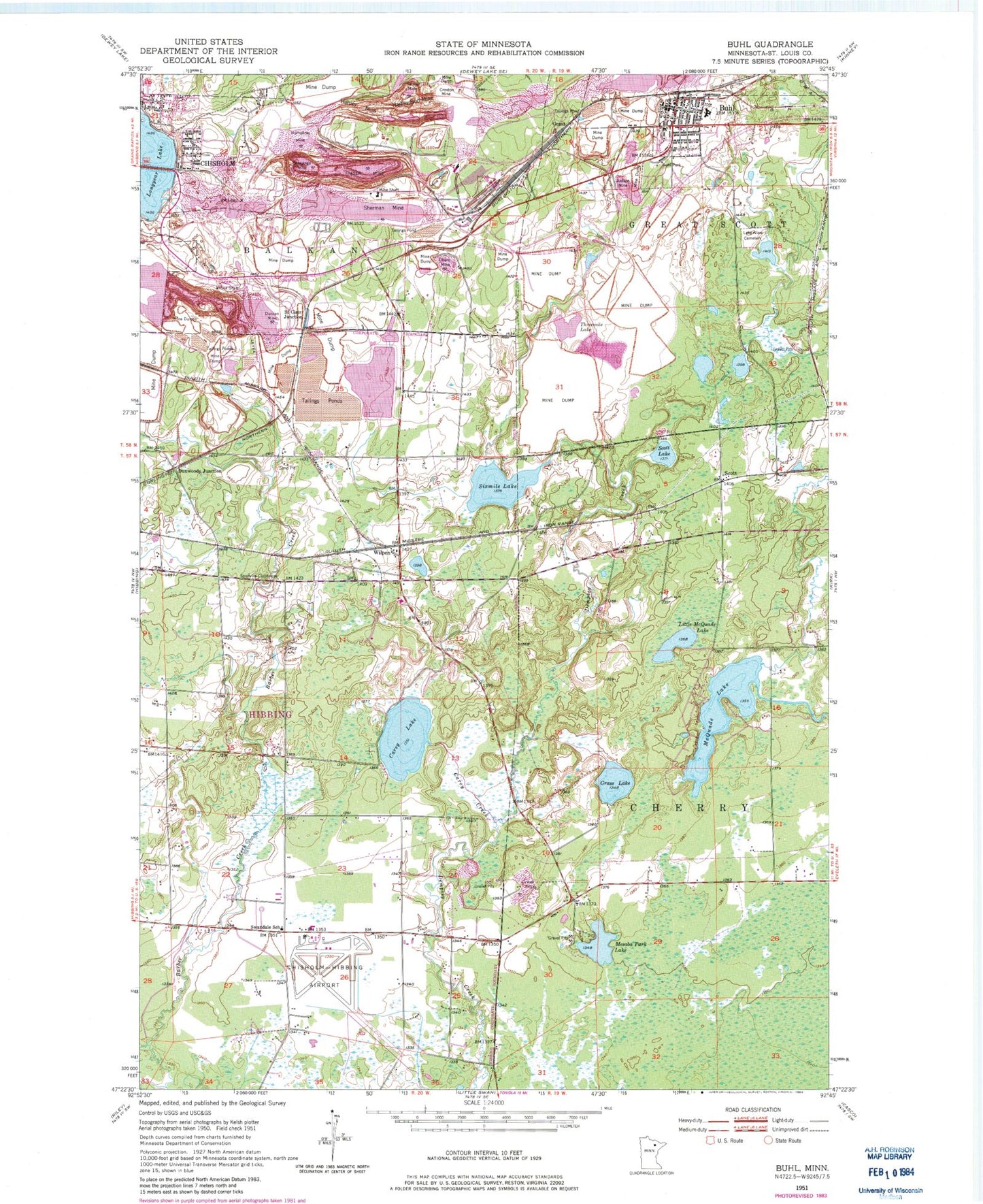
MyTopo
Classic USGS Buhl Minnesota 7.5'x7.5' Topo Map
Couldn't load pickup availability
Historical USGS topographic quad map of Buhl in the state of Minnesota. Map scale may vary for some years, but is generally around 1:24,000. Print size is approximately 24" x 27"
This quadrangle is in the following counties: St. Louis.
The map contains contour lines, roads, rivers, towns, and lakes. Printed on high-quality waterproof paper with UV fade-resistant inks, and shipped rolled.
Contains the following named places: Buchanan Nursing Home, Buhl, Buhl Park, Buhl Police Department, Buhl Post Office, Buhl Public Library, Buhl Station, Buhl Volunteer Fire Department and Ambulance Service, Carey Creek, Carey Lake, Carey Lake Park, Chisholm - Hibbing Airport Fire Department, City of Buhl, Croxton Mine, Douglas Mine, Douglas Tailings Basin, Douglas Tailings Dike, Duncan Mine, Dunwoody Junction, Dunwoody Mine, Elbern Mine, First Lutheran Church, Fraser Mine, Grandview Memorial Garden, Grant, Grant Mine, Grass Lake, Hartley Burt Mine, Hartley Mine, Heritage Manor Health Care Center, Humphrey Mine, Judson Mine, Lake View Cemetery, Life Link III Air Ambulance Hibbing, Little McQuade Lake, Longyear Lake, McQuade Lake, Mesaba Park Lake, Mesabi Nursing Home, Monroe-Tener Mine, Our Lady of Sacred Heart Church, Palmer Mine, Range Regional Airport, Saint Clair Junction, Saint Clair Mine, Saint Louis County Sheriff's Office Buhl, Scott, Scott Lake, Shenango Mine, Sherman Group Tailings Basin, Sherman Group Tailings Dike, Sherman Mine, Sherman Mine Waste Water Basin, Sherman Mine Waste Water Dike, Sixmile Lake, Spudville Clubhouse, Swandale School, Threemile Lake, Vaughn Steffensrud Elementary School, Wilpen, Wilpen Post Office, Wilpen Station, WIRR-FM (Virginia-Hibbing)