MyTopo
Classic USGS Bull Island South Carolina 7.5'x7.5' Topo Map
Couldn't load pickup availability
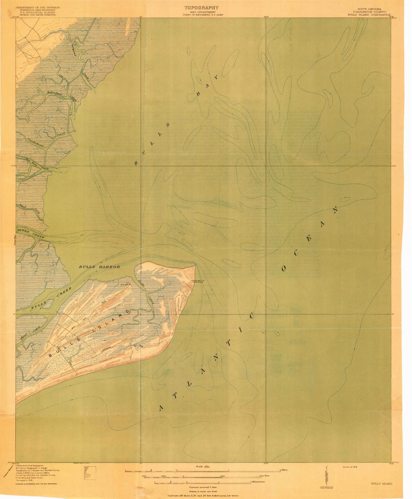
Historical USGS topographic quad map of Bull Island in the state of South Carolina. Map scale may vary for some years, but is generally around 1:24,000. Print size is approximately 24" x 27"
This quadrangle is in the following counties: Charleston.
The map contains contour lines, roads, rivers, towns, and lakes. Printed on high-quality waterproof paper with UV fade-resistant inks, and shipped rolled.
Contains the following named places: Anderson Creek, Belvedere Creek, Big Pond, Bird Island, Bird Island Shoal, Blind Creek, Bull Breakers, Bull Creek, Bull Harbor, Bull Island, Bulls Bay, Jack Creek, Lower Summerhouse Pond, Moccasin Pond, Northeast Point, Saltpond Creek, Sewee Camp, Summerhouse Creek, Turkey Walk Trail, Upper Summerhouse Pond, Vanderhorst Creek, Venning Creek, White Island, Wilson Cemetery