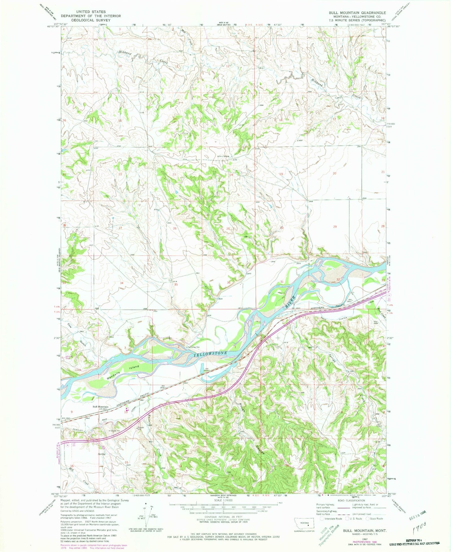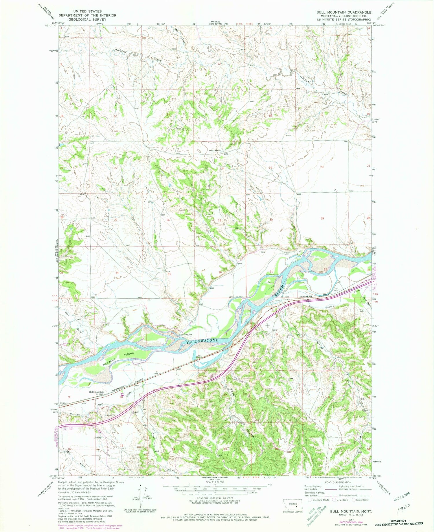
MyTopo
Classic USGS Bull Mountain Montana 7.5'x7.5' Topo Map
Regular price
$16.95
Regular price
Sale price
$16.95
Unit price
per
Couldn't load pickup availability
Historical USGS topographic quad map of Bull Mountain in the state of Montana. Map scale may vary for some years, but is generally around 1:24,000. Print size is approximately 24" x 27"
This quadrangle is in the following counties: Yellowstone.
The map contains contour lines, roads, rivers, towns, and lakes. Printed on high-quality waterproof paper with UV fade-resistant inks, and shipped rolled.
Contains the following named places: 03N31E03CBBB01 Well, 03N31E04DBDD01 Well, 04N32E32BBBC01 Well, Bull Mountain, Cow Gulch, Kaiser Creek, Mill Creek, Randalls Island, Reed Creek, Rough Coulee, Spring Creek