
MyTopo
Classic USGS Bull Run Reservoir Nevada 7.5'x7.5' Topo Map
Couldn't load pickup availability
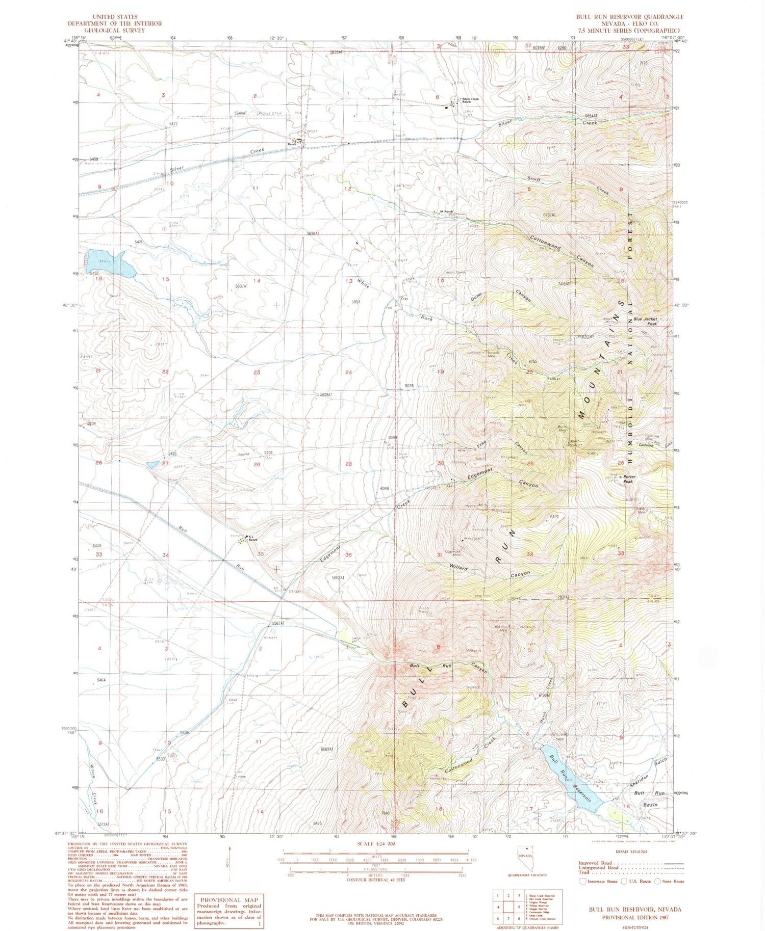
Historical USGS topographic quad map of Bull Run Reservoir in the state of Nevada. Map scale may vary for some years, but is generally around 1:24,000. Print size is approximately 24" x 27"
This quadrangle is in the following counties: Elko.
The map contains contour lines, roads, rivers, towns, and lakes. Printed on high-quality waterproof paper with UV fade-resistant inks, and shipped rolled.
Contains the following named places: Blue Jacket Mine, Blue Jacket Peak, Breakneck Creek, Bull Run Canyon, Bull Run Dam, Bull Run Mine, Bull Run Reservoir, Burns Mine, California Mine, Cottonwood Canyon, Cottonwood Creek, Devils Gap, Dunn Canyon, Echo, Echo Canyon, Edgemont, Edgemont Canyon, Edgemont Creek, Edgemont Mine, Edgemont Mining District, Edgemont Post Office, Excelsior, Excelsior Post Office, Governor Chillis Camp, Little Giant Lode, Lucky Girl Group, Marsh Creek, Montana Mine, Monument Lode, Nevada Mine, North Star Lode, Petan Ranch Airport, Petan Ranch School, Porter Peak, Ranch Creek, Riddle Mine, Round Mountain Reservoir Dam, S L Ranch, Seven J Ranch, Sheridan Gulch, Silver Creek Ranch, Storff Creek, Sunrise Lode, Twentyfour Ranch, White Rock, White Rock Creek, White Rock Mine, White Rock Post Office, Willard Canyon


