MyTopo
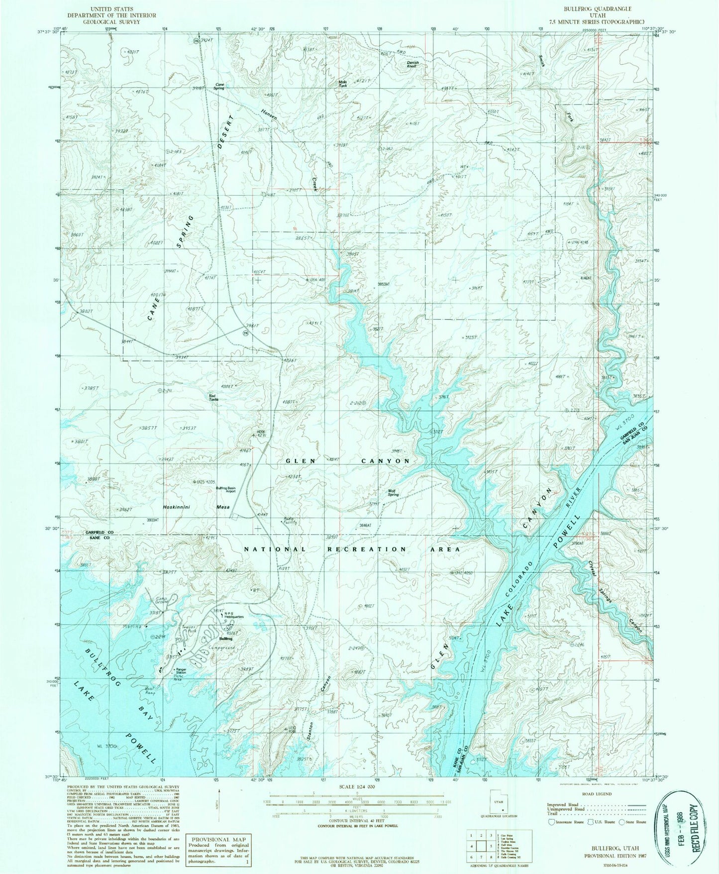
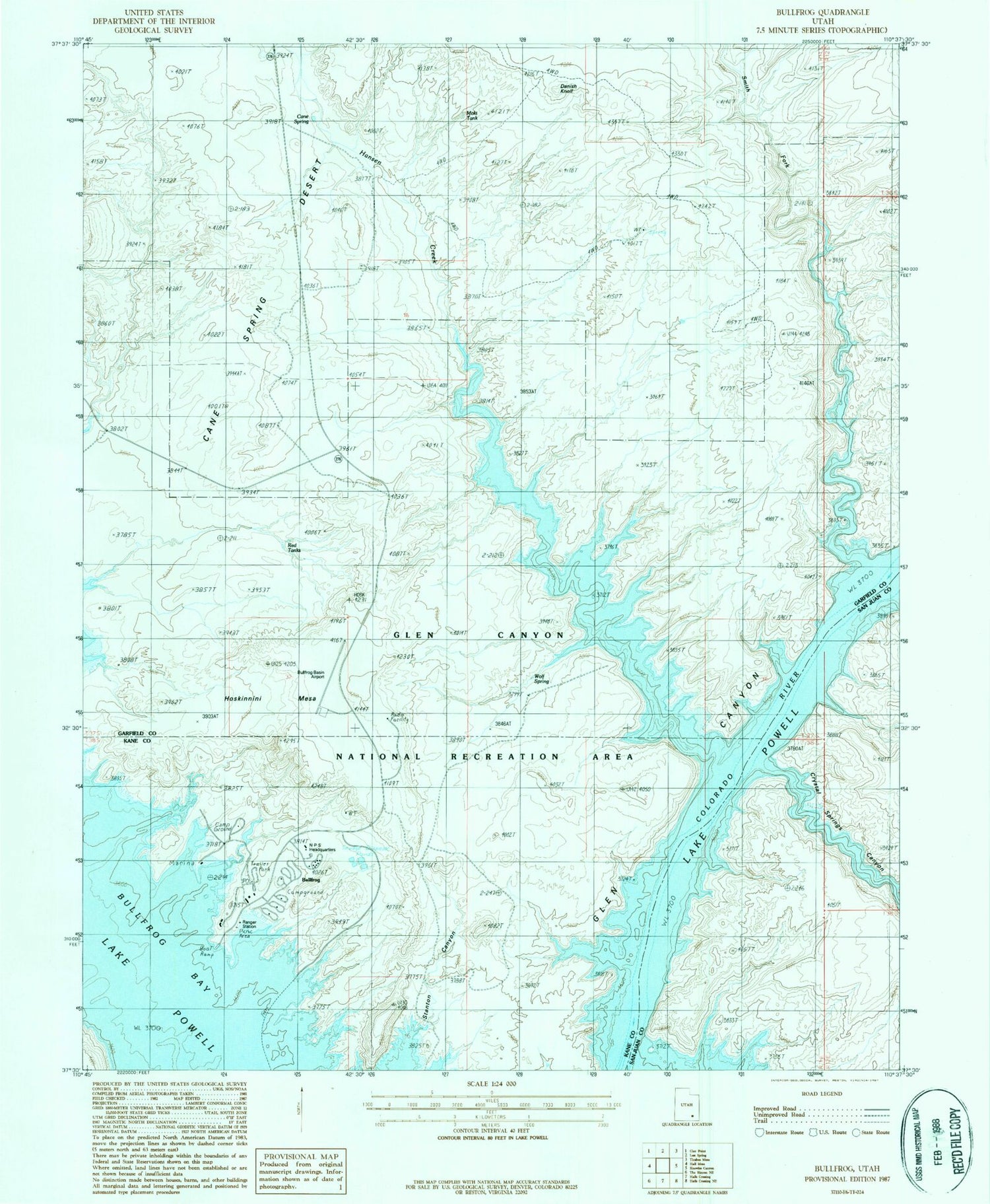
Classic USGS Bullfrog Utah 7.5'x7.5' Topo Map
Couldn't load pickup availability
Historical USGS topographic quad map of Bullfrog in the state of Utah. Map scale is 1:24000. Print size is approximately 24" x 27"
This quadrangle is in the following counties: Garfield, Kane, San Juan.
The map contains contour lines, roads, rivers, towns, and lakes. Printed on high-quality waterproof paper with UV fade-resistant inks, and shipped rolled.
Contains the following named places: Bullfrog, Bullfrog Basin Airport, Bullfrog Basin Campground, Bullfrog Basin Marina, Bullfrog Bay, Cane Spring, Crystal Springs Canyon, Danish Knoll, Elbow Bar, Hansen Creek, Hoskinnini Mesa, Moki Tank, Moqui Bar, National Park Service Headquarters, Painted Hill RV Park, Red Tanks, Smith Bar, Smith Fork, Stanton Canyon, U.S. Forest Service Clinic, United States Forest Service Clinic Heliport, Wolf Spring