MyTopo
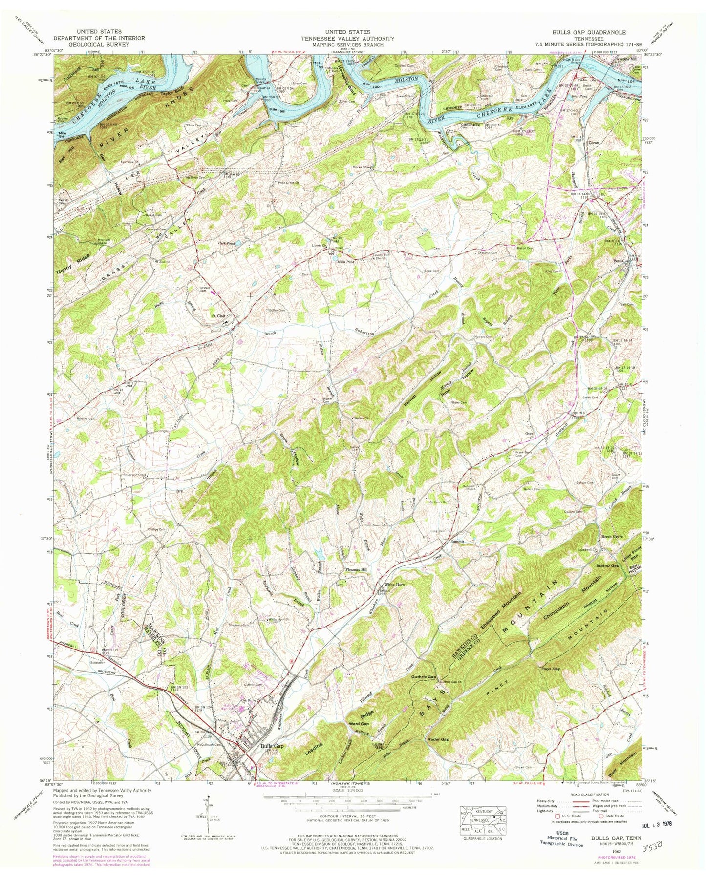
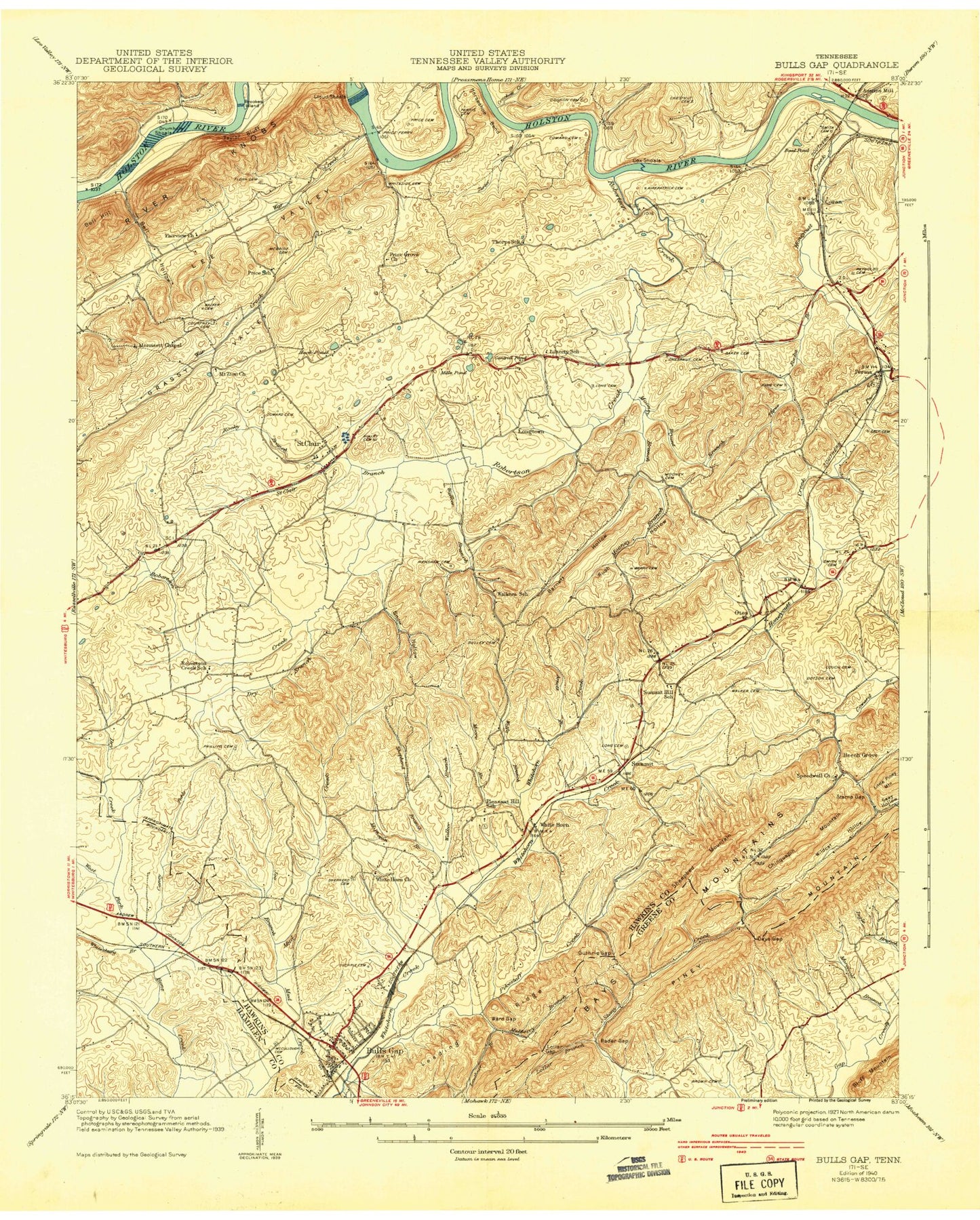
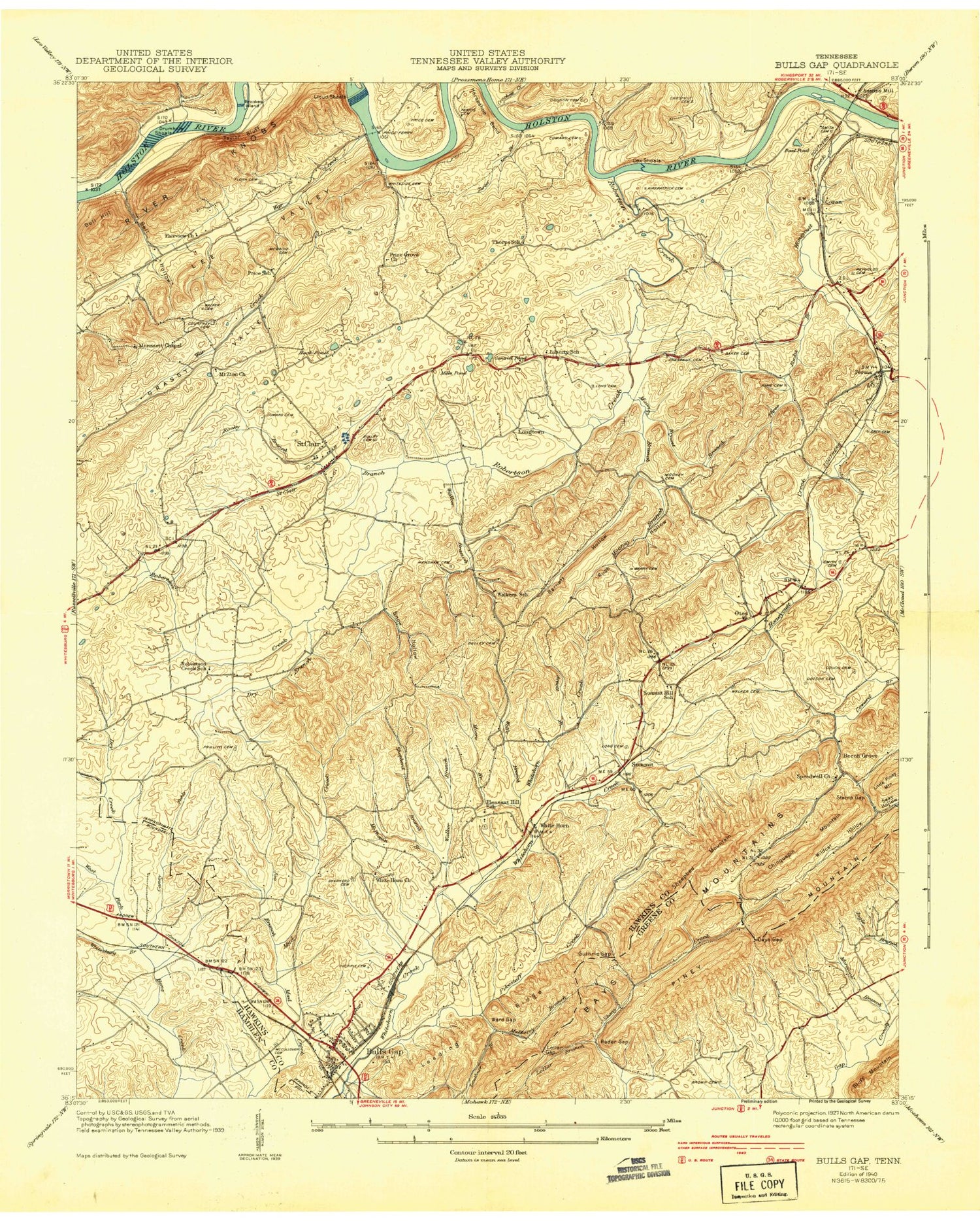
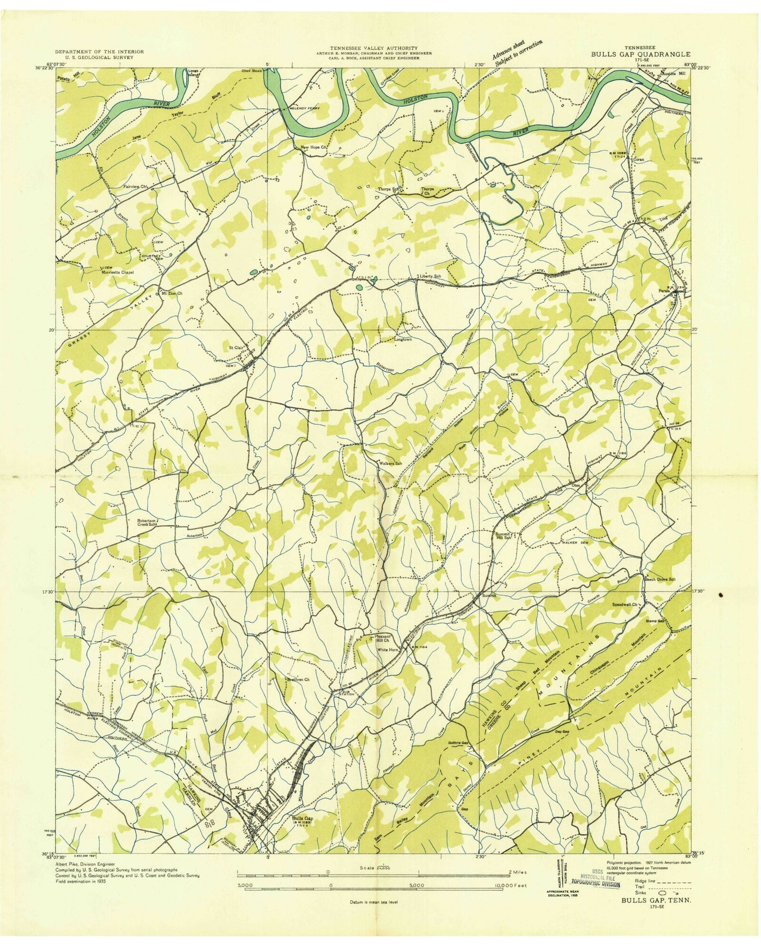
Classic USGS Bulls Gap Tennessee 7.5'x7.5' Topo Map
Couldn't load pickup availability
Historical USGS topographic quad map of Bulls Gap in the state of Tennessee. Map scale may vary for some years, but is generally around 1:24,000. Print size is approximately 24" x 27"
This quadrangle is in the following counties: Greene, Hamblen, Hawkins.
The map contains contour lines, roads, rivers, towns, and lakes. Printed on high-quality waterproof paper with UV fade-resistant inks, and shipped rolled.
Contains the following named places: Arnott Branch, Austins Mill, Bacon Cemetery, Barnett Hollow, Beal Pond, Beech Grove, Beech Grove School, Bell Hill, Bell Hollow, Berry Cemetery, Brookes Island, Brown Cemetery, Bryant Branch, Bulls Gap, Bulls Gap Division, Bulls Gap High School, Bulls Gap Post Office, Bulls Gap Volunteer Fire Department, Bulls Gap Volunteer Fire Department Station 2, Burdine Cemetery, Caldwell Cemetery, Caney Fork, Cantrell Pond, Cedar Grove Cemetery, Cherokee Lake, Chestnut Cemetery, Chinquapin Mountain, Cloud Shoals, Coldsprings Branch, Commissioner District 7, Coran, Couch Cemetery, Courtney Cemetery, Coward Cemetery, Coxes Shoals, Crockett Creek, Davis Cemetery, Days Gap, Dotson Cemetery, Drumhole Shoals, Dry Branch, East Fork Bent Creek, Ed Berry Cemetery, Fair View Church, Flora Cemetery, Flora Ferry, Frank Berry Cemetery, Gulley Cemetery, Guthrie Cemetery, Guthrie Gap, Guthrie Gap Church, Heck Cemetery, Heck Pond, Honeycutt Creek, Hopewell Baptist Church, Horseshoe Bend, Hugh B Day Bridge, King Cemetery, Lauthner Branch, Leading Ridge, Lee Valley, Liberty Church, Liberty Hill Church, Liberty School, Lollar Branch, Lollar Gap, Long Cemetery, Longtown, Malinda Bridge, McBride Cemetery, McCullough Cemetery, McPheron Branch, Mills Pond, Mooney Branch, Mooney Cemetery, Moore Branch, Morelock Branch, Morrisett Chapel, Mount Zion Baptist Church, Mulberry Branch, New Hope Church, Oak Grove Church, Otes, Otes United Methodist Church, Persia, Persia School, Phillips Cemetery, Pikestaff Creek, Pleasant Hill, Pleasant Hill Church, Pleasant Hill School, Price Cemetery, Price Grove Church, Prices Ferry, Rader Gap, Reynolds Cemetery, Rices Ferry, River Knobs, Robertson Creek, Robertson Creek Church, Robertson Creek School, Rocky Branch, Rush Hollow, Saint Clair, Saint Clair Branch, Saint Clair Elementary School, Saint Clair Park, Saint Clair United Methodist Church, Seay Hollow, Self Cemetery, Shanks Ripple, Sheepbed Mountain, Shepherd Branch, Shepherd Cemetery, Short Creek, Smith Cemetery, Smiths Islands, Smiths Shoals, Snow Hollow, Speedwell Church, Stamp Gap, Summit, Summit Hill School, Tarter Branch, Tarter Cemetery, Taylor Bluff, Thorps Chapel, Thorps Church, Thorps School, Three Forks Branch, Town of Bulls Gap, Walker Branch, Walker Cemetery, Walkers School, War Creek, Ward Gap, White Horn, White Horn Church, Whitesburg Branch, Whiteside Cemetery, Wildcat Hollow, Wolfe Branch, ZIP Code: 37711