MyTopo
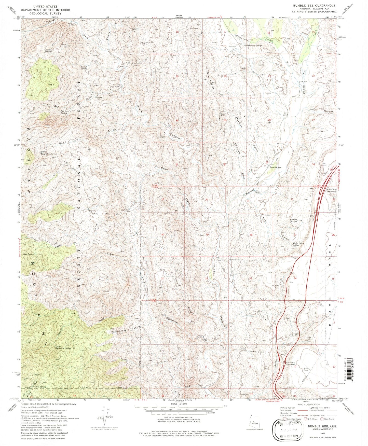
Classic USGS Bumble Bee Arizona 7.5'x7.5' Topo Map
Couldn't load pickup availability
Historical USGS topographic quad map of Bumble Bee in the state of Arizona. Typical map scale is 1:24,000, but may vary for certain years, if available. Print size: 24" x 27"
This quadrangle is in the following counties: Yavapai.
The map contains contour lines, roads, rivers, towns, and lakes. Printed on high-quality waterproof paper with UV fade-resistant inks, and shipped rolled.
Contains the following named places: Alkali Canyon, American Gulch, Barrel Spring, Bench Well, Bill Arp Creek, Bill Arp Mine, Bill Arp Spring, Bimetals Mine, Bland Hill, Bland Mine, Bumble Bee, Bumble Bee Creek, Castle Creek, Castle Creek Cabin, Castle Creek Trail, Crazy Basin Creek, Dead Cow Gulch, Government Spring, Government Spring Wash, Harris Spring, Howard Copper Mine, Howard Silver Mine, Last Chance Mine, Lower Dead Cow Spring, Mexican Gulch, Mud Spring, North Fork Rock Creek, Poison Creek, Poland Creek, R and H Mine, Rattlesnake Canyon, Rock Creek, Roosevelt Mine, Sheep Gulch, Sheep Gulch Spring, South Fork Rock Creek, Sunset Point, Sycamore Creek, Thunderbolt Mine, Tiger Canyon, Turkey Creek, Upper Sycamore Spring, Willow Spring, Bill Arp Mine Spring, Eightyeight Mine, Sheep Spring, Sunset Point Rest Area, East Boulder Creek