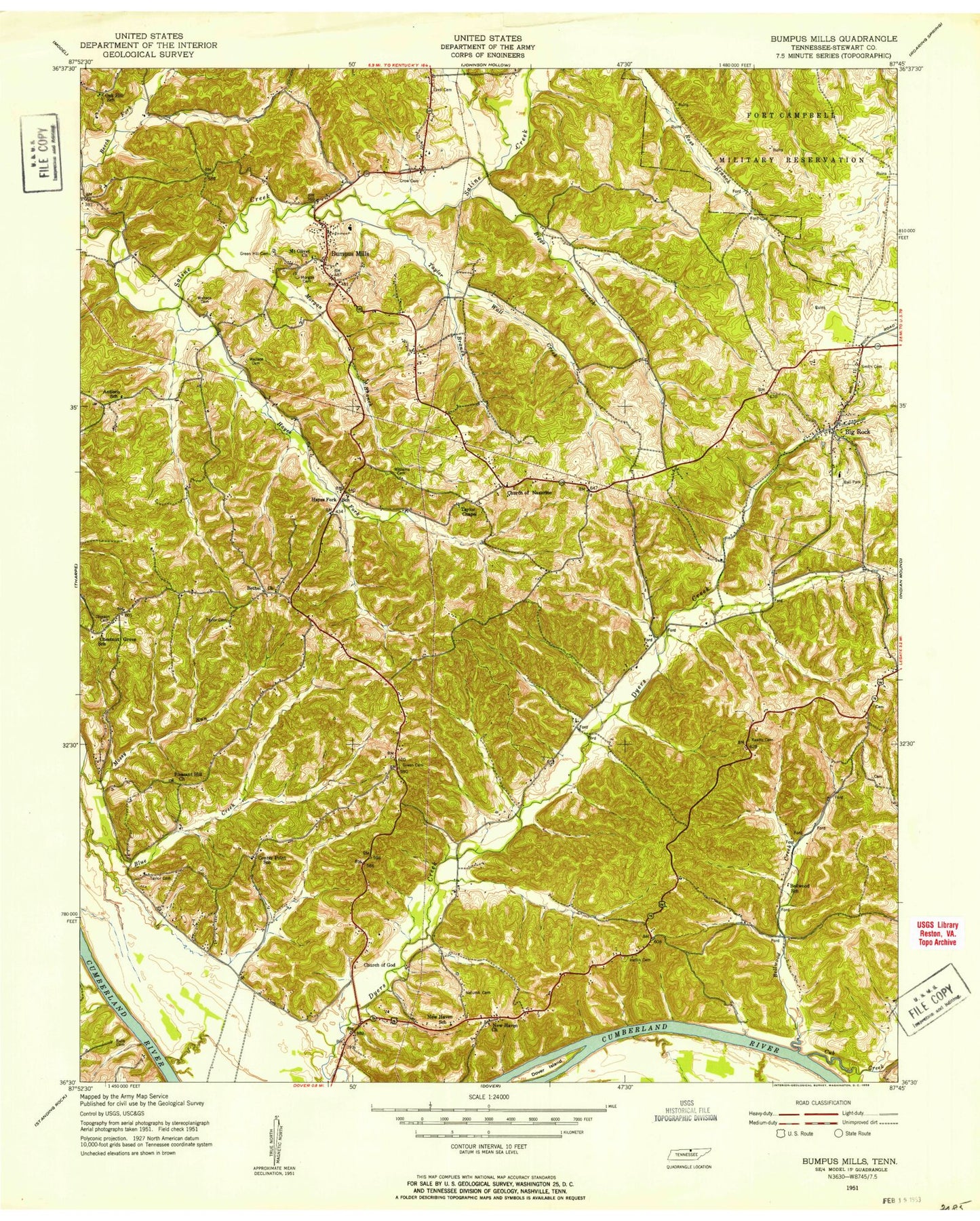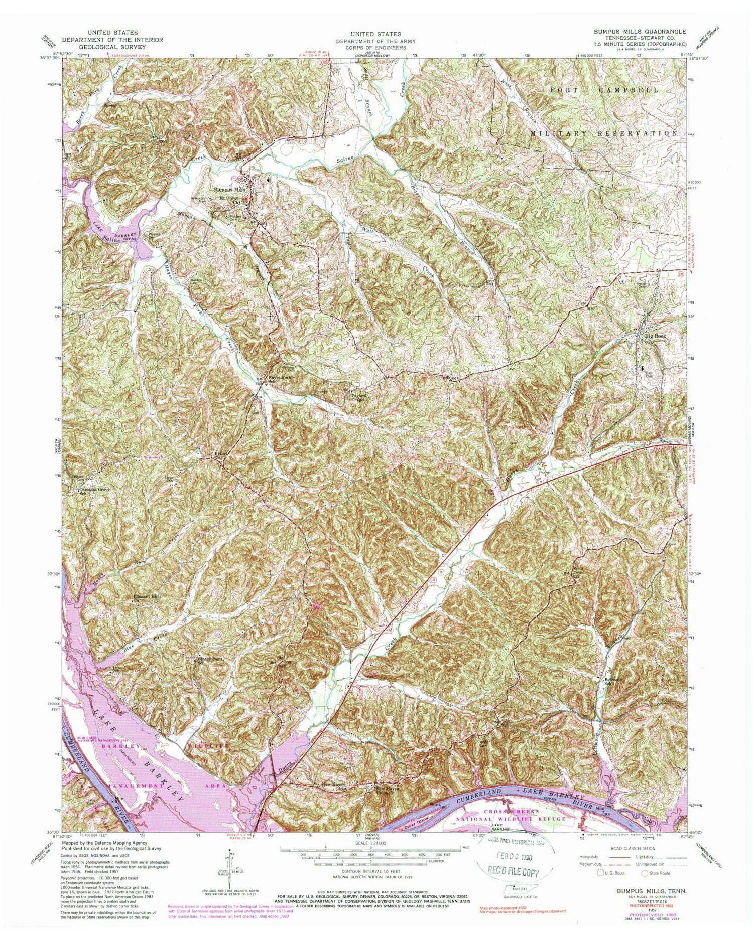
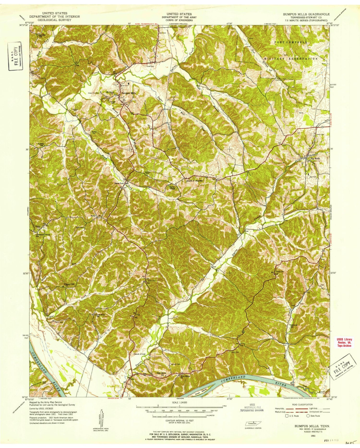
MyTopo
Classic USGS Bumpus Mills Tennessee 7.5'x7.5' Topo Map
Couldn't load pickup availability
Historical USGS topographic quad map of Bumpus Mills in the state of Tennessee. Map scale is 1:24000. Print size is approximately 24" x 27"
This quadrangle is in the following counties: Stewart.
The map contains contour lines, roads, rivers, towns, and lakes. Printed on high-quality waterproof paper with UV fade-resistant inks, and shipped rolled.
Contains the following named places: Athens School (historical), Bellwood Branch, Bellwood Furnace (historical), Bellwood Hollow, Bellwood Landing (historical), Bellwood School, Bethel Church, Big Rock, Big Rock Census Designated Place, Big Rock Post Office, Big Rock School, Biggs Branch, Biggs Hollow, Blue Creek Recreation Area, Bumpus Mills, Bumpus Mills Post Office, Bumpus Mills School, Camp Antioch School (historical), Carney Landing (historical), Center Point School, Chestnut Grove, Chestnut Grove School, Church of the Nazarene, Commissioner District 3, Crow Cemetery, Cub Creek, Cub Creek Cove, Dover Island, Dryers Creek Recreational Area, Ellis School (historical), Ezell Cemetery, George Wallace Cemetery, Glasgow Landing (historical), Green Hill Cemetery, Hargis Hollow, Harrison Ridge, Hayes Fork Creek, Hayes Fork School, Heflin Cemetery, Indian Branch, Indian Mound-Bumpus Mills Division (historical), Jackson Cemetery, Joiner Hollow, Keatts Cemetery, Keel Hollow, Lees Chapel, Line Wallace Cemetery, Lottie Wallace Cemetery, Melton Spring, Morgan Branch, Morgan Cemetery, Morris Creek, Mossy Run Creek, Mount Olivet Church, Mount Storm Church (historical), Mud Creek, Nelums Cemetery, New Haven, New Haven School, New Haven Union Church, Oak Hill School (historical), Phillips Church (historical), Pleasant Hill Church, Pool Two, Pool Two Dam, Ralls Cemetery, Robinson Hill, Saline Furnace (historical), Scott Branch, Sextons Landing (historical), Sharper Branch, Smith Cemetery, Spring Branch, Stewart County, Stewart County Volunteer Fire Service Station 3 New Haven, Stewart County Volunteer Fire Service Station 7 Bumpus Mills, Sugar Camp Hollow, Taylor Branch, Taylor Cemetery, Taylor Cemetery, Taylors Chapel, Taylors Chapel Cemetery, Wagners Landing (historical), Walker Ridge, Wall Creek, Wall Hollow, Wallace Ridge, Wiley Spring Branch, Williams Cemetery, Wyatt Hollow, Yarborough Hollow