MyTopo
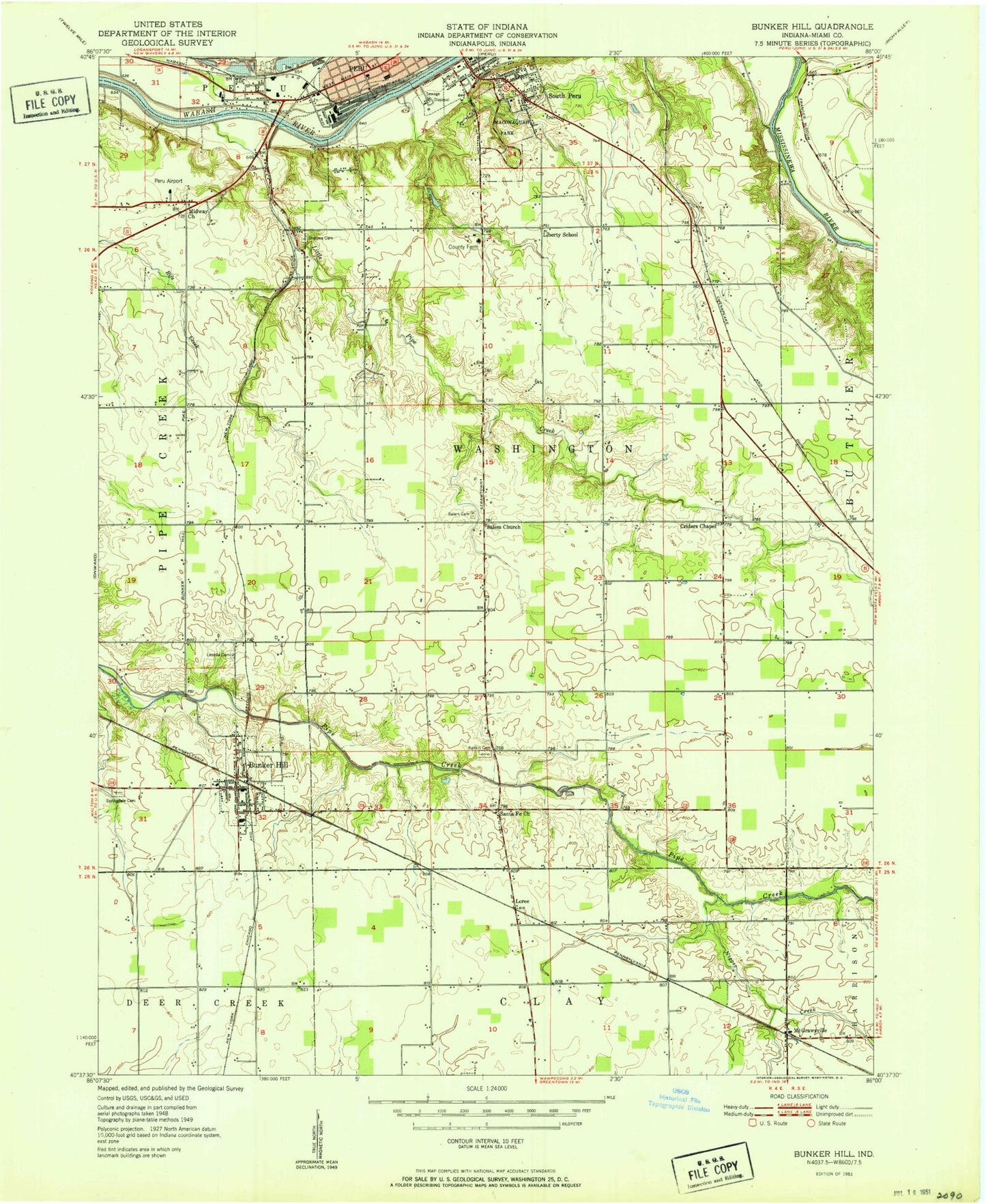
Classic USGS Bunker Hill Indiana 7.5'x7.5' Topo Map
Couldn't load pickup availability
Historical USGS topographic quad map of Bunker Hill in the state of Indiana. Map scale may vary for some years, but is generally around 1:24,000. Print size is approximately 24" x 27"
This quadrangle is in the following counties: Miami.
The map contains contour lines, roads, rivers, towns, and lakes. Printed on high-quality waterproof paper with UV fade-resistant inks, and shipped rolled.
Contains the following named places: Bunker Hill, Bunker Hill Elementary School, Bunker Hill Post Office, Crider Cemetery, Emmanuel Church, Flora, Goodenough Airport, Graff Ditch, Holman Elementary School, Leonda Cemetery, Lesher Ditch, Liberty School, Little Pipe Creek, Loree, Maconaquah Elementary School, Maconaquah High School, Maconaquah Middle School, Maconaquah Park, McGrawsville, Miami County Emergency Management Agency, Midway Church, Miller Strip Airport, Nead Elementary School, Negro Creek, Oakley, Park View Heights, Peru Fire Department Station 1, Pipe Creek Township Volunteer Fire Department, Rankin Cemetery, Robison Airport, Salem Cemetery, Salem Church, Salem Ditch, Schoolman Ditch, Sharpee Cemetery, Shinn Bone Lane Airport, South Peru, Springdale Cemetery, Town of Bunker Hill, Township of Washington, Wells, West City Park, ZIP Code: 46914