MyTopo
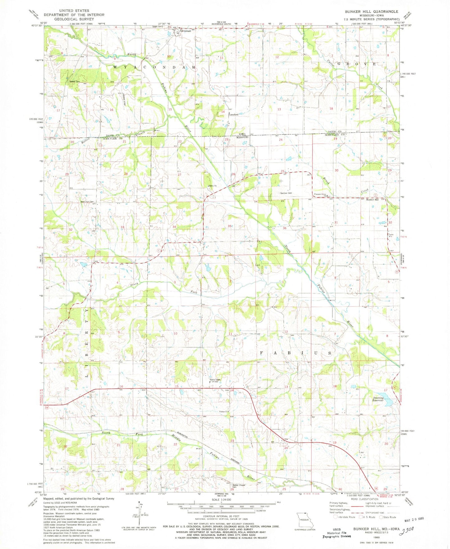
Classic USGS Bunker Hill Missouri 7.5'x7.5' Topo Map
Couldn't load pickup availability
Historical USGS topographic quad map of Bunker Hill in the states of Missouri, Iowa. Map scale may vary for some years, but is generally around 1:24,000. Print size is approximately 24" x 27"
This quadrangle is in the following counties: Davis, Schuyler.
The map contains contour lines, roads, rivers, towns, and lakes. Printed on high-quality waterproof paper with UV fade-resistant inks, and shipped rolled.
Contains the following named places: Batten Branch, Bridwell Cemetery, Brush Creek School, Bunker Hill, Darby Church, Del Norte Post Office, Donald Newcomb Lake, Downing City Lake, Downing City Lake Dam, Downing Reservoir, Dutchy School, Fabius Cemetery, Fabius Church, Fabius School, Gardner Cemetery, Howell Cemetery, Jaybird Darby School, Klondike Church, Lancaster City Lake, Lancaster City Lake Dam, Lunsford, Lunsford Post Office, New Zion Cemetery, New Zion School, Newcomb Dam - North Dam, Newcomb Dam - South Dam, Newcomb Hereford Ranch Airport, Norman Lake, Norman Lake Dam, Number 521 Dam, Number 524 Dam, Pleasant Grove Church, Reeves School, Savannah, Savannah Cemetery, Savannah Church, Savannah Post Office, Small Cemetery, South Fork North Fabius River, Township of Fabius, Vinita, Walker Chapel Cemetery, ZIP Code: 63548