
MyTopo
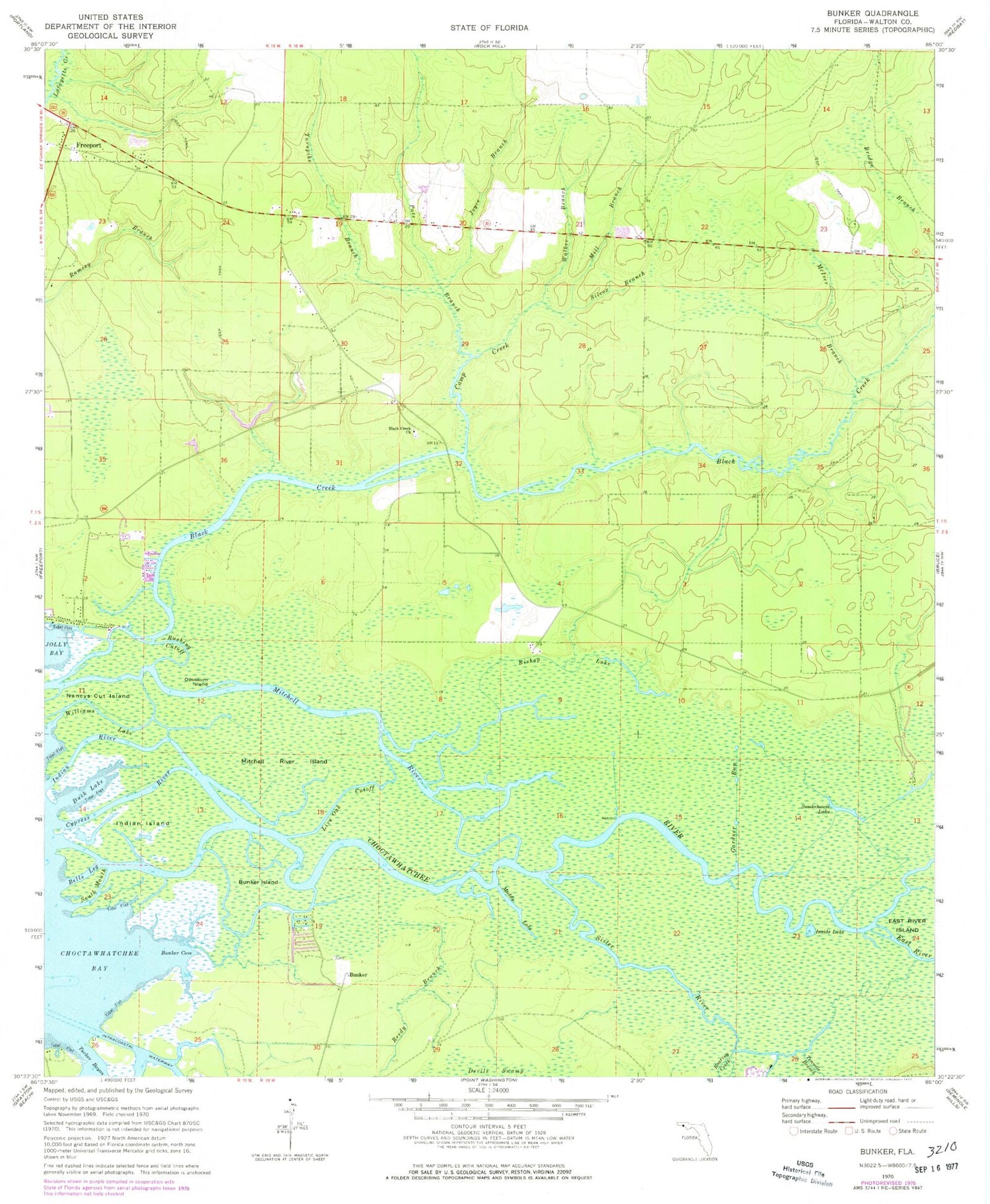
Classic USGS Bunker Florida 7.5'x7.5' Topo Map
Couldn't load pickup availability
Historical USGS topographic quad map of Bunker in the state of Florida. Typical map scale is 1:24,000, but may vary for certain years, if available. Print size: 24" x 27"
This quadrangle is in the following counties: Walton.
The map contains contour lines, roads, rivers, towns, and lakes. Printed on high-quality waterproof paper with UV fade-resistant inks, and shipped rolled.
Contains the following named places: Bells Leg, Bishop Lake, Black Creek, Black Creek Church, Bunker Cove, Bunker Island, Camp Creek, Cypress River, Duck Lake, East River, Gardner Run, Indian Island, Indian River, Inside Lake, Joyce Branch, Live Oak Cutoff, McIver Branch, Mitchell River, Mitchell River Island, Muddy Lake, Nancys Cut Island, Opossum Island, Pate Branch, Reedy Branch, Roaring Creek, Rushing Cutoff, Silcox Branch, Sister River, Smokehouse Lake, South Mouth, Tenmile Branch, Tucker Bayou, Turnpike Branch, Walker Branch, Williams Lake, Choctawhatchee River, Bunker, Old Bay View, Eden Gardens State Park, Freeport Division, Dugger Field, Freeport Post Office


