MyTopo
Classic USGS Burden Kansas 7.5'x7.5' Topo Map
Couldn't load pickup availability
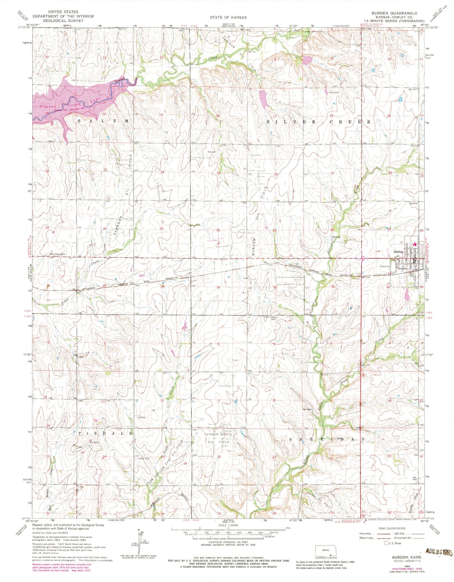
Historical USGS topographic quad map of Burden in the state of Kansas. Typical map scale is 1:24,000, but may vary for certain years, if available. Print size: 24" x 27"
This quadrangle is in the following counties: Cowley.
The map contains contour lines, roads, rivers, towns, and lakes. Printed on high-quality waterproof paper with UV fade-resistant inks, and shipped rolled.
Contains the following named places: Township of Tisdale, Township of Sheridan, Silver Creek Cemetery, Burden Oil Field, Salem Cemetery, Shannon Oil Field, Bolack Oil Field, Tisdale Cemetery, Turner North Oil Field, Burden, Plum Creek, Township of Silver Creek, Frog Hollow Oil Field, Central Elementary School, Timber Creek Lake, Central Junior - Senior High School, Hard Scrable School (historical), Moscow School (historical), Old Salem School (historical), Prairie Home School (historical), Silver Creek School (historical), Victor Point School (historical), Cowley County Fire District 3 Burden, City of Burden, Central Elementary School, Burden Police Department, Burden United Methodist Church, First Baptist Church, Burden Wastewater Plant, Burden City Hall, Fleming Feed and Grain Company Grain Elevator Number 2, Burden Post Office