
MyTopo
Classic USGS Burdickville Michigan 7.5'x7.5' Topo Map
Couldn't load pickup availability
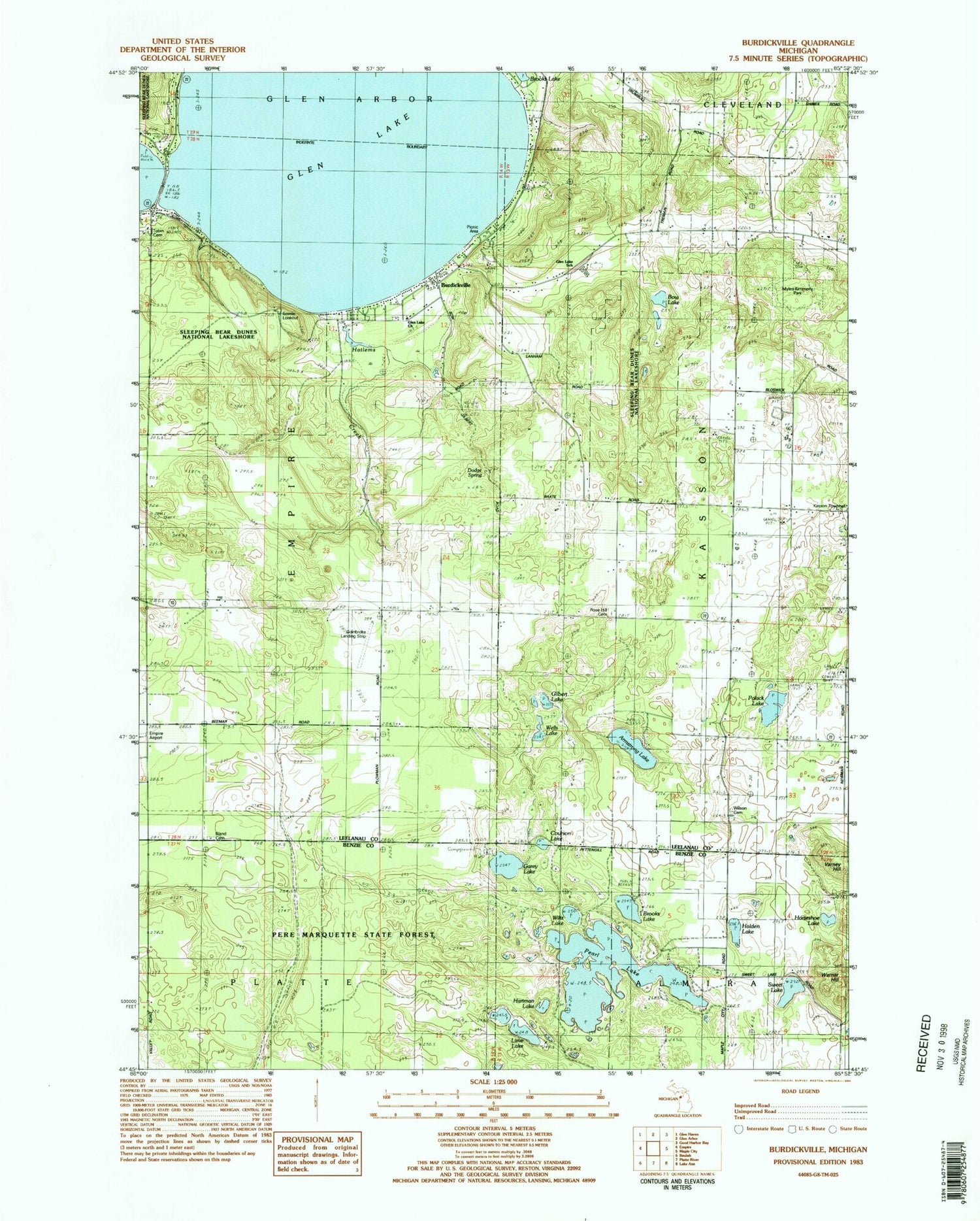
Historical USGS topographic quad map of Burdickville in the state of Michigan. Typical map scale is 1:24,000, but may vary for certain years, if available. Print size: 24" x 27"
This quadrangle is in the following counties: Benzie, Leelanau.
The map contains contour lines, roads, rivers, towns, and lakes. Printed on high-quality waterproof paper with UV fade-resistant inks, and shipped rolled.
Contains the following named places: Armstrong Lake, Bland Cemetery, Bow Lake, Brooks Lake, Brooks Lake, Burdickville, Community Church, Courson Lake, Gilbert Lake, Glen Lake, Glen Lake High School, Hartman Lake, Holden Lake, Horseshoe Lake, Kasson Center School, Lime Lake, Pearl Lake, Rose Hill Cemetery, Sweet Lake, Polack Lake, Varney Hill, Warner Hill, Wells Lake, Wilson Cemetery, Wiltz Lake, Garey Lake, WMLB-FM (Glen Arbor), Township of Kasson, Pearl Lake Natural Area, Kasson Townhall, Myles Kimmerly Park, Dodge Spring, Glen Lake Church, Tobin Cemetery, Sleepy Bear Campground, Dunes Golf Club, Burdickville Post Office (historical), Burdickville Cemetery, Old Settlers Park Historical Marker, Oviatt Post Office (historical), Osborn Post Office (historical)


