
MyTopo
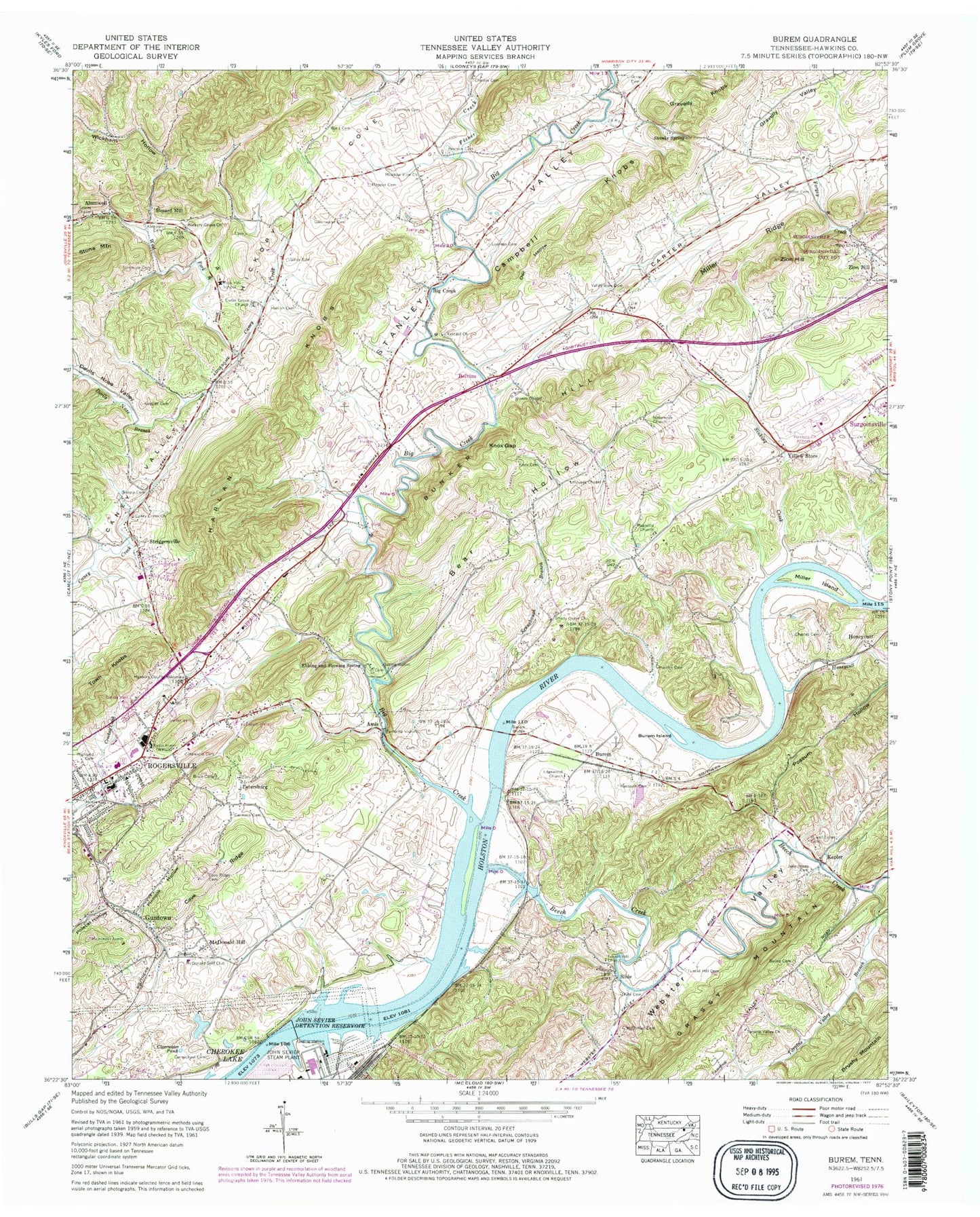
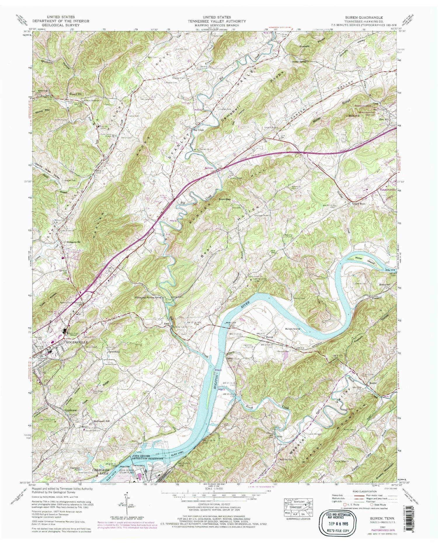
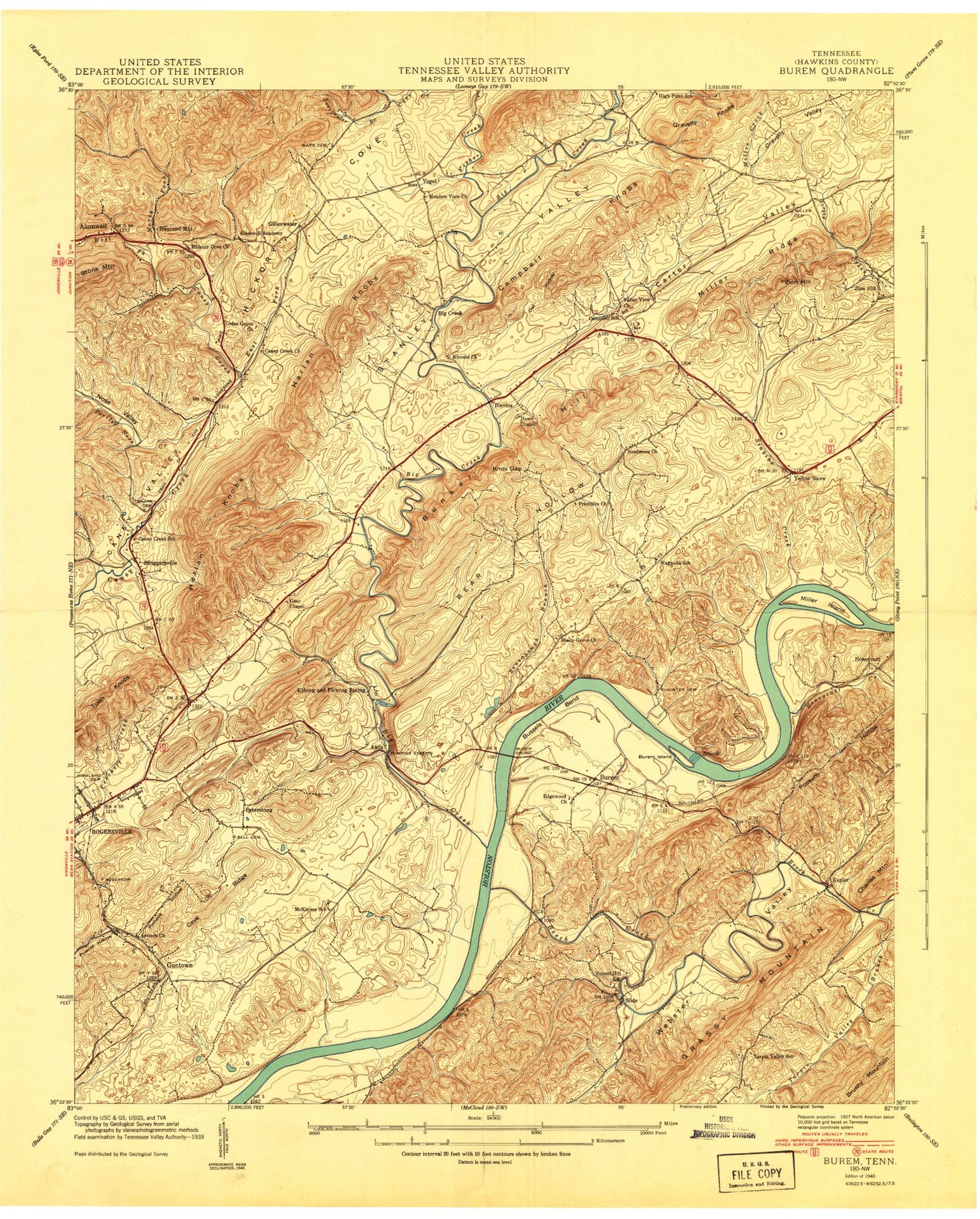
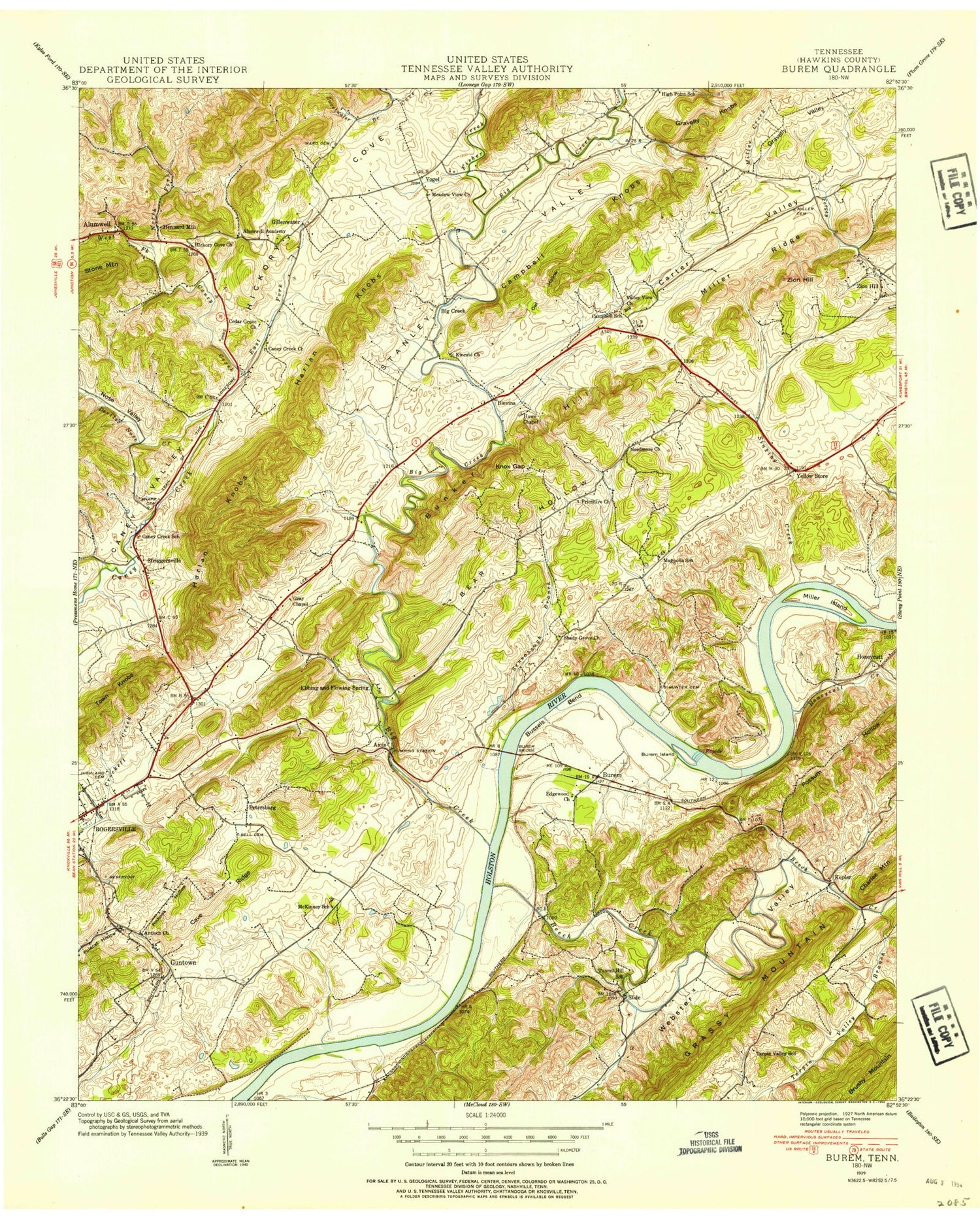
Classic USGS Burem Tennessee 7.5'x7.5' Topo Map
Couldn't load pickup availability
Historical USGS topographic quad map of Burem in the state of Tennessee. Map scale may vary for some years, but is generally around 1:24,000. Print size is approximately 24" x 27"
This quadrangle is in the following counties: Hawkins.
The map contains contour lines, roads, rivers, towns, and lakes. Printed on high-quality waterproof paper with UV fade-resistant inks, and shipped rolled.
Contains the following named places: Alumwell Academy, Amis, Antioch Church, Bailey Cemetery, Bass Chapel, Bear Hollow, Beech Creek, Belvins, Bethel Church, Big Creek, Big Creek Baptist Church, Big Creek School, Big Creek Shoals, Brice Cemetery, Brushy Mountain, Bunker Hill, Burem, Burem Bridge, Burem Island, Burem Lake, Burem Lake Dam, Burem Post Office, Burhams Shoals, Bussels Bend, Campbell Knobs, Campbell School, Caney Creek Church, Caney Creek School, Caney Creek Spring, Carmack Cemetery, Carmichael Cemetery, Carter Valley, Cave Ridge, Cave Ridge Cemetery, Cedar Grove Church, Charles Cemetery, Charles Island, Charles Shoals, Chissolms Ford, Clearwater Pond, Cold Spring, Commissioner District 5, Devils Nose Branch, Devils Nose Valley, Ebbing and Flowing School, Ebbing and Flowing Spring, Ebbing and Flowing Springs United Methodist Church, Edgewood Church, Epson Spring, Fisher Creek, Gillenwater, Gillenwater Cemetery, Gilley Cemetery, Grassy Mountain, Gravelly Valley, Gray Chapel, Gross Cemetery, Guntown, Harlan Knobs, Harrison Cemetery, Hawkins Cemetery, Hawkins County, Hawkins County Airport, Hawkins County EMS, Hawkins County Milestone, Hawkins County Rescue Squad, Hawkins County Sheriff's Office, Hawkins Elementary School, Henard Mill, Herron Cemetery, Hickory Cove, Hickory Grove Church, High Point School, Highland Cemetery, Hipshire Hollow, Honeycutt, Honeycutt Creek, Honeycutt Post Office, Houses Chapel, Howes Chapel, Hunter Cemetery, Jacksons Islands, Jacksons Shoals, Jake Jones Cemetery, John Sevier Detention Reservoir, John Sevier State Waterfowl Refuge, John Sevier Steam Plant, Keplar Baptist Church, Kepler, Kepler Elementary School, Kincaid Church, Kite Cemetery, Klepper Cemetery, Knox Cemetery, Knox Gap, Knox Valley, Looneys Cemetery, Magnolia Church, Magnolia School, McClellan Cemetery, McDonald Golf Club, McDonald Hill, McKinney Cemetery, McKinney School, Meadow View Church, Melody Orchard, Miller Cemetery, Miller Flats, Miller Island, Miller Ridge, Miller Shoals, Miller Spring, Needmore Church, Owl Hollow, Parkview Shopping Center, Pearson Cemetery, Petersburg, Pinhook Hollow, Polecat Hollow, Possum Hollow, Powell Jones Cemetery, Rock Hill School, Rogersville Middle School, Sensabaugh Branch, Shady Grove Church, Shanks Spring, Sizemore Cemetery, Slide, Slide Post Office, Snapp Cemetery, Spears Shoals, Spires Chapel, Stanley Valley, Stanley Valley Volunteer Fire Department, Stinking Creek, Striggersville, Striggersville Volunteer Fire Department, Striggersville Volunteer Fire Department Station 1, Sweetwater Branch, Tarpin Valley School, Tarpine Valley Branch, Tarpine Valley Church, Tunnel Cemetery, Tunnel Hill Cemetery, Tunnel Hill Church, Tunnel Hill School, Union Church, Valley View Cemetery, Valley View Church, Vogel, Ward Cemetery, Webster Valley, West Fork Caney Creek, Wickham Hollow, Winegar Hollow, WRGS-AM (Rogersville), Yellow Store, Yellow Store Post Office, Zion Church, Zion Hill, Zion Hill School, ZIP Code: 37857