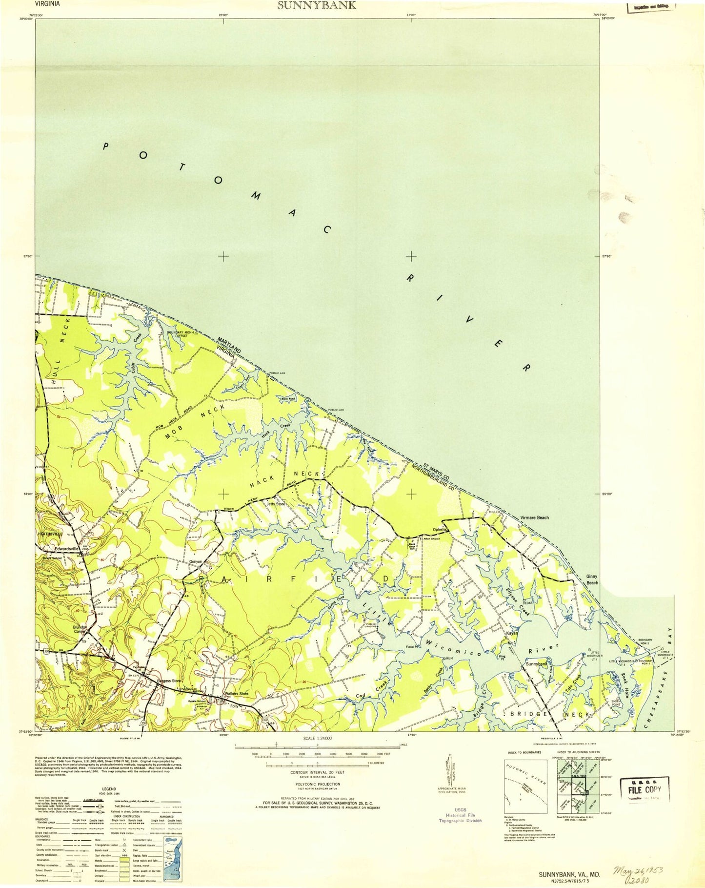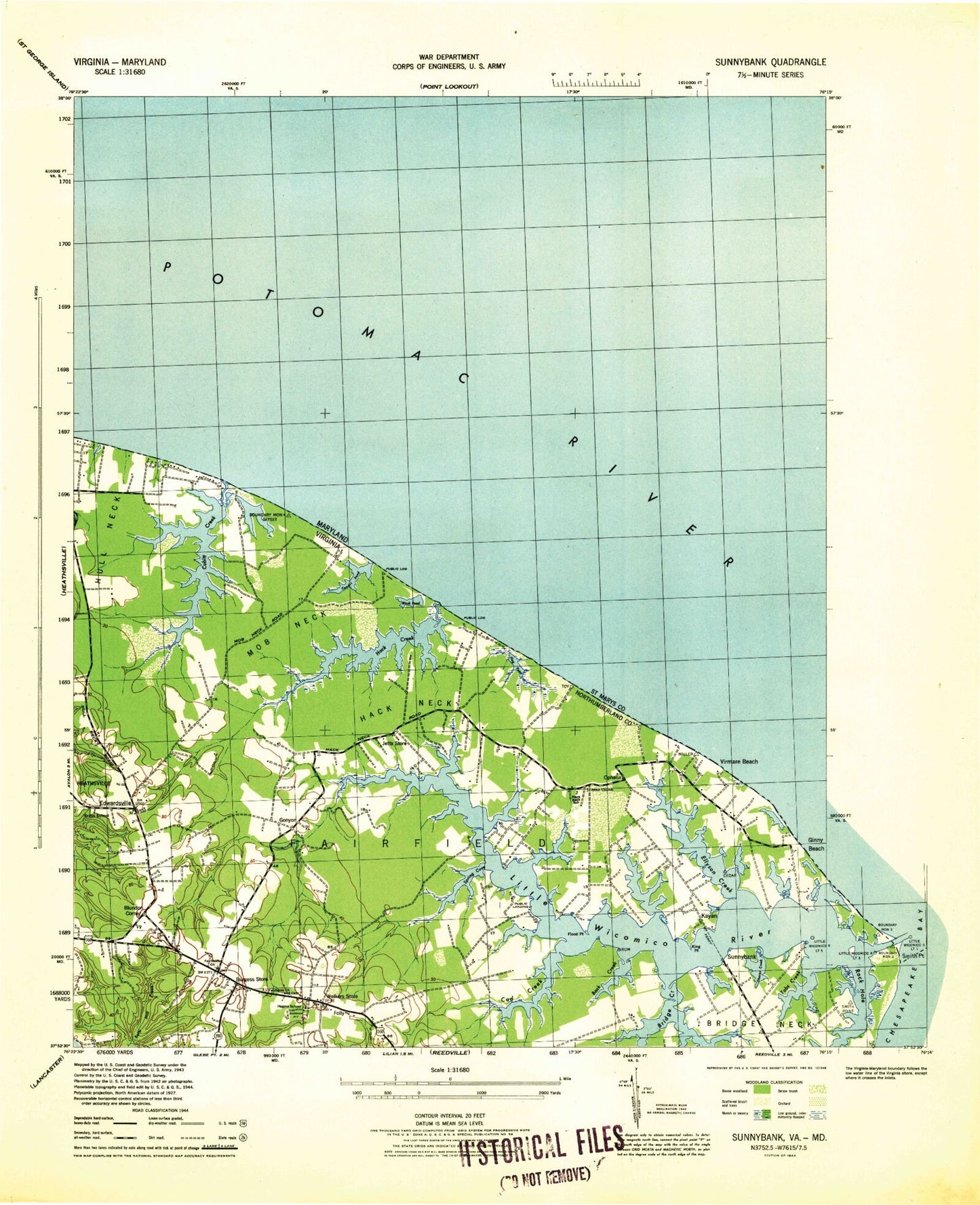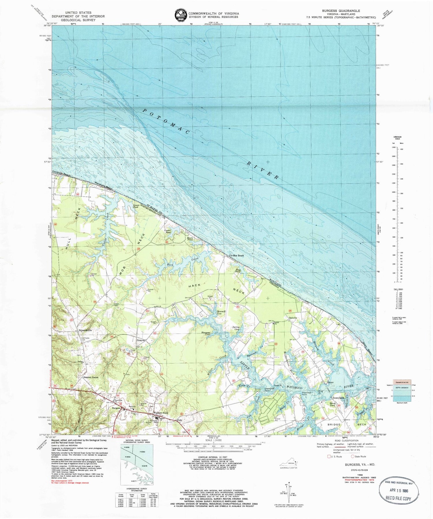
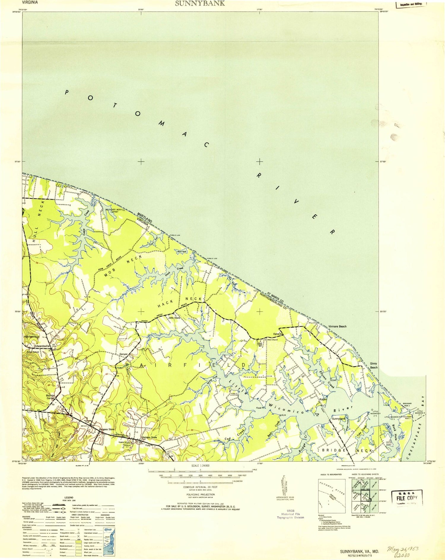

MyTopo
Classic USGS Burgess Virginia 7.5'x7.5' Topo Map
Couldn't load pickup availability
Historical USGS topographic quad map of Burgess in the states of Virginia, Maryland. Map scale may vary for some years, but is generally around 1:24,000. Print size is approximately 24" x 27"
This quadrangle is in the following counties: Northumberland, St. Mary's.
The map contains contour lines, roads, rivers, towns, and lakes. Printed on high-quality waterproof paper with UV fade-resistant inks, and shipped rolled.
Contains the following named places: Afton Church, Back Creek, Black Pond, Blundon Corner, Bridge Creek, Bridge Neck, Bridgemans Back Creek, Burgess, Burgess Post Office, Cod Creek, Condit Pond, Cordreys Beach, Cubitt Creek, Davis Mill, Davis Mill Run, Davis Millpond, Donlins Cove, Edwardsville, Edwardsville School, Ellyson Creek, Fairfields Cemetery, Fairfields Church, Fairfields School, Federhart-Ophelia Airport, Flag Pond, Flood Point, Folly, Galilee Church, Gills Point, Ginny Beach, Gonyon, Grays School, Greenfield Point, Hack Creek, Hack Neck, Hack Neck School, Hacks Neck Landing, Hansons Cove, Horse Pond, Hull Neck, Hygeia School, Jett Airpark, Jetts Store, Kayan, King Point, Little Wicomico Landing, Lowes Pond, Marshalls Beach, Mob Neck, Northumberland Volunteer Rescue Squad Station 2, Ophelia, Ophelia Post Office, Peachtree Point, Potomac River, Sawmill Cove, Serenity Farm Airport, Sharps Creek, Shiloh Church, Sloop Creek, Slough Creek, Smith Point Marina, Spences Creek, Spring Cove, Sunnybank, Sunnybank Ferry, Vir-Mar Beach, Walkers Store, Willis Creek, ZIP Code: 22530