MyTopo
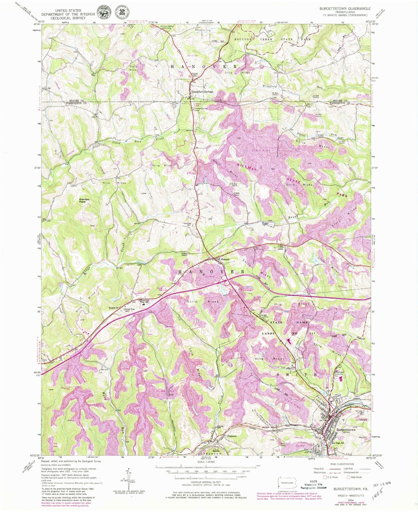
Classic USGS Burgettstown Pennsylvania 7.5'x7.5' Topo Map
Couldn't load pickup availability
Historical USGS topographic quad map of Burgettstown in the state of Pennsylvania. Typical map scale is 1:24,000, but may vary for certain years, if available. Print size: 24" x 27"
This quadrangle is in the following counties: Beaver, Washington.
The map contains contour lines, roads, rivers, towns, and lakes. Printed on high-quality waterproof paper with UV fade-resistant inks, and shipped rolled.
Contains the following named places: Burgettstown, Burgettstown Community Park, Chestnut Ridge Cemetery, Florence, Frankfort Springs, Frankfort Springs Grange, Grandview Cemetery, Hanover Township School, Our Lady of Lourdes Cemetery, Tucker Church, Union High School, United Church, Warriors Point, Dinsmore Reservoir, Dinsmore Storage Number Two Dam, Pa-483 Dam, Flood Dam 483, Flood Dam 482, Five Points, Comettsburg, Frankfort Springs, Bertha, Dinsmore, Miller Airport (historical), Frankfort Springs (historical), Francis Mine, Ponderosa Golflands Golf Course, State Game Lands Number 117, Hamilton, Purdy, Bologna Heliport, Borough of Frankfort Springs, Borough of Burgettstown, Township of Hanover, Burgettstown Community Library, Tri-State Christian Academy, Hanover Volunteer Fire Department, Burgettstown Volunteer Fire Company Station 21, Jackson's Mill Covered Bridge, Frankfort Springs Presbyterian Church Cemetery, Frankfort Springs United Presbyterian Church Cemetery, Burgettstown Post Office