MyTopo
Classic USGS Burkesville Kentucky 7.5'x7.5' Topo Map
Couldn't load pickup availability
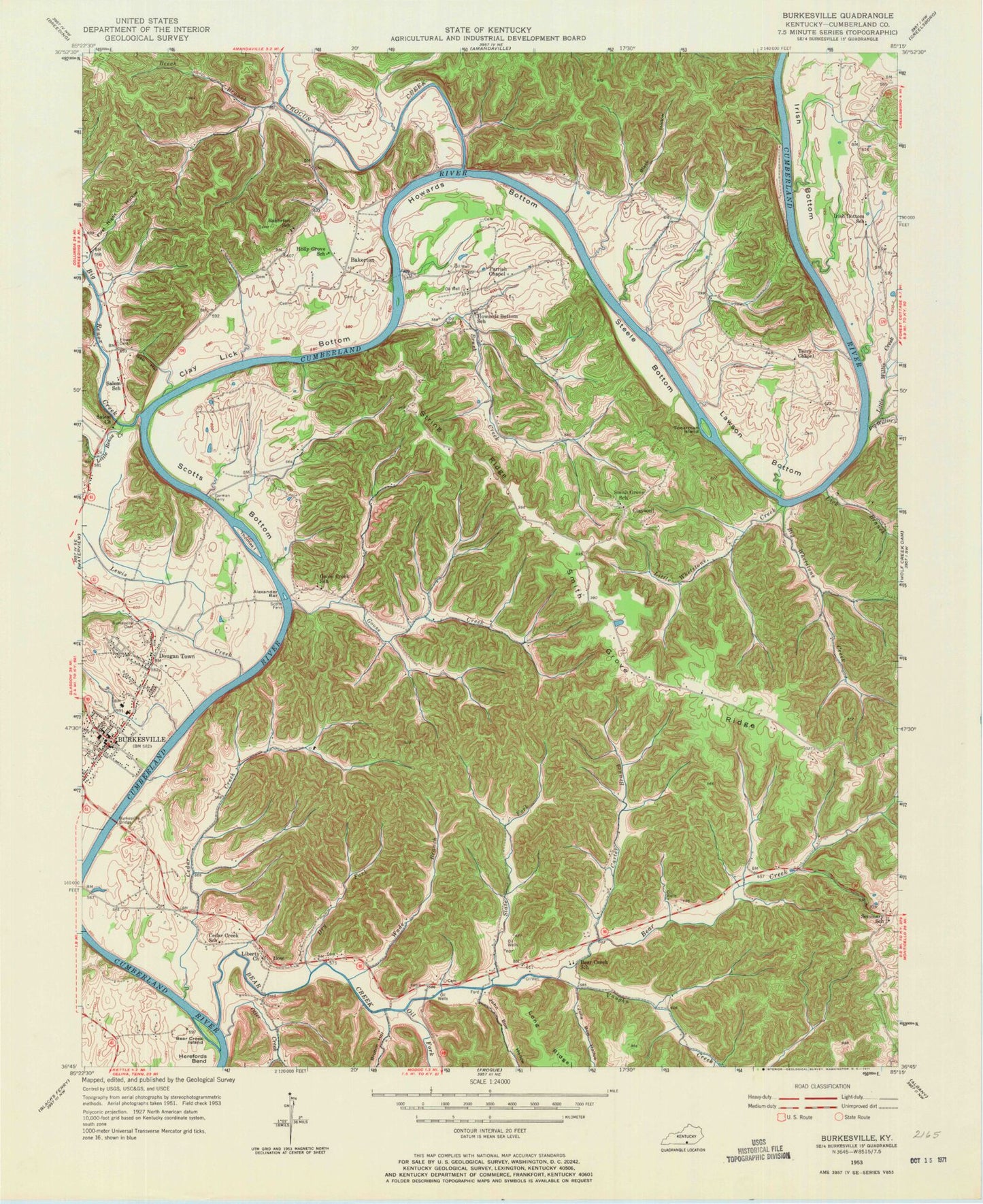
Historical USGS topographic quad map of Burkesville in the state of Kentucky. Map scale is 1:24000. Print size is approximately 24" x 27"
This quadrangle is in the following counties: Cumberland.
The map contains contour lines, roads, rivers, towns, and lakes. Printed on high-quality waterproof paper with UV fade-resistant inks, and shipped rolled.
Contains the following named places: Alexander Bar, Bakerton, Bakerton School, Bear Creek, Bear Creek Island, Bear Creek School, Beech Branch, Big Renox Creek, Big Whetstone Creek, Big Willis Creek, Black Hollow, Bow, Brush Creek, Bruton Hollow, Burkesville, Burkesville Bridge, Burkesville Cemetery, Burkesville Fire Department, Burkesville Police Station, Burkesville Post Office, Carter Branch, Cedar Creek, Cedar Creek School, City of Burkesville, Clay Lick Bottom, Claywell, Crocus Creek, Cumberland County Hospital, Cumberland County Sheriff's Department, Dougan Town, Dry Fork, First Night Hollow, Flower Cemetery, Gap Hollow, Garman Ferry, Goose Creek, Goose Creek School, Hicks Branch, Holly Grove School, Howards Bottom, Howards Bottom School, Irish Bottom, Irish Bottom School, John Bow Hollow, Julia Bow Hollow, Lawson Bottom, Lewis Creek, Lewis Creek (historical), Liberty Church, Lick Branch, Little Renox Creek, Little Whetstone Creek, Little Willis Creek, Morris Branch, Oil Fork, Otter Creek, Parrish Chapel, Rocky Branch, Salem Baptist Church (historical), Salem School, Scotts Bottom, Scotts Ferry, Seminary School, Slate Fork, Smith Grove Ridge, Smith Grove School, Spearman Island, Steele Bottom, String Ridge, Terry Chapel, Thomas Island, Twin Branch, Vaughn Creek, Wade Branch, WKYR-AM (Burkesville), Wolfpen Hollow