MyTopo
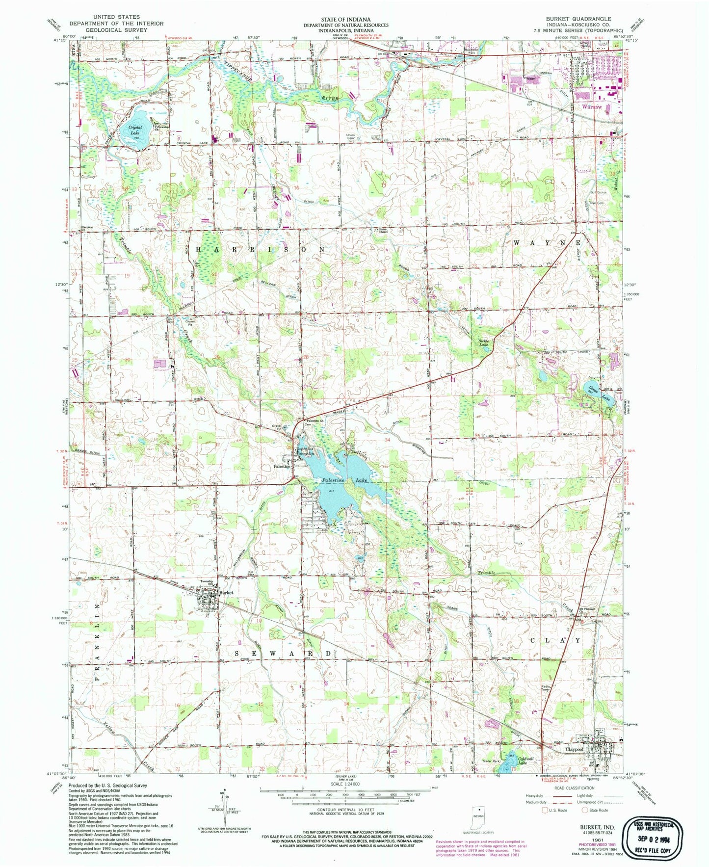
Classic USGS Burket Indiana 7.5'x7.5' Topo Map
Couldn't load pickup availability
Historical USGS topographic quad map of Burket in the state of Indiana. Map scale may vary for some years, but is generally around 1:24,000. Print size is approximately 24" x 27"
This quadrangle is in the following counties: Kosciusko.
The map contains contour lines, roads, rivers, towns, and lakes. Printed on high-quality waterproof paper with UV fade-resistant inks, and shipped rolled.
Contains the following named places: Adams Ditch, Bierce Ditch, Boggs Ditch, Burket, Burket Elementary School, Burket Firemans Training Center, Burket Post Office, Burket Volunteer Fire Department, Claypool, Claypool Elementary School, Claypool Post Office, Claypool Volunteer Fire Department, Cooks Chapel, Cretcher Ditch, Crystal Lake, Fellowship Church, Goose Lake, Harrison Church, Kuhn Ditch, Magee Ditch, Marsh Ditch, Merrit Ditch, Mount Pleasant Church, Nye Cemetery, Palestine, Palestine Church, Palestine Lake, Palestine Lake Dam, Pyle Ditch, Ring Ditch, Robbins Ditch, Sellers Ditch, Sickle Lake, Sloan Ditch, Town of Burket, Town of Claypool, Township of Harrison, Trail Creek, Ulsch Ditch, Union Cemetery, Walnut Creek, Williamson Ditch, Wooden Cemetery, Yellow Creek, ZIP Code: 46508