MyTopo
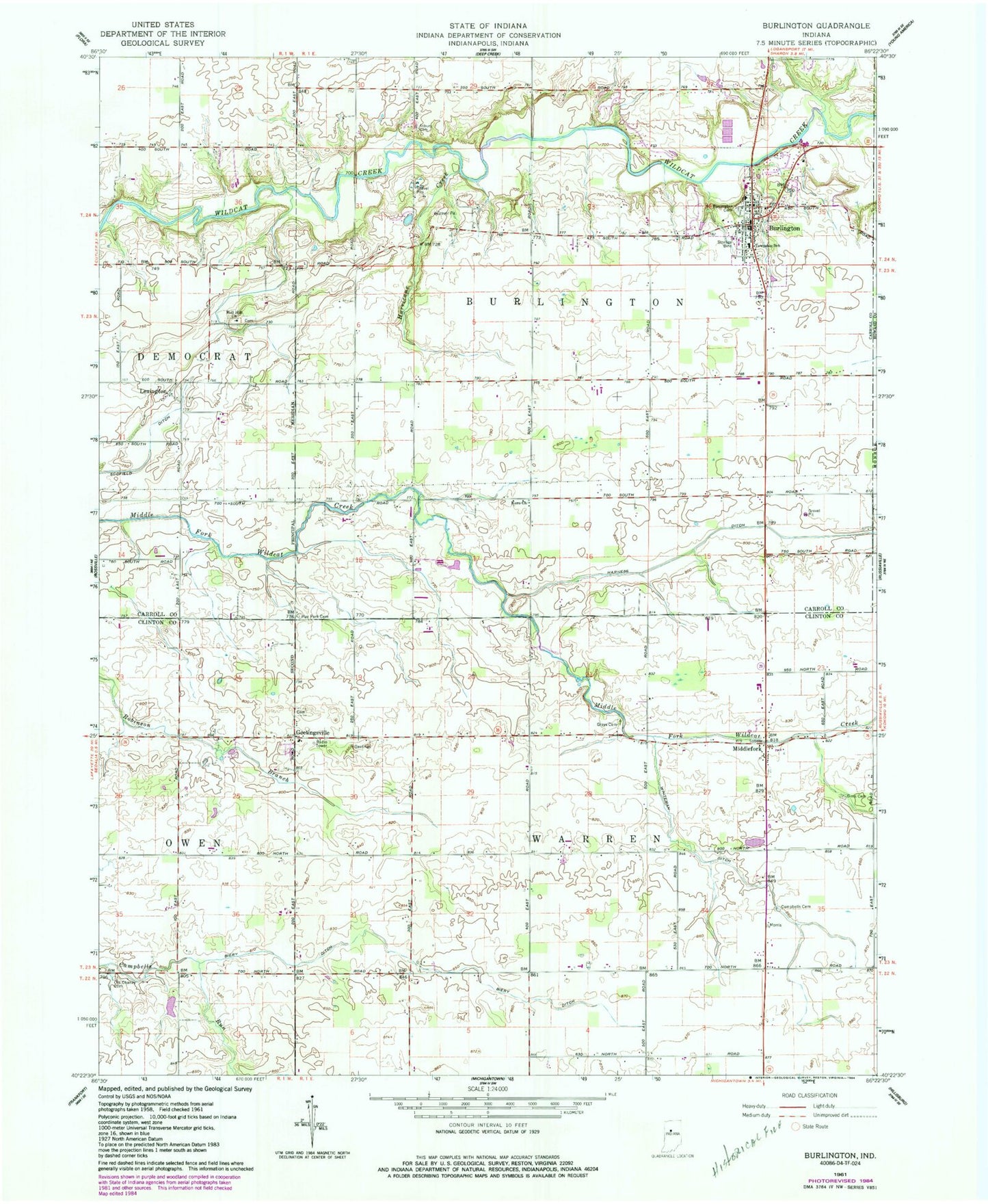
Classic USGS Burlington Indiana 7.5'x7.5' Topo Map
Couldn't load pickup availability
Historical USGS topographic quad map of Burlington in the state of Indiana. Map scale may vary for some years, but is generally around 1:24,000. Print size is approximately 24" x 27"
This quadrangle is in the following counties: Carroll, Clinton, Howard.
The map contains contour lines, roads, rivers, towns, and lakes. Printed on high-quality waterproof paper with UV fade-resistant inks, and shipped rolled.
Contains the following named places: Asbury Cemetery, Biery Ditch, Boll Hill Church, Burlington, Burlington Cemetery, Burlington Fire Department, Burlington Post Office, Campbell Cemetery, Carroll County Emergency Medical Services, Geetingsville, Grays Cemetery, Harness Ditch, Hurricane Creek, Hye Park Cemetery, Koro Church, Lemert Airport, Lexington, Middlefork, Old Chaney Cemetery, Scofield Ditch, Shaffer Stock Farms, Sims Cemetery, Town of Burlington, Township of Burlington, Township of Warren, Whiteman Ditch, WSHW-FM (Frankfort), ZIP Codes: 46915, 46920